Fairlawn, Ohio
Fairlawn is a city in Summit County, Ohio, United States, and a suburb of Akron. The population was 7,437 at the 2010 census. It is part of the Akron Metropolitan Statistical Area.
Fairlawn, Ohio | |
|---|---|
 Medical offices in Fairlawn | |
 Location in Summit County and the state of Ohio. | |
| Coordinates: 41°7′46″N 81°37′5″W | |
| Country | United States |
| State | Ohio |
| County | Summit |
| Government | |
| • Mayor | William J. Roth Jr. (R)[1] |
| Area | |
| • Total | 4.58 sq mi (11.85 km2) |
| • Land | 4.57 sq mi (11.82 km2) |
| • Water | 0.01 sq mi (0.03 km2) |
| Elevation | 1,010 ft (308 m) |
| Population | |
| • Total | 7,437 |
| • Estimate (2019)[5] | 7,514 |
| • Density | 1,646.00/sq mi (635.57/km2) |
| Time zone | UTC-5 (Eastern (EST)) |
| • Summer (DST) | UTC-4 (EDT) |
| ZIP codes | 44313, 44333, 44334, 44398 |
| Area code(s) | 330, 234 |
| FIPS code | 39-26166[6] |
| GNIS feature ID | 1040312[3] |
| Website | http://www.cityoffairlawn.com/ |
Geography
Fairlawn is located at 41°7′46″N 81°37′5″W (41.129555, -81.618103).[7]
According to the United States Census Bureau, the city has a total area of 4.49 square miles (11.63 km2), of which 4.48 square miles (11.60 km2) is land and 0.01 square miles (0.03 km2) is water.[8]
History
Fairlawn was founded as a hamlet in 1891 when the Northern Ohio Railway was built. In 1908 it had a mill, general store, a blacksmith, and other businesses.[9] It was incorporated as Fairlawn Village in 1960.[10] It became a city when its population reached 6,200 in the 1970 census. (Fairlawn, 2003)
Demographics
| Historical population | |||
|---|---|---|---|
| Census | Pop. | %± | |
| 1970 | 6,102 | — | |
| 1980 | 6,100 | 0.0% | |
| 1990 | 5,779 | −5.3% | |
| 2000 | 7,307 | 26.4% | |
| 2010 | 7,437 | 1.8% | |
| Est. 2019 | 7,514 | [5] | 1.0% |
| Sources:[6][11] | |||
2010 census
As of the census[4] of 2010, there were 7,437 people, 3,219 households, and 1,978 families living in the city. The population density was 1,660.0 inhabitants per square mile (640.9/km2). There were 3,455 housing units at an average density of 771.2 per square mile (297.8/km2). The racial makeup of the city was 82.1% White, 11.0% African American, 4.3% Asian, 0.5% from other races, and 2.0% from two or more races. Hispanic or Latino of any race were 2.3% of the population.
There were 3,219 households, of which 25.1% had children under the age of 18 living with them, 46.8% were married couples living together, 10.6% had a female householder with no husband present, 4.0% had a male householder with no wife present, and 38.6% were non-families. 34.2% of all households were made up of individuals, and 16.7% had someone living alone who was 65 years of age or older. The average household size was 2.20 and the average family size was 2.82.
The median age in the city was 46.8 years. 19.4% of residents were under the age of 18; 5.7% were between the ages of 18 and 24; 22.3% were from 25 to 44; 29.2% were from 45 to 64; and 23.4% were 65 years of age or older. The gender makeup of the city was 47.1% male and 52.9% female.
Of the city's population over the age of 25, 51.1% hold a bachelor's degree or higher.[12]
2000 census
As of the census[6] of 2000, there were 7,307 people, 2,986 households, and 1,976 families living in the city. The population density was 1,649.7 people per square mile (636.9/km2). There were 3,141 housing units at an average density of 709.1 per square mile (273.8/km2). The racial makeup of the city was 88.81% White, 6.12% African American, 0.07% Native American, 3.30% Asian, 0.01% Pacific Islander, 0.44% from other races, and 1.26% from two or more races. Hispanic or Latino of any race were 1.08% of the population.
There were 2,986 households, out of which 27.0% had children under the age of 18 living with them, 56.2% were married couples living together, 8.1% had a female householder with no husband present, and 33.8% were non-families. 29.2% of all households were made up of individuals, and 12.1% had someone living alone who was 65 years of age or older. The average household size was 2.30 and the average family size was 2.85.
In the city the population was spread out, with 20.3% under the age of 18, 5.4% from 18 to 24, 26.0% from 25 to 44, 24.5% from 45 to 64, and 23.8% who were 65 years of age or older. The median age was 44 years. For every 100 females, there were 83.9 males. For every 100 females age 18 and over, there were 82.0 males.
The median income for a household in the city was $62,180, and the median income for a family was $78,947. Males had a median income of $56,303 versus $35,136 for females. The per capita income for the city was $34,927. About 0.6% of families and 1.5% of the population were below the poverty line, including 1.2% of those under age 18 and 1.5% of those age 65 or over.
Transportation and shopping
Fairlawn is served by West Market Street, part of State Route 18. Market Street is a wide road with up to seven lanes. Fairlawn has a busy shopping district along the Route 18 corridor, to the extent where most areas have reached saturation. The area is anchored by Fairlawn Town Center, Summit Mall, Wal-Mart, Sam's Club, and other businesses and restaurants. The Montrose shopping district also includes neighboring Copley Township and Bath Township.
Fairlawn is also served by Interstate 77, which passes through the southern part of the city.
References
- Hagelberg, Kymberli (24 October 2011). "Elections 2011: William Roth is Running for Mayor of Fairlawn". Patch Media. Retrieved 1 February 2016.
- "2019 U.S. Gazetteer Files". United States Census Bureau. Retrieved July 28, 2020.
- "US Board on Geographic Names". United States Geological Survey. 2007-10-25. Retrieved 2008-01-31.
- "U.S. Census website". United States Census Bureau. Retrieved 2013-01-06.
- "Population and Housing Unit Estimates". Retrieved May 21, 2020.
- "U.S. Census website". United States Census Bureau. Retrieved 2008-01-31.
- "US Gazetteer files: 2010, 2000, and 1990". United States Census Bureau. 2011-02-12. Retrieved 2011-04-23.
- "US Gazetteer files 2010". United States Census Bureau. Archived from the original on 2012-01-25. Retrieved 2013-01-06.
- Doyle, William B. (1908). Centennial HIstory of Summit County, Ohio and Representative Citizens. Chicago, Ill.: Biographical Publishing Company. p. 102.
When the Northern Ohio Railroad was built, in 1891, it gave Copley an outlet, and was the means of starting a new hamlet -- Fairlawn, which now boasts a mill, general store, smithy, etc.
- "Macedonia To Pick Officials May 8". Akron Beacon Journal. Akron, Ohio. 1961-11-24. p. 13. Retrieved 2019-03-03.
Norton and Fairlawn were incorporated in 1960 while Reminderville was formed in 1955 from a small part of Twinsburg Twp.
- "Ohio: Population and Housing Unit Counts" (PDF). U.S. Census Bureau. Retrieved 22 November 2013.
- "Archived copy". Archived from the original on 2016-01-13. Retrieved 2014-01-11.CS1 maint: archived copy as title (link)
Further reading
- City of Fairlawn, Ohio (2003). Fairlawn, Ohio: Our History. Retrieved December 23, 2004.
External links
Municipalities and communities of Summit County, Ohio, United States | ||
|---|---|---|
| Cities | 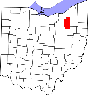 Map of Ohio highlighting Summit County | |
| Villages | ||
| Townships | ||
| CDPs | ||
| Unincorporated communities | ||
| Footnotes | ‡This populated place also has portions in an adjacent county or counties | |
| Authority control |
|
|---|