Siler City, North Carolina
Siler City is a town in western Chatham County, North Carolina, United States. As of the 2010 census, the town's population was 7,887.[5] The population of the small town has increased by 75% from 1990 to 2018. The population was estimated to be 8,205 in 2018.[6]
Siler City, North Carolina | |
|---|---|
Town | |
 North Chatham Avenue, downtown | |
| Motto(s): "Balanced for Progress" | |
 Location of Siler City, North Carolina | |
| Coordinates: 35°43′34″N 79°27′47″W | |
| Country | United States |
| State | North Carolina |
| County | Chatham |
| Area | |
| • Total | 6.04 sq mi (15.63 km2) |
| • Land | 6.01 sq mi (15.58 km2) |
| • Water | 0.02 sq mi (0.05 km2) |
| Elevation | 623 ft (190 m) |
| Population (2010) | |
| • Total | 7,887 |
| • Estimate (2019)[2] | 8,225 |
| • Density | 1,367.64/sq mi (528.08/km2) |
| Time zone | UTC-5 (Eastern (EST)) |
| • Summer (DST) | UTC-4 (EDT) |
| ZIP code | 27344 |
| Area code(s) | 919 Exchanges: 663,742,795 |
| FIPS code | 37-61860[3] |
| GNIS feature ID | 0994799[4] |
| Website | www |
History
In recent years, Siler City has become a suburb of Greensboro and the Research Triangle Park. Since 1997, it has developed as a center of industrial-scale poultry processing, and attracted numerous immigrants and Latinos for the jobs. The changing demographics have challenged the town as it works to absorb the new population and different cultures. In three years, the majority-Latino soccer team of the high school qualified for the state championship, creating a new fan base.
The Bowen-Jordan Farm, Cadmus N. Bray House, Bray-Paschal House, East Raleigh Street Historic District, Gregson-Hadley House, Former High Point Bending and Chair Company, Hotel Hadley, North Third Avenue Historic District, Siler City City Hall, Siler City Commercial Historic District, Siler City High School, Snipes-Fox House, William Teague House, and Burdett Woody House are listed on the National Register of Historic Places.[7][8]
Geography
Siler City is located in western Chatham County at 35°43′34″N 79°27′47″W (35.726030, -79.462962).[9] U.S. Route 64 passes through the northern part of the town as 11th Street, leading east 16 miles (26 km) to Pittsboro, the Chatham County seat, and west 21 miles (34 km) to Asheboro. U.S. Route 421 bypasses Siler City to the northeast, with access from Exits 168, 171, and 174. US 421 leads northwest 32 miles (51 km) to Greensboro and southeast 24 miles (39 km) to Sanford.
According to the United States Census Bureau, the town has a total area of 6.0 square miles (15.6 km2), of which 0.02 square miles (0.06 km2), or 0.37%, is water.[5]
Demographics
The population has increased by 75% from 1990 to the 2016 estimate, as workers have been attracted to new jobs in the poultry processing industry.
| Historical population | |||
|---|---|---|---|
| Census | Pop. | %± | |
| 1890 | 254 | — | |
| 1900 | 440 | 73.2% | |
| 1910 | 895 | 103.4% | |
| 1920 | 1,253 | 40.0% | |
| 1930 | 1,730 | 38.1% | |
| 1940 | 2,197 | 27.0% | |
| 1950 | 2,501 | 13.8% | |
| 1960 | 4,455 | 78.1% | |
| 1970 | 4,689 | 5.3% | |
| 1980 | 4,446 | −5.2% | |
| 1990 | 4,808 | 8.1% | |
| 2000 | 6,966 | 44.9% | |
| 2010 | 7,887 | 13.2% | |
| Est. 2019 | 8,225 | [2] | 4.3% |
| U.S. Decennial Census[10] | |||
As of the census of 2010, there were 7,887 people, 2,603 households, and 1,802 families residing in the town. The population density was 507.4/km2 (1,314/mi2). There were 2,890 housing units (2,603 of which were occupied) at an average density of 186.0/km2 (481.7/mi2). The racial makeup of the town was 44.0% White, 19.1% African American, 1.7% Native American, 0.4% Asian, 0.2% Pacific Islander, 31.1% some other race, and 3.4% from two or more races. Hispanic or Latino of any ethnicity comprised 49.8% of the population.[11]
There were 2,603 households, out of which 43.2% had children under the age of 18 living with them, 43.1% were headed by married couples living together, 18.4% had a female householder with no husband present, and 30.8% were non-families. 25.2% of all households were made up of individuals, and 11.1% were someone living alone who was 65 years of age or older. The average household size was 2.94, and the average family size was 3.50.[11]
In the town, the population was spread out, with 29.8% under the age of 18, 11.0% from 18 to 24, 28.4% from 25 to 44, 18.9% from 45 to 64, and 12.1% who were 65 years of age or older. The median age was 31.1 years. For every 100 females there were 96.5 males. For every 100 females age 18 and over, there were 92.5 males.[11]
For the period 2009–13, the estimated median annual income for a household in the town was $30,676, and the median income for a family was $34,838. Male full-time workers had a median income of $27,732 versus $24,877 for females. The per capita income for the town was $14,234. About 15.5% of families and 22.2% of the population were below the poverty line, including 34.4% of those under age 18 and 7.9% of those age 65 or over.[12]
Government and infrastructure
The North Carolina Department of Public Safety (formerly the North Carolina Department of Juvenile Justice and Delinquency Prevention) operates the Chatham Youth Development Center juvenile correctional facility in the Central Carolina Business Park in Siler City. The facility, which opened in 2008, serves both boys and girls.[13]
Education
Siler City is part of the Chatham County Public Schools District, with Jordan-Matthews High School, SAGE Academy, Chatham Middle School, Siler City Elementary School and Virginia Cross Elementary School serving the town. Chatham Charter High School is also located in Siler City, as well as Chatham Charter School.
Airport

Siler City Municipal Airport (5W8) is a single-runway airport located 3 miles (5 km) southwest of downtown Siler City. The airport is used both by local residents and as a refueling stop for transiting military and general aviation aircraft. [14][15]
Notable residents
- Frances Bavier (1902–1989), actress best remembered for her role as Aunt Bee on The Andy Griffith Show, a 1960s television sitcom set in North Carolina, lived here in retirement and is buried here.
Representation in other media
- Siler City was featured in episode 140 (season 5, episode 13) of The Andy Griffith Show (December 14, 1964) as the place where Andy and Helen were taken by a game warden for fishing without a license.[16] The city was featured again on The Andy Griffith Show (11 January, 1965) in episode 143, (season 5, episode 17) as the home of Sheriff Jackson, who visits Andy to see how Mayberry does traffic safety,[17] and once more (January 1, 1968) in episode 236 (season 8, episode 17) as the place where Aunt Bee starred in a cooking show on the local tv station. In this episode Andy described the city as only a 25-minute drive from Mayberry. [18]
- The town was the setting for Paul Cuadros' book, A Home on the Field: How One Championship Soccer Team Inspires Hope for the Revival of Small Town America (2006), a non-fiction account of his experience coaching a majority-Latino soccer team at the high school to a state championship in spite of adversity faced by the students.[19][20]
References
- "2019 U.S. Gazetteer Files". United States Census Bureau. Retrieved July 27, 2020.
- "Population and Housing Unit Estimates". United States Census Bureau. May 24, 2020. Retrieved May 27, 2020.
- "U.S. Census website". United States Census Bureau. Retrieved 2008-01-31.
- "US Board on Geographic Names". United States Geological Survey. 2007-10-25. Retrieved 2008-01-31.
- "Geographic Identifiers: 2010 Demographic Profile Data (G001): Siler City town, North Carolina". U.S. Census Bureau, American Factfinder. Archived from the original on February 12, 2020. Retrieved December 29, 2014.
- "Population and Housing Unit Estimates". Retrieved August 25, 2019.
- "National Register Information System". National Register of Historic Places. National Park Service. July 9, 2010.
- "National Register of Historic Places Listings". Weekly List of Actions Taken on Properties: 12/27/11 through 12/30/11. National Park Service. 2012-01-06.
- "US Gazetteer files: 2010, 2000, and 1990". United States Census Bureau. 2011-02-12. Retrieved 2011-04-23.
- "Census of Population and Housing". Census.gov. Retrieved June 4, 2015.
- "Profile of General Population and Housing Characteristics: 2010 Demographic Profile Data (DP-1): Siler City town, North Carolina". U.S. Census Bureau, American Factfinder. Archived from the original on December 29, 2014. Retrieved December 29, 2014.
- "Selected Economic Characteristics: 2009-2013 American Community Survey 5-Year Estimates (DP03): Siler City town, North Carolina". U.S. Census Bureau, American Factfinder. Archived from the original on December 29, 2014. Retrieved December 29, 2014.
- "Youth Development Centers Archived 2015-12-22 at the Wayback Machine." North Carolina Department of Public Safety. Retrieved on December 16, 2015. "Central Carolina Business Park 560 Progress Blvd. Siler City, N.C. 27344"
- "5W8 - Siler City Municipal". AirNav.
- "Siler City Municipal Airport (5W8)". Town of Siler CIty.
- Internet Movie Database
- https://www.imdb.com/title/tt0512485/
- https://www.imdb.com/title/tt0512596/
- Cuadros, Paul (26 August 2006). "A Home on the Field in TIME". TIME Magazine.
External links
| Wikimedia Commons has media related to Siler City, North Carolina. |
- Town website
- Chatham Economic Development Corporation
- Atlantic & Yadkin Railway
- Siler City Merchants Association
- Chatham County Events, Community Website for all events, parks, and businesses in Chatham County
Municipalities and communities of Chatham County, North Carolina, United States | ||
|---|---|---|
| Towns |  | |
| CDPs | ||
| Unincorporated communities | ||
| Footnotes | ‡This populated place also has portions in an adjacent county or counties | |
Greater Durham-Chapel Hill Metropolitan Region (Durham MSA, part of the Research Triangle) | ||
|---|---|---|
| Principal cities | 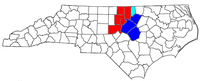 | |
| Other significant cities | ||
| Counties | ||
| Major universities | ||
| Transportation |
| |
| Newspapers | ||
| Miscellaneous | ||