Siddikine
Siddikine (Arabic: صديقين) is a village in Southern Lebanon, located in Tyre District, Governorate of South Lebanon.
Siddikine صديقين | |
|---|---|
Village | |
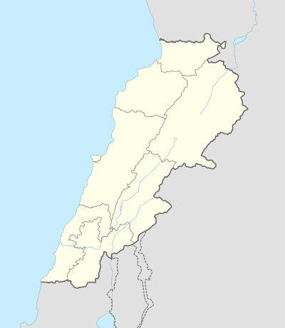 Siddikine Location within Lebanon | |
| Coordinates: 33°11′24″N 35°18′37″E | |
| Grid position | 179/288 PAL |
| Country | |
| Governorate | South Lebanon Governorate |
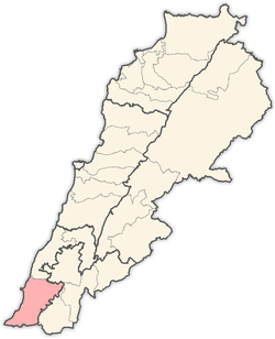
| District | Tyre District |
| Time zone | UTC+2 (EET) |
| • Summer (DST) | UTC+3 (EEST) |
| Dialing code | +9617 |
Origin of name
E. H. Palmer wrote that the name means "the truthful ones".[1]
History
In 1596, it was named as a village, Sidiqin, in the Ottoman nahiya (subdistrict) of Tibnin under the liwa' (district) of Safad, with a population of 46 households, all Muslim. The villagers paid a fixed tax rate of 25% on agricultural products, such as wheat, barley, summer crops, fruit trees, goats and beehives, in addition to occasional revenues; a total of 10,752 akçe.[2][3]
In 1875, Victor Guérin noted: "Here are what appears to be the remains of an ancient synagogue. Its direction is from south to north, which is the general direction of the ancient synagogues of Palestine; and, besides, here I remarked two monolithic pillars, cut one side in pilaster fashion, and rounded on the other side like a half column. This kind of pillar generally terminates the end of the range of columns in these synagogues."[4]
In 1881, the PEF's Survey of Western Palestine (SWP) described it: "A village, built of stone, with many ruined houses; contains about 150 Metawileh; surrounded by figs, gardens, and arable land. Water from cisterns and 'Ain el Tuzeh."[5]
They further noted: "There are remains of an early Christian site at this village; some well-dressed stones scattered about with crosses on them: There are also rock-cut cisterns, tombs, and stone olive and wine presses. The site of the ancient place was a little to the north of the present village."[6]
References
- Palmer, 1881, p. 32
- Hütteroth and Abdulfattah, 1977, p. 179
- Note that Rhode, 1979, p. 6 writes that the register that Hütteroth and Abdulfattah studied was not from 1595/6, but from 1548/9
- Guérin, 1880, p. 389; as translated in Conder and Kitchener, 1881, SWP I, p. 139
- Conder and Kitchener, 1881, SWP I, p. 94
- Conder and Kitchener, 1881, SWP I, p. 138
Bibliography
- Conder, C.R.; Kitchener, H.H. (1881). The Survey of Western Palestine: Memoirs of the Topography, Orography, Hydrography, and Archaeology. 1. London: Committee of the Palestine Exploration Fund.
- Guérin, V. (1880). Description Géographique Historique et Archéologique de la Palestine (in French). 3: Galilee, pt. 2. Paris: L'Imprimerie Nationale.
- Hütteroth, Wolf-Dieter; Abdulfattah, Kamal (1977). Historical Geography of Palestine, Transjordan and Southern Syria in the Late 16th Century. Erlanger Geographische Arbeiten, Sonderband 5. Erlangen, Germany: Vorstand der Fränkischen Geographischen Gesellschaft. ISBN 3-920405-41-2.
- Palmer, E.H. (1881). The Survey of Western Palestine: Arabic and English Name Lists Collected During the Survey by Lieutenants Conder and Kitchener, R. E. Transliterated and Explained by E.H. Palmer. Committee of the Palestine Exploration Fund.
- Rhode, H. (1979). Administration and Population of the Sancak of Safed in the Sixteenth Century. Columbia University.
External links
- Saddiqine, Localiban
- Survey of Western Palestine, Map 2: IAA, Wikimedia commons
Capital: Tyre | ||
| Towns and villages |
|  |
| Palestinian refugee camps | ||
| Other | ||