Sheffield, Ohio
Sheffield is a village in Lorain County, Ohio, United States, along the Black River. The population was 3,982 at the 2010 census.
Sheffield, Ohio | |
|---|---|
 The old Burrell house | |
 Location of Sheffield, Ohio | |
 Location of Sheffield in Lorain County | |
| Coordinates: 41°26′53″N 82°5′0″W | |
| Country | United States |
| State | Ohio |
| County | Lorain |
| Government | |
| • Mayor | John D. Hunter |
| Area | |
| • Total | 10.84 sq mi (28.08 km2) |
| • Land | 10.74 sq mi (27.82 km2) |
| • Water | 0.10 sq mi (0.25 km2) |
| Elevation | 633 ft (193 m) |
| Population | |
| • Total | 3,982 |
| • Estimate (2019)[4] | 4,402 |
| • Density | 409.76/sq mi (158.21/km2) |
| Time zone | UTC-5 (Eastern (EST)) |
| • Summer (DST) | UTC-4 (EDT) |
| ZIP code | 44054 |
| Area code(s) | 440 |
| FIPS code | 39-72060[5] |
| GNIS feature ID | 1048375[2] |
| Website | sheffieldvillage |
Geography
Sheffield is located at 41°26′53″N 82°5′0″W (41.448009, -82.083397).[6]
According to the United States Census Bureau, the village has a total area of 10.84 square miles (28.08 km2), of which 10.74 square miles (27.82 km2) is land and 0.10 square miles (0.26 km2) is water.[7]
Demographics
| Historical population | |||
|---|---|---|---|
| Census | Pop. | %± | |
| 1940 | 733 | — | |
| 1950 | 1,147 | 56.5% | |
| 1960 | 1,664 | 45.1% | |
| 1970 | 1,730 | 4.0% | |
| 1980 | 1,886 | 9.0% | |
| 1990 | 1,943 | 3.0% | |
| 2000 | 2,949 | 51.8% | |
| 2010 | 3,982 | 35.0% | |
| Est. 2019 | 4,402 | [4] | 10.5% |
| U.S. Decennial Census[8] | |||
2010 census
As of the census[3] of 2010, there were 3,982 people, 1,581 households, and 1,160 families living in the village. The population density was 370.8 inhabitants per square mile (143.2/km2). There were 1,666 housing units at an average density of 155.1 per square mile (59.9/km2). The racial makeup of the village was 89.3% White, 4.0% African American, 0.3% Native American, 2.7% Asian, 1.4% from other races, and 2.2% from two or more races. Hispanic or Latino of any race were 6.1% of the population.
There were 1,581 households, of which 26.9% had children under the age of 18 living with them, 63.3% were married couples living together, 6.9% had a female householder with no husband present, 3.2% had a male householder with no wife present, and 26.6% were non-families. 21.9% of all households were made up of individuals, and 10.7% had someone living alone who was 65 years of age or older. The average household size was 2.51 and the average family size was 2.94.
The median age in the village was 45.2 years. 20.2% of residents were under the age of 18; 6.2% were between the ages of 18 and 24; 23.2% were from 25 to 44; 34.2% were from 45 to 64; and 16.2% were 65 years of age or older. The gender makeup of the village was 49.3% male and 50.7% female.
2000 census
As of the census[5] of 2000, there were 2,949 people, 1,089 households, and 866 families living in the village. The population density was 272.6 people per square mile (105.2/km2). There were 1,147 housing units at an average density of 106.0 per square mile (40.9/km2). The racial makeup of the village was 90.88% White, 4.27% African American, 0.10% Native American, 0.81% Asian, 0.10% Pacific Islander, 2.61% from other races, and 1.22% from two or more races. Hispanic or Latino of any race were 5.93% of the population.
There were 1,089 households, out of which 34.5% had children under the age of 18 living with them, 67.4% were married couples living together, 9.1% had a female householder with no husband present, and 20.4% were non-families. 16.5% of all households were made up of individuals, and 7.3% had someone living alone who was 65 years of age or older. The average household size was 2.71 and the average family size was 3.06.
In the village, the population was spread out, with 26.3% under the age of 18, 6.6% from 18 to 24, 29.3% from 25 to 44, 26.2% from 45 to 64, and 11.6% who were 65 years of age or older. The median age was 39 years. For every 100 females there were 94.4 males. For every 100 females age 18 and over, there were 95.2 males.
The median income for a household in the village was $59,816, and the median income for a family was $66,136. Males had a median income of $43,313 versus $35,174 for females. The per capita income for the village was $25,218. About 2.5% of families and 3.2% of the population were below the poverty line, including 5.1% of those under age 18 and none of those age 65 or over.
Education
Sheffield is served by the Sheffield-Sheffield Lake City Schools.
Notable person
- Lee Richmond, a 19th-century major league baseball pitcher, was born in Sheffield.[9]
References
- "2019 U.S. Gazetteer Files". United States Census Bureau. Retrieved July 28, 2020.
- "US Board on Geographic Names". United States Geological Survey. 2007-10-25. Retrieved 2008-01-31.
- "U.S. Census website". United States Census Bureau. Retrieved 2013-01-06.
- "Population and Housing Unit Estimates". United States Census Bureau. May 24, 2020. Retrieved May 27, 2020.
- "U.S. Census website". United States Census Bureau. Retrieved 2008-01-31.
- "US Gazetteer files: 2010, 2000, and 1990". United States Census Bureau. 2011-02-12. Retrieved 2011-04-23.
- "US Gazetteer files 2010". United States Census Bureau. Archived from the original on 2012-01-25. Retrieved 2013-01-06.
- "Census of Population and Housing". Census.gov. Retrieved June 4, 2015.
- Reichler, Joseph L., ed. (1979) [1969]. The Baseball Encyclopedia (4th ed.). New York: Macmillan Publishing. ISBN 0-02-578970-8.
External links
Places adjacent to Sheffield, Ohio | |
|---|---|
Municipalities and communities of Lorain County, Ohio, United States | ||
|---|---|---|
| Cities | 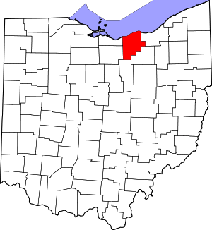 Map of Ohio highlighting Lorain County | |
| Villages | ||
| Townships | ||
| CDPs | ||
| Unincorporated communities | ||
| Ghost town | ||
| Footnotes | ‡This populated place also has portions in an adjacent county or counties | |