Eaton Township, Lorain County, Ohio
Eaton Township is one of the eighteen townships of Lorain County, Ohio, United States. As of the 2010 census, the population was 5,750.[3]
Eaton Township, Lorain County, Ohio | |
|---|---|
 Location of Eaton Township in Lorain County | |
| Coordinates: 41°19′13″N 82°1′38″W | |
| Country | United States |
| State | Ohio |
| County | Lorain |
| Area | |
| • Total | 22.99 sq mi (59.55 km2) |
| • Land | 22.92 sq mi (59.35 km2) |
| • Water | 0.08 sq mi (0.20 km2) |
| Elevation | 791 ft (241 m) |
| Population | |
| • Total | 5,750 |
| • Density | 251/sq mi (96.9/km2) |
| Time zone | UTC-5 (Eastern (EST)) |
| • Summer (DST) | UTC-4 (EDT) |
| FIPS code | 39-24220[4] |
| GNIS feature ID | 1086507[2] |
| Website | eatontownship |
Geography
Located in eastern Lorain County, it borders the following townships and cities:
- North Ridgeville - north
- Olmsted Township, Cuyahoga County - northeast corner
- Columbia Township - east
- Liverpool Township, Medina County - southeast corner
- Grafton Township - southeast
- Grafton - south
- Carlisle Township - west
- Elyria - northwest
Parts of two municipalities, separate from Eaton Township, occupy land that was once part of Eaton Township: a small corner of Elyria in the northwest, and the majority of Grafton in the south. The census-designated place of Eaton Estates lies in the center of the township.
Name and history
It is the only Eaton Township statewide.[5]
Government
The township is governed by a three-member board of trustees, who are elected in November of odd-numbered years to a four-year term beginning on the following January 1. Two are elected in the year after the presidential election and one is elected in the year before it. There is also an elected township fiscal officer,[6] who serves a four-year term beginning on April 1 of the year after the election, which is held in November of the year before the presidential election. Vacancies in the fiscal officership or on the board of trustees are filled by the remaining trustees.
References
- "U.S. Gazetteer Files: 2019: County Subdivisions: Ohio". U.S. Census Bureau Geography Division. Retrieved July 31, 2020.
- "US Board on Geographic Names". United States Geological Survey. 2007-10-25. Retrieved 2008-01-31.
- "Total Population: 2010 Census DEC Summary File 1 (P1), Eaton township, Lorain County, Ohio". data.census.gov. U.S. Census Bureau. Retrieved July 31, 2020.
- "U.S. Census website". United States Census Bureau. Retrieved 2008-01-31.
- "Detailed map of Ohio" (PDF). United States Census Bureau. 2000. Retrieved 2007-02-16.
- §503.24, §505.01, and §507.01 of the Ohio Revised Code. Accessed 4/30/2009.
External links
Municipalities and communities of Lorain County, Ohio, United States | ||
|---|---|---|
| Cities | 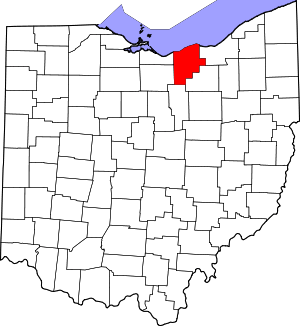 Map of Ohio highlighting Lorain County | |
| Villages | ||
| Townships | ||
| CDPs | ||
| Unincorporated communities | ||
| Ghost town | ||
| Footnotes | ‡This populated place also has portions in an adjacent county or counties | |