Shōwa, Gunma
Shōwa (昭和村, Shōwa-mura) is a village located in Gunma Prefecture, Japan. As of February 2015, the village had an estimated population of 7,229, and a population density of 113 persons per km2. Its total area is 64.14 km2.
Shōwa 昭和村 | |
|---|---|
Village | |
.JPG) Shōwa village office | |
 Flag  Seal | |
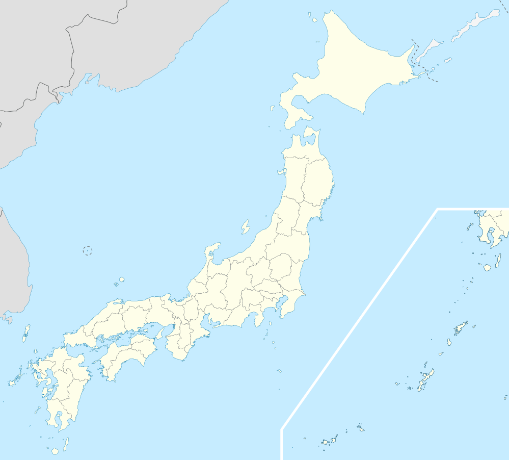
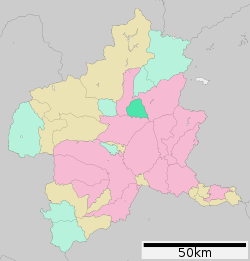 Location of Shōwa in Gunma Prefecture | |
 Shōwa | |
| Coordinates: 36°38′23.1″N 139°3′57.2″E | |
| Country | Japan |
| Region | Kantō |
| Prefecture | Gunma Prefecture |
| District | Tone |
| Area | |
| • Total | 64.14 km2 (24.76 sq mi) |
| Population (February 2015) | |
| • Total | 7,229 |
| • Density | 113/km2 (290/sq mi) |
| Time zone | UTC+9 (Japan Standard Time) |
| City symbols | |
| • Tree | Sakura |
| • Flower | Azalea |
| • Bird | Green pheasant |
| Phone number | 0278-24-5111 |
| Address | 388 Ōaza Itoi, Shōwa-mura, Tone-gun, Gunma-ken 379-1298 |
| Website | https://www.vill.showa.gunma.jp/ |
Geography
Located in central Gunma, Shōwa is on the northwestern slopes of Mt. Akagi, it is surrounded on the north, east, and west by the city of Numata and borders Shibukawa to the south
Surrounding municipalities
History
The area of present-day Shōwa was part of the tenryō holdings in Kōzuke Province administered directly by the Tokugawa shogunate during the Edo period. On April 1, 1889 with the creation of the municipalities system after the Meiji Restoration, Kuroho and Itonose villages were established within Kitaseta District, Gunma. In 1896, Kitaseta District and a portion of Agatsuma District were transferred to Tone District, The two villages merged on November 1, 1958 to form Shōwa.
Economy
Traditionally, the economy of Shōwa was heavily dependent on agriculture; primarily market gardening.
Education
- Primary Schools
- Higashi Elementary School
- Okawara Elementary School
- Minami Elementary School
- Middle Schools
- Shōwa Junior High School
Transportation
Shōwa is not served by any railway services. The nearest station is Numata in the neighboring city of Numata.
Highways
- Kan-Etsu Expressway – Akagi-Kōgen SA, Shōwa IC
External links
![]()
- Official Website (in Japanese)
Maebashi (capital) | ||
| Core cities |
| |
| Special cities | ||
| Cities | ||
| Districts | ||
| Authority control |
|
|---|