Serra de Santa Bárbara
Serra de Santa Bárbara is the peak of an inactive volcano in the western part of the island of Terceira, Azores, Portugal. At 1,021 m (3,350 ft) elevation, it is the highest point of the island.[1] It is named after the village located on the coast to the south, Santa Bárbara in the municipality of Angra do Heroísmo.[2]
| Serra de Santa Bárbara | |
|---|---|
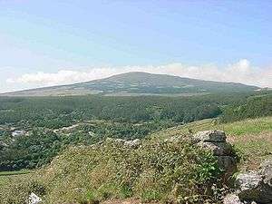 Serra de Santa Bárbara from the south | |
| Highest point | |
| Elevation | 1,021 m (3,350 ft) |
| Prominence | 1,000 m (3,300 ft) |
| Coordinates | 38°44′31″N 27°19′09″W |
| Geography | |
 Serra de Santa Bárbara | |
| Geology | |
| Mountain type | Caldera |
| Volcanic belt | Mid-Atlantic Ridge |
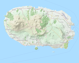
The peak lies on the south rim of the Santa Barbara Caldera which is approximately one kilometer wide, having two smaller peaks in the center of the caldera.[3] The upper slopes and the floor of the caldera are covered by holly and juniper forests,[4] almost all of which are protected in the Nature Reserve of Serra de Santa Barbara e dos Mistérios Negros.[5]
In 1761 a portion of the volcano erupted, and according to local religious lore, the villagers took a holy relic up to the erupting lava, and the lava stopped.[6]
Notes and references
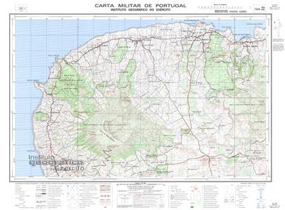
- "Map 22 Biscoitos (Terceira, Açores)" (Map). Arquipélago dos Açores - Central. 1:25,000 (in Portuguese). Lisbon: Instituto Geográfico do Exército. 2002. Retrieved 7 December 2015.
- "Map 24 Angra do Heroísmo (Terceira)" (Map). Arquipélago dos Açores - Central. 1:25,000 (in Portuguese). Lisbon: Instituto Geográfico do Exército. 2002.
- Terceira Island, AMS M789 (GSGS 4123) (Map) (fourth ed.). 1:50,000. United States Army Map Service. 1948.
- Elias, Rui Bento (2013). "Floresta natural dos Açores" (PDF). Pingo de Lava (in Portuguese). 1 (especial 50 anos): 35–37, page 36.
- "Nature Reserve of Serra de Santa Barbara e dos Mistérios Negros". Government of the Azores.
- Quando no sítio conhecido por "Entre o Pico e a Serra" rebentou um vulcão cujos fumos densos desceram da cumeada da Serra de Santa Bárbara, a coroa do Império do Outeiro foi levada ao local e as lavas não avançaram mais para além do sítio onde depois foi construído o Império. Noé, Paula (2012). Os Impérios do Espírito Santo na Ilha Terceira (PDF) (in Portuguese). Sacavém, Portugal: Instituto da Habitação e Reabilitação Urbana. p. 6.