Secor, Illinois
Secor is a village in Woodford County, Illinois, United States. The population was 373 at the 2010 census. It is part of the Peoria, Illinois Metropolitan Statistical Area. Secor is located just off U.S. Route 24 between El Paso and Eureka.
Secor | |
|---|---|
Village | |
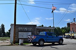 Secor post office | |
 Location of Secor in Woodford County, Illinois. | |
.svg.png) Location of Illinois in the United States | |
| Coordinates: 40°44′28″N 89°8′9″W | |
| Country | United States |
| State | Illinois |
| County | Woodford |
| Area | |
| • Total | 0.29 sq mi (0.75 km2) |
| • Land | 0.29 sq mi (0.75 km2) |
| • Water | 0.00 sq mi (0.00 km2) |
| Elevation | 733 ft (223 m) |
| Population (2010) | |
| • Total | 373 |
| • Estimate (2019)[2] | 355 |
| • Density | 1,224.14/sq mi (472.12/km2) |
| Time zone | UTC-6 (CST) |
| • Summer (DST) | UTC-5 (CDT) |
| ZIP Code(s) | 61771 |
| Area code(s) | 309 |
| FIPS code | 17-68510 |
| Wikimedia Commons | Secor, Illinois |
History
The town was named after Charles A. Secor. A partner in the Engineering firm that laid out the eastern branch of the Peoria and Oquawka Railroad.
Geography
Secor is located at 40°44′28″N 89°8′9″W (40.741074, -89.135875).[3]
According to the 2010 census, Secor has a total area of 0.3 square miles (0.78 km2), all land.[4]
Demographics
| Historical population | |||
|---|---|---|---|
| Census | Pop. | %± | |
| 1870 | 407 | — | |
| 1880 | 456 | 12.0% | |
| 1890 | 379 | −16.9% | |
| 1900 | 373 | −1.6% | |
| 1910 | 358 | −4.0% | |
| 1920 | 311 | −13.1% | |
| 1930 | 280 | −10.0% | |
| 1940 | 335 | 19.6% | |
| 1950 | 375 | 11.9% | |
| 1960 | 427 | 13.9% | |
| 1970 | 508 | 19.0% | |
| 1980 | 488 | −3.9% | |
| 1990 | 389 | −20.3% | |
| 2000 | 379 | −2.6% | |
| 2010 | 373 | −1.6% | |
| Est. 2019 | 355 | [2] | −4.8% |
| U.S. Decennial Census[5] | |||
As of the census[6] of 2000, there were 379 people, 144 households, and 109 families residing in the village. The population density was 1,068.7 people per square mile (418.1/km2). There were 155 housing units at an average density of 437.1 per square mile (171.0/km2). The racial makeup of the village was 99.74% White and 0.26% African American.
There were 144 households out of which 31.9% had children under the age of 18 living with them, 62.5% were married couples living together, 9.0% had a female householder with no husband present, and 24.3% were non-families. 18.8% of all households were made up of individuals and 7.6% had someone living alone who was 65 years of age or older. The average household size was 2.63 and the average family size was 2.98.
In the village, the population was spread out with 26.6% under the age of 18, 6.3% from 18 to 24, 26.9% from 25 to 44, 24.8% from 45 to 64, and 15.3% who were 65 years of age or older. The median age was 38 years. For every 100 females, there were 95.4 males. For every 100 females age 18 and over, there were 95.8 males.
The median income for a household in the village was $44,205, and the median income for a family was $44,722. Males had a median income of $32,232 versus $17,500 for females. The per capita income for the village was $22,635. About 9.4% of families and 8.2% of the population were below the poverty line, including 6.5% of those under age 18 and 17.2% of those age 65 or over.
Notable people
- Minnie Vautrin, an American missionary.
References
- "2019 U.S. Gazetteer Files". United States Census Bureau. Retrieved July 14, 2020.
- "Population and Housing Unit Estimates". United States Census Bureau. May 24, 2020. Retrieved May 27, 2020.
- "US Gazetteer files: 2010, 2000, and 1990". United States Census Bureau. 2011-02-12. Retrieved 2011-04-23.
- "G001 - Geographic Identifiers - 2010 Census Summary File 1". United States Census Bureau. Retrieved 2015-12-25.
- "Census of Population and Housing". Census.gov. Retrieved June 4, 2015.
- "U.S. Census website". United States Census Bureau. Retrieved 2008-01-31.
External links
Municipalities and communities of Woodford County, Illinois, United States | ||
|---|---|---|
| Cities | Map of Illinois highlighting Woodford County | |
| Villages | ||
| Townships | ||
| Unincorporated communities | ||
| Authority control |
|
|---|