Sainte-Colombe-sur-Gand
Sainte-Colombe-sur-Gand is a commune in the Loire department in central France.
Sainte-Colombe-sur-Gand | |
|---|---|
Commune | |
 | |
Location of Sainte-Colombe-sur-Gand 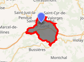
| |
 Sainte-Colombe-sur-Gand  Sainte-Colombe-sur-Gand | |
| Coordinates: 45°52′47″N 4°16′32″E | |
| Country | France |
| Region | Auvergne-Rhône-Alpes |
| Department | Loire |
| Arrondissement | Roanne |
| Canton | Le Coteau |
| Intercommunality | Balbigny |
| Government | |
| • Mayor (2014–2020) | Jean-Pierre Bissay |
| Area 1 | 13.56 km2 (5.24 sq mi) |
| Population (2017-01-01)[1] | 408 |
| • Density | 30/km2 (78/sq mi) |
| Time zone | UTC+01:00 (CET) |
| • Summer (DST) | UTC+02:00 (CEST) |
| INSEE/Postal code | 42209 /42540 |
| Elevation | 468–774 m (1,535–2,539 ft) (avg. 628 m or 2,060 ft) |
| 1 French Land Register data, which excludes lakes, ponds, glaciers > 1 km2 (0.386 sq mi or 247 acres) and river estuaries. | |
Population
| Year | Pop. | ±% |
|---|---|---|
| 1793 | 1,140 | — |
| 1806 | 1,174 | +3.0% |
| 1821 | 1,197 | +2.0% |
| 1831 | 1,327 | +10.9% |
| 1841 | 1,405 | +5.9% |
| 1851 | 1,497 | +6.5% |
| 1861 | 1,487 | −0.7% |
| 1872 | 1,506 | +1.3% |
| 1881 | 1,418 | −5.8% |
| 1891 | 1,285 | −9.4% |
| 1901 | 1,065 | −17.1% |
| 1911 | 881 | −17.3% |
| 1921 | 701 | −20.4% |
| 1931 | 612 | −12.7% |
| 1946 | 573 | −6.4% |
| 1954 | 537 | −6.3% |
| 1962 | 507 | −5.6% |
| 1968 | 478 | −5.7% |
| 1975 | 451 | −5.6% |
| 1982 | 420 | −6.9% |
| 1990 | 437 | +4.0% |
| 1999 | 420 | −3.9% |
| 2012 | 425 | +1.2% |
| 2016 | 418 | −1.6% |
See also
References
- "Populations légales 2017". INSEE. Retrieved 6 January 2020.
| Wikimedia Commons has media related to Sainte-Colombe-sur-Gand. |
| Authority control |
|
|---|
This article is issued from Wikipedia. The text is licensed under Creative Commons - Attribution - Sharealike. Additional terms may apply for the media files.