Saint-Rirand
Saint-Rirand is a commune in the Loire department in central France.
Saint-Rirand | |
|---|---|
Commune | |
Location of Saint-Rirand 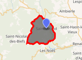
| |
 Saint-Rirand  Saint-Rirand | |
| Coordinates: 46°04′37″N 3°50′58″E | |
| Country | France |
| Region | Auvergne-Rhône-Alpes |
| Department | Loire |
| Arrondissement | Roanne |
| Canton | Renaison |
| Intercommunality | Côte roannaise |
| Government | |
| • Mayor (2014–2020) | Didier Prunet |
| Area 1 | 16.43 km2 (6.34 sq mi) |
| Population (2017-01-01)[1] | 140 |
| • Density | 8.5/km2 (22/sq mi) |
| Time zone | UTC+01:00 (CET) |
| • Summer (DST) | UTC+02:00 (CEST) |
| INSEE/Postal code | 42281 /42370 |
| Elevation | 486–1,035 m (1,594–3,396 ft) (avg. 590 m or 1,940 ft) |
| 1 French Land Register data, which excludes lakes, ponds, glaciers > 1 km2 (0.386 sq mi or 247 acres) and river estuaries. | |
Population
| Year | Pop. | ±% |
|---|---|---|
| 1793 | 660 | — |
| 1806 | 455 | −31.1% |
| 1821 | 611 | +34.3% |
| 1831 | 602 | −1.5% |
| 1841 | 578 | −4.0% |
| 1851 | 615 | +6.4% |
| 1861 | 600 | −2.4% |
| 1872 | 587 | −2.2% |
| 1881 | 578 | −1.5% |
| 1891 | 725 | +25.4% |
| 1901 | 538 | −25.8% |
| 1911 | 548 | +1.9% |
| 1921 | 419 | −23.5% |
| 1931 | 335 | −20.0% |
| 1946 | 257 | −23.3% |
| 1954 | 226 | −12.1% |
| 1962 | 216 | −4.4% |
| 1968 | 180 | −16.7% |
| 1975 | 140 | −22.2% |
| 1982 | 134 | −4.3% |
| 1990 | 124 | −7.5% |
| 1999 | 110 | −11.3% |
| 2008 | 150 | +36.4% |
| 2017 | 140 | −6.7% |
See also
References
- "Populations légales 2017". INSEE. Retrieved 6 January 2020.
| Wikimedia Commons has media related to Saint-Rirand. |
| Authority control |
|
|---|
This article is issued from Wikipedia. The text is licensed under Creative Commons - Attribution - Sharealike. Additional terms may apply for the media files.