Rutland, Massachusetts
Rutland is a town in Worcester County, Massachusetts, United States. The population was 7,973 at the 2010 census. Rutland is the geographic center of Massachusetts; a tree, the Central Tree, located on Central Tree Road, marks the general spot.
Rutland, Massachusetts | |
|---|---|
 Community Hall | |
 Seal | |
| Nickname(s): "Geographical Center of Massachusetts"[1] | |
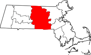
 Location in Worcester County and the state of Massachusetts. | |
| Coordinates: 42°22′10″N 71°56′55″W | |
| Country | United States |
| State | Massachusetts |
| County | Worcester |
| Settled | 1686 |
| Incorporated | 1713 |
| Government | |
| • Type | Open town meeting |
| Area | |
| • Total | 36.4 sq mi (94.3 km2) |
| • Land | 35.3 sq mi (91.3 km2) |
| • Water | 1.2 sq mi (3.0 km2) |
| Elevation | 1,112 ft (339 m) |
| Population (2010) | |
| • Total | 7,973 |
| • Density | 220/sq mi (85/km2) |
| Time zone | UTC−5 (Eastern) |
| • Summer (DST) | UTC−4 (Eastern) |
| ZIP Code | 01543 |
| Area code(s) | 508/774 |
| FIPS code | 25-58825 |
| GNIS feature ID | 0618381 |
| Website | Town of Rutland, Massachusetts |
History
The town was first settled in 1666 as Naquag. Officially incorporated in 1713, the Town of Rutland was made up of Barre, Hubbardston, Oakham, Princeton, and the northern half of Paxton. In Northern Rutland there are prison camps used during the Revolutionary War used for captured Hessian mercenaries hired by the British.
Geography
According to the United States Census Bureau, the town has a total area of 36.4 square miles (94 km2), of which 35.3 square miles (91 km2) is land and 1.1 square miles (2.8 km2), or 3.16%, is water.
Rutland is bordered by Princeton on the northeast, Holden on the east, Paxton on the southeast, Oakham on the southwest, and Barre and Hubbardston on the northwest. Rutland has five villages within its limits: New Boston, West Rutland, Muschopauge, North Rutland, and Turkey Hill
Rutland is approximately 13 miles (21 km) northwest of Worcester, 52 miles (84 km) west of Boston, and 181 miles (291 km) northeast of New York City. Rutland is the highest town between The Berkshires and the Atlantic. The town common is 1,200 feet (370 m) above sea level. It is also the exact geographical center of Massachusetts.
Demographics
| Year | Pop. | ±% |
|---|---|---|
| 1850 | 1,223 | — |
| 1860 | 1,076 | −12.0% |
| 1870 | 1,024 | −4.8% |
| 1880 | 1,059 | +3.4% |
| 1890 | 980 | −7.5% |
| 1900 | 1,334 | +36.1% |
| 1910 | 1,743 | +30.7% |
| 1920 | 1,743 | +0.0% |
| 1930 | 2,442 | +40.1% |
| 1940 | 2,181 | −10.7% |
| 1950 | 3,056 | +40.1% |
| 1960 | 3,253 | +6.4% |
| 1970 | 3,198 | −1.7% |
| 1980 | 4,334 | +35.5% |
| 1990 | 4,936 | +13.9% |
| 2000 | 6,353 | +28.7% |
| 2010 | 7,973 | +25.5% |
| * = population estimate. Source: United States Census records and Population Estimates Program data.[2][3][4][5][6][7][8][9][10][11] | ||
As of the year 2008, there were approximately 8,257 people, 2,300 households, and 1,721 families residing in the town. The population density was 180.2 people per square mile (69.6/km2). There were 2,392 housing units at an average density of 67.8 per square mile (26.2/km2). The racial makeup of the town was 96.58% White, 1.04% Black or African American, 0.14% Native American, 0.46% Asian, 0.44% from other races, and 1.34% from two or more races. Hispanic or Latino of any race were 1.32% of the population.
There were 2,253 households, out of which 42.3% had children under the age of 18 living with them, 64.1% were married couples living together, 8.6% had a female householder with no husband present, and 24.8% were non-families. Of all households 19.9% were made up of individuals, and 6.6% had someone living alone who was 65 years of age or older. The average household size was 2.77 and the average family size was 3.21.
In the town, the population was spread out, with 30.8% under the age of 18, 6.1% from 18 to 24, 33.8% from 25 to 44, 21.7% from 45 to 64, and 7.7% who were 65 years of age or older. The median age was 35 years. For every 100 females, there were 102.1 males. For every 100 females age 18 and over, there were 95.6 males.
The median income for a household in the town was $62,846, and the median income for a family was $70,689. Males had a median income of $45,824 versus $35,390 for females. The per capita income for the town was $23,311. About 1.5% of families and 3.3% of the population were below the poverty line, including 2.0% of those under age 18 and 7.3% of those age 65 or over.
Politics
| County-level state agency heads | |
|---|---|
| Clerk of Courts: | Dennis P. McManus (D) |
| District Attorney: | Joe Early Jr. (D) |
| Register of Deeds: | Katie Toomey (D) |
| Register of Probate: | Stephanie Fattman (R) |
| County Sheriff: | Lew Evangelidis (R) |
| State government | |
| State Representative(s): | Kimberly Ferguson (R) |
| State Senator(s): | Anne Gobi (D) |
| Governor's Councilor(s): | Jen Caissie (R) |
| Federal government | |
| U.S. Representative(s): | James P. McGovern (D-2nd District), |
| U.S. Senators: | Elizabeth Warren (D), Ed Markey (D) |
Internally, Rutland uses a town meeting style system of governance. As of 2019, the Board of Selectmen is composed of Sheila H. Dibb, Jeffrey A. Stillings, Mitchell Ruscitti, Leah M. Whiteman, and Wayne A. Walker. Terms for the board of selectmen are staggered.[12]
Arts and culture
Each year, Rutland holds a four-day-long Fourth of July celebration, beginning on July 1. Events include performances by area musicians, a lip-sync concert, chicken barbecue hosted by the local Fire Brigade, a Historical Society Lemonade Social, and an acclaimed fireworks show. On the Fourth, Rutland holds a parade with floats made by local organizations and special guests including local and regional politicians.
August also brings in the Central Tree Chowder Chilli Challenge, an event hosted and sponsored by the Rutland Fire Brigade. Area restaurants compete for local bragging rights for having the best area clam chowder. With two ways to "win", restaurants compete for both the people's choice as well as the votes of their peers and competitors.
While the main draw to the day is the clam chowder, the event has evolved into a family-oriented day. There is no admission fee except for those who wish to sample the chowder. However, there are also pony rides, face painting, "exotic" animal exhibits, inflatable rooms for kids, a free "train ride" (a lawn tractor towing three cars around the local athletic track), as well as miscellaneous vendors, both local and from surrounding towns.
Proceeds go to the local Fire Brigade, which uses the money for restoration of the town's original fire station, and also to help supplement the expenses of the Fire Department by purchasing much needed equipment that would otherwise have to wait for town funding.
Education
Rutland is a part of the Wachusett Regional School District.
There are two elementary schools: Naquag Elementary, for grades up to 2nd (named after the tribe of Indians that once resided there), and Glenwood Elementary, grades 3rd through 5th.
The middle school is Central Tree Middle School.
The public high schools are Wachusett Regional High School in Holden, and Bay Path Regional Vocational Technical High School in Charlton.
See also
- Geographic centers of the United States
References
- "Town of Rutland, Massachusetts". Town of Rutland, Massachusetts. Retrieved August 29, 2012.
- "Total Population (P1), 2010 Census Summary File 1". American FactFinder, All County Subdivisions within Massachusetts. United States Census Bureau. 2010.
- "Massachusetts by Place and County Subdivision - GCT-T1. Population Estimates". United States Census Bureau. Retrieved July 12, 2011.
- "1990 Census of Population, General Population Characteristics: Massachusetts" (PDF). US Census Bureau. December 1990. Table 76: General Characteristics of Persons, Households, and Families: 1990. 1990 CP-1-23. Retrieved July 12, 2011.
- "1980 Census of the Population, Number of Inhabitants: Massachusetts" (PDF). US Census Bureau. December 1981. Table 4. Populations of County Subdivisions: 1960 to 1980. PC80-1-A23. Retrieved July 12, 2011.
- "1950 Census of Population" (PDF). Bureau of the Census. 1952. Section 6, Pages 21-10 and 21-11, Massachusetts Table 6. Population of Counties by Minor Civil Divisions: 1930 to 1950. Retrieved July 12, 2011.
- "1920 Census of Population" (PDF). Bureau of the Census. Number of Inhabitants, by Counties and Minor Civil Divisions. Pages 21-5 through 21-7. Massachusetts Table 2. Population of Counties by Minor Civil Divisions: 1920, 1910, and 1920. Retrieved July 12, 2011.
- "1890 Census of the Population" (PDF). Department of the Interior, Census Office. Pages 179 through 182. Massachusetts Table 5. Population of States and Territories by Minor Civil Divisions: 1880 and 1890. Retrieved July 12, 2011.
- "1870 Census of the Population" (PDF). Department of the Interior, Census Office. 1872. Pages 217 through 220. Table IX. Population of Minor Civil Divisions, &c. Massachusetts. Retrieved July 12, 2011.
- "1860 Census" (PDF). Department of the Interior, Census Office. 1864. Pages 220 through 226. State of Massachusetts Table No. 3. Populations of Cities, Towns, &c. Retrieved July 12, 2011.
- "1850 Census" (PDF). Department of the Interior, Census Office. 1854. Pages 338 through 393. Populations of Cities, Towns, &c. Retrieved July 12, 2011.
- "Board of Selectmen | Rutland MA". www.townofrutland.org. Retrieved 2020-01-20.
- C. B. Tillinghast. The free public libraries of Massachusetts. 1st Report of the Free Public Library Commission of Massachusetts. Boston: Wright & Potter, 1891.
- Rutland Free Public Library. Retrieved 2010-11-10.
- July 1, 2007 through June 30, 2008; cf. The FY2008 Municipal Pie: What’s Your Share? Commonwealth of Massachusetts, Board of Library Commissioners. Boston: 2009. Available: Municipal Pie Reports Archived 2012-01-23 at the Wayback Machine. Retrieved 2010-08-04.
External links
| Wikimedia Commons has media related to Rutland, Massachusetts. |
| Wikisource has the text of a 1920 Encyclopedia Americana article about Rutland, Massachusetts. |
- Massachusetts state community page for Rutland
- Official website
- Rutland MA 4th of July
- Wachusett Region town page for Rutland
- Rutland, MA Historical Society
- Rutland, MA Crop Hunger Walk
- . Appletons' Cyclopædia of American Biography. 1900.