Rural Municipality of Kelsey
Kelsey is a rural municipality in the province of Manitoba in Western Canada. It consists of several disjoint parts. The largest part is Carrot Valley, located around and southwest of The Pas along the Carrot River, but the communities of Wanless (54°11′40″N 101°22′22″W) and Cranberry Portage (54°35′12″N 101°22′41″W), located further north, are also part of the municipality. It is 867.64 km² large. Also lying in the area around The Pas is the Opaskwayak Cree Nation Indian reserve.
Kelsey | |
|---|---|
| Rural Municipality of Kelsey | |
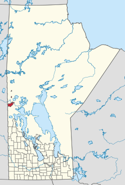 Location within Manitoba | |
| Country | Canada |
| Province | Manitoba |
| Federal riding | Churchill—Keewatinook Aski |
| Provincial riding | The Pas-Kameesak |
| Government | |
| • Reeve | Rod Berezowecki |
| • Office location | The Pas |
| Area | |
| • Total | 867.64 km2 (335.00 sq mi) |
| Population (2016) | |
| • Total | 2,424 |
| Postal code | R9A 1K6 |
| Website | Official website |
Communities
- Cranberry Portage
- Freshford
- Grace Lake
- Moostissoostikwan
- Ralls Island
- Rocky Lake
- The Pas (independent Town)
- Umpherville
- Wanless
- Westray
Demographics
According to the 2011 National Household Survey,[2] the population of Kelsey is 2,125. The population density was 2.6 per km². The racial make up of Kelsey is solely made up of Aboriginals (44.0%); First Nations (23.1%) and Metis (20.7%), and Whites (56.0%). The religious make up of Kelsey is; Christian (74.5%), non-religious (25.5%). Every resident of Kelsey is a Canadian citizen. About 4.0% of the population can speak a language that is not recognized as an official language of Canada.
External links
Sources
- Municipal Officials Directory (PDF). Winnipeg, Manitoba: Manitoba Municipal Relations. 2019.
- http://www12.statcan.gc.ca/nhs-enm/2011/dp-pd/prof/details/page.cfm?Lang=E&Geo1=CSD&Code1=4621052&Data=Count&SearchText=kelsey&SearchType=Begins&SearchPR=01&A1=Aboriginal%20peoples&B1=All&Custom=&TABID=1
Places adjacent to Rural Municipality of Kelsey | |
|---|---|
| Cities |
|  |
|---|---|---|
| Towns | ||
| Rural municipalities | ||
| First Nations | ||
| Indian reserves | ||
| Unorganized areas | ||
| Unincorporated communities | ||