Richland, New York
Richland is a town in Oswego County, New York, United States. The population was 5,718 at the 2010 census.
Richland, New York | |
|---|---|
Town | |
 Location in Oswego County and the state of New York. | |
| Coordinates: 43°32′53″N 76°8′7″W | |
| Country | United States |
| State | New York |
| County | Oswego |
| Area | |
| • Total | 60.05 sq mi (155.53 km2) |
| • Land | 57.25 sq mi (148.27 km2) |
| • Water | 2.80 sq mi (7.25 km2) |
| Elevation | 387 ft (118 m) |
| Population (2010) | |
| • Total | 5,718 |
| • Estimate (2016)[2] | 5,606 |
| • Density | 97.92/sq mi (37.81/km2) |
| Time zone | UTC-5 (Eastern (EST)) |
| • Summer (DST) | UTC-4 (EDT) |
| ZIP code | 13144 |
| Area code(s) | 315 |
| FIPS code | 36-61533 |
| GNIS feature ID | 0979419 |
| Website | Town website |
The Town of Richland is in the northeast part of Oswego County.
History
The town was first settled around 1801. The Town of Richland was formed from part of the Town of Williamstown in 1807.
Geography
According to the United States Census Bureau, the town has a total area of 60.1 square miles (156 km2), of which, 57.2 square miles (148 km2) of it is land and 2.9 square miles (7.5 km2) of it (4.86%) is water.
The west border of the town is Lake Ontario.
Demographics
| Historical population | |||
|---|---|---|---|
| Census | Pop. | %± | |
| 1820 | 488 | — | |
| 1830 | 2,733 | 460.0% | |
| 1840 | 4,050 | 48.2% | |
| 1850 | 4,079 | 0.7% | |
| 1860 | 4,128 | 1.2% | |
| 1870 | 3,975 | −3.7% | |
| 1880 | 3,991 | 0.4% | |
| 1890 | 3,771 | −5.5% | |
| 1900 | 3,535 | −6.3% | |
| 1910 | 3,791 | 7.2% | |
| 1920 | 3,738 | −1.4% | |
| 1930 | 3,816 | 2.1% | |
| 1940 | 3,848 | 0.8% | |
| 1950 | 4,067 | 5.7% | |
| 1960 | 4,554 | 12.0% | |
| 1970 | 5,324 | 16.9% | |
| 1980 | 5,594 | 5.1% | |
| 1990 | 5,917 | 5.8% | |
| 2000 | 5,824 | −1.6% | |
| 2010 | 5,718 | −1.8% | |
| Est. 2016 | 5,606 | [2] | −2.0% |
| U.S. Decennial Census[3] | |||
As of the census[4] of 2000, there were 5,824 people, 2,257 households, and 1,543 families residing in the town. The population density was 101.9 people per square mile (39.3/km2). There were 2,890 housing units at an average density of 50.5 per square mile (19.5/km2). The racial makeup of the town was 98.15% White, 0.19% African American, 0.33% Native American, 0.39% Asian, 0.12% from other races, and 0.82% from two or more races. Hispanic or Latino of any race were 0.65% of the population.
There were 2,257 households, out of which 34.4% had children under the age of 18 living with them, 53.2% were married couples living together, 10.5% had a female householder with no husband present, and 31.6% were non-families. 26.1% of all households were made up of individuals, and 12.9% had someone living alone who was 65 years of age or older. The average household size was 2.57 and the average family size was 3.10.
In the town, the population was spread out, with 27.7% under the age of 18, 7.0% from 18 to 24, 28.9% from 25 to 44, 23.2% from 45 to 64, and 13.2% who were 65 years of age or older. The median age was 36 years. For every 100 females, there were 97.6 males. For every 100 females age 18 and over, there were 94.8 males.
The median income for a household in the town was $36,410, and the median income for a family was $43,564. Males had a median income of $36,035 versus $22,337 for females. The per capita income for the town was $16,780. About 9.6% of families and 13.4% of the population were below the poverty line, including 16.6% of those under age 18 and 13.8% of those age 65 or over.
Communities and locations in Richland
- Pulaski – The Village of Pulaski.
- Ramona Beach – A community on the shore of Lake Ontario.
References
- "2016 U.S. Gazetteer Files". United States Census Bureau. Retrieved Jul 5, 2017.
- "Population and Housing Unit Estimates". Retrieved June 9, 2017.
- "Census of Population and Housing". Census.gov. Retrieved June 4, 2015.
- "U.S. Census website". United States Census Bureau. Retrieved 2008-01-31.
External links
Municipalities and communities of Oswego County, New York, United States | ||
|---|---|---|
| Cities | 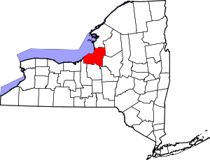 | |
| Towns | ||
| Villages | ||
| CDPs | ||
| Other hamlets |
| |
| Footnotes | ‡This populated place also has portions in an adjacent county or counties | |