Pool Malebo
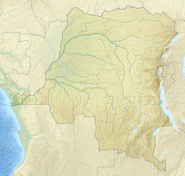
The Pool Malebo, formerly Stanley Pool, also known as Lake Nkunda by local indigenous people in pre-colonial times, is a lake-like widening in the lower reaches of the Congo River.[1] The river serves as the border between the Republic of the Congo on the north and the Democratic Republic of the Congo to the south.
| Pool Malebo | |
|---|---|
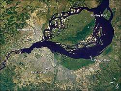 Satellite image of the Pool Malebo; the capital cities of Brazzaville, ROC and Kinshasa, DRC are indicated. | |
 Pool Malebo  Pool Malebo | |
| Coordinates | 4°16′55″S 15°29′19″E |
| Lake type | Fluvial |
| Primary inflows | Congo River |
| Primary outflows | Congo River |
| Surface elevation | 900 ft (270 m) |
| Islands | Mbamu |
| Settlements | Brazzaville, Kinshasa |
The pool's former name was in honor of the early English explorer and journalist Henry Morton Stanley, who mapped this area.
History
In the late 19th century, English colonists named this natural feature Stanley Pool, after English explorer and journalist Henry Morton Stanley, who had mapped and reported on this region. When a railway was constructed nearby, a plaque was installed at Palaba to commemorate the rail line connecting Matadi to Stanley Pool.[2]
Description
The Pool Malebo is about 35 km (22 mi) long, 23 km (14 mi) wide and 500 km2 in surface area. Its central part is occupied by M'Bamou or Bamu Island[1] (180 km2), which is Republic of the Congo territory.
The pool is shallow with depths of 3–10 m. But water levels may vary by as much as 3 m over the course of a year, because of seasonal flooding. The altitude here is an average of 272 m (900 ft).
Geography
The capitals of the Republic of the Congo and the Democratic Republic of the Congo —Brazzaville and Kinshasa, respectively— are located on opposite shores of the southern part of Pool Malebo. These two capital cities are the closest geographically of any in the world (other than the contiguous Rome, Italy and Vatican City).
The Pool is the beginning of the navigable part of the Congo River upstream to the cities of Mbandaka, Kisangani and Bangui. Downstream, navigation of the river is blocked by its descent through hundreds of meters in a series of rapids known as the Livingstone Falls.[3]:Vol.Two,255 The river reaches sea level at the port of Boma, Congo, after a passage of 300 km.
Ecology
Flora
There are many palm and papyrus swamps along the edges of the river and pool. Floating mats of Eichhornia plants move on the river and drift through the pool.[4]
Fauna
Fish
Most fish endemic to the area are catfishes, including the mountain catfish, L. brieni, Leptoglanis mandevillei, L. bouilloni and Atopochilus chabanaudi, an upside-down catfish.[4] More than 200 fish species have been documented. Mormyrids are the most common, with over 40 species, and have the highest diversification.[4]
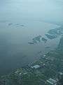 Aerial view of Pool Malebo from above Kinshasa
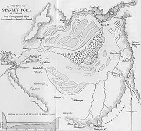
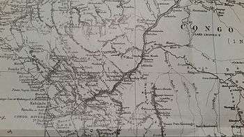 Stanley's route is depicted by the solid black line.
_pg751_Panorama_du_Stanley_Pool.jpg) View of Stanley Pool from Leopoldville, 1889 (now Kinshasa)
View of Stanley Pool from Leopoldville, 1889 (now Kinshasa)
See also
References
- "Malebo Pool". Encyclopædia Britannica. Accessed June 2011.
- "Kongo Central province (Democratic Republic of the Congo), plaque at Palabala commemorating the railway". collections.lib.uwm.edu.
- Stanley, H.M., 1899, Through the Dark Continent, London: G. Newnes, Vol. One ISBN 0486256677, Vol. Two ISBN 0486256685
- "Malebo Pool" Archived 2011-10-05 at the Wayback Machine. "Freshwater Ecoregions of the World". The Nature Conservancy. Accessed June 2011.
| Wikimedia Commons has media related to Pool Malebo. |