Pine Lake, Georgia
Pine Lake is the smallest city in DeKalb County, Georgia, United States. The population was 730 at the 2010 census.[5]
Pine Lake, Georgia | |
|---|---|
 Pine Lake | |
| Motto(s): Hidden Treasure | |
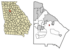 Location in DeKalb County and the state of Georgia | |
| Coordinates: 33°47′29″N 84°12′23″W | |
| Country | United States |
| State | Georgia |
| County | DeKalb |
| Settled | 1929 |
| Incorporated (city) | December 1937 |
| Government | |
| • Type | Mayor-Council |
| • Mayor | Melanie Hammet |
| Area | |
| • Total | 0.25 sq mi (0.66 km2) |
| • Land | 0.24 sq mi (0.61 km2) |
| • Water | 0.02 sq mi (0.04 km2) |
| Elevation | 948 ft (289 m) |
| Population (2010) | |
| • Total | 730 |
| • Estimate (2019)[2] | 754 |
| • Density | 3,181.43/sq mi (1,227.81/km2) |
| Time zone | UTC-5 (Eastern (EST)) |
| • Summer (DST) | UTC-4 (EDT) |
| ZIP code | 30072 |
| Area code(s) | 404 |
| FIPS code | 13-61040[3] |
| GNIS feature ID | 0332672[4] |
| Website | www |
History
Pine Lake was established as a city in December 1937,[6] after a short life as a summer retreat run by the Pine Woods Corporation. The corporation sold lots around a small fishing lake to Atlantans who lived in (then) faraway areas like Buckhead for use as a weekend retreat. The 20' x 100' lots sold for $69, and the advertisement for lots directed people "from Decatur down the [unpaved] Rockbridge Road East." Many homeowners continued to use their property as a weekend getaway long after the city incorporated. Prior to development, Pine Lake was a portion of a farm. The lake was formerly a widened region of Snapfinger Creek, and the valley that encompasses much of the town was where corn was grown. The lake was dammed by the Army Corps of Engineers as erosion and flood control, prior to the official FDR lake projects.
Geography
Pine Lake is located at 33°47′29″N 84°12′23″W (33.791505, -84.206428).[7]
According to the United States Census Bureau, the city has a total area of 0.2 square miles (0.52 km2), of which 0.2 square miles (0.52 km2) is land and 5.00% is water.
Demographics
| Historical population | |||
|---|---|---|---|
| Census | Pop. | %± | |
| 1940 | 2 | — | |
| 1950 | 566 | 28,200.0% | |
| 1960 | 738 | 30.4% | |
| 1970 | 866 | 17.3% | |
| 1980 | 901 | 4.0% | |
| 1990 | 810 | −10.1% | |
| 2000 | 621 | −23.3% | |
| 2010 | 730 | 17.6% | |
| Est. 2019 | 754 | [2] | 3.3% |
| U.S. Decennial Census[8] | |||
As of the census[3] of 2000, there were 621 people, 321 households, and 139 families residing in the city. The population density was 3,293.0 people per square mile (1,261.9/km2). There were 349 housing units at an average density of 1,850.7 per square mile (709.2/km2). The population data was challenged in 2002 and the Census agreed that the housing units were under surveyed. The insufficient survey was due to the lack of postal delivery in the city (as with cities with fewer than 750 individual units). The Tax digest listed 690 houses. Since no official survey was done on all households, the Census did not change the population. The racial makeup of the city was 74.72% White, 17.55% African American, 0.16% Native American, 0.16% Pacific Islander, 3.54% from other races, and 3.86% from two or more races. Hispanic or Latino of any race were 6.76% of the population.
There were 321 households, out of which 18.4% had children under the age of 18 living with them, 26.5% were married couples living together, 12.8% had a female householder with no husband present, and 56.4% were non-families. 39.9% of all households were made up of individuals, and 2.8% had someone living alone who was 65 years of age or older. The average household size was 1.93 and the average family size was 2.58.
In the city, the population was spread out, with 15.6% under the age of 18, 6.9% from 18 to 24, 43.2% from 25 to 44, 27.2% from 45 to 64, and 7.1% who were 65 years of age or older. The median age was 38 years. For every 100 females, there were 91.7 males. For every 100 females age 18 and over, there were 81.9 males.
The median income for a household in the city was $41,029, and the median income for a family was $35,313. Males had a median income of $31,250 versus $28,295 for females. The per capita income for the city was $21,529. About 11.4% of families and 15.5% of the population were below the poverty line, including 27.0% of those under age 18 and 8.1% of those age 65 or over.
Education
Residents are zoned to schools in the DeKalb County School System.
- Rockbridge Elementary School
- Stone Mountain Middle School
- Stone Mountain High School
All of the schools are located outside of the Pine Lake city limits in unincorporated sections of DeKalb County.
Many families have chosen to send their younger children to the International Community School.
References
- "2019 U.S. Gazetteer Files". United States Census Bureau. Retrieved July 9, 2020.
- "Population and Housing Unit Estimates". United States Census Bureau. May 24, 2020. Retrieved May 27, 2020.
- "U.S. Census website". United States Census Bureau. Retrieved 2008-01-31.
- "US Board on Geographic Names". United States Geological Survey. 2007-10-25. Retrieved 2008-01-31.
- "Race, Hispanic or Latino, Age, and Housing Occupancy: 2010 Census Redistricting Data (Public Law 94-171) Summary File (QT-PL), Pine Lake city, Georgia". United States Census Bureau. Retrieved October 28, 2011.
- Krakow, Kenneth K. (1975). Georgia Place-Names: Their History and Origins (PDF). Macon, GA: Winship Press. p. 176. ISBN 0-915430-00-2.
- "US Gazetteer files: 2010, 2000, and 1990". United States Census Bureau. 2011-02-12. Retrieved 2011-04-23.
- "Census of Population and Housing". Census.gov. Retrieved June 4, 2015.
External links
| Wikimedia Commons has media related to Pine Lake, Georgia. |
- City of Pine Lake official website
- Pine Lake Association of Involved Neighbors
- Pine Lake page at Georgia.gov
Municipalities and communities of DeKalb County, Georgia, United States | ||
|---|---|---|
| Cities | 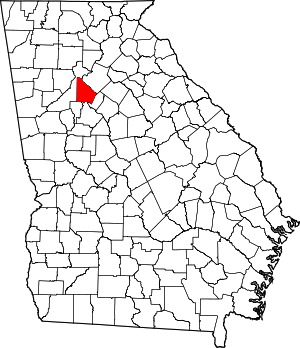 Map of Georgia highlighting DeKalb County | |
| CDPs | ||
| Neighborhoods and unincorporated communities |
| |
| Ghost town | ||
| Footnotes | ‡This populated place also has portions in an adjacent county or counties | |