Perry (village), New York
Perry is a village in the Towns of Perry and Castile in Wyoming County, New York. The population was 3,673 at the 2010 census. The village is at the junction of New York State Route 39 and New York State Route 246.
Perry, New York | |
|---|---|
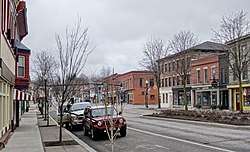 Main Street, April 2020 | |
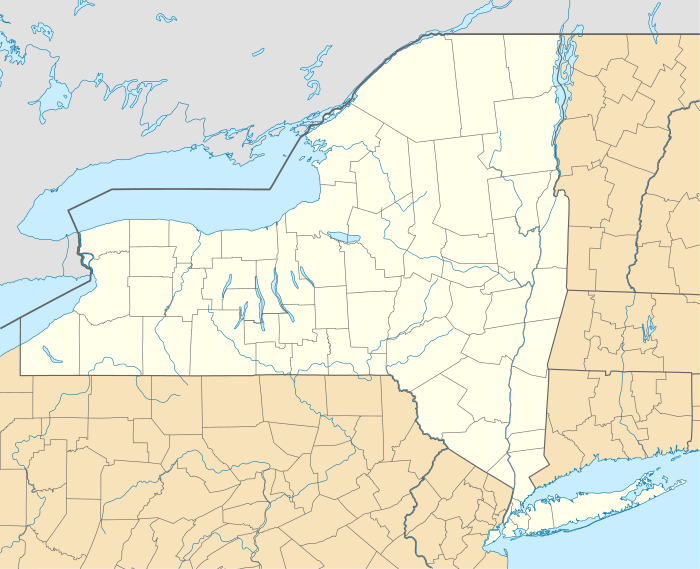 Perry, New York Location within the state of New York | |
| Coordinates: 42°43′1″N 78°0′16″W | |
| Country | United States |
| State | New York |
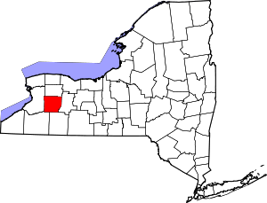
| County | Wyoming |
| Settled | 1809 |
| Incorporated | May 17, 1830 |
| Named for | Oliver Hazard Perry |
| Area | |
| • Total | 2.45 sq mi (6.34 km2) |
| • Land | 2.34 sq mi (6.05 km2) |
| • Water | 0.11 sq mi (0.29 km2) |
| Elevation | 1,371 ft (418 m) |
| Population (2010) | |
| • Total | 3,673 |
| • Estimate (2019)[2] | 3,488 |
| • Density | 1,492.51/sq mi (576.16/km2) |
| Time zone | UTC-5 (Eastern (EST)) |
| • Summer (DST) | UTC-4 (EDT) |
| ZIP code | 14530 |
| Area code(s) | 585 |
| FIPS code | 36-57243 |
| GNIS feature ID | 0960202 |
| Website | www |
History
The Village of Perry was incorporated in 1830.
The Perry Downtown Historic District, First Methodist Episcopal Church of Perry, Brick Presbyterian Church, Barna C. Roup House, and Epworth Hall are listed on the National Register of Historic Places.[3][4][5]
Demographics
| Historical population | |||
|---|---|---|---|
| Census | Pop. | %± | |
| 1870 | 867 | — | |
| 1880 | 1,115 | 28.6% | |
| 1890 | 1,528 | 37.0% | |
| 1900 | 2,763 | 80.8% | |
| 1910 | 4,388 | 58.8% | |
| 1920 | 4,717 | 7.5% | |
| 1930 | 4,231 | −10.3% | |
| 1940 | 4,468 | 5.6% | |
| 1950 | 4,533 | 1.5% | |
| 1960 | 4,629 | 2.1% | |
| 1970 | 4,538 | −2.0% | |
| 1980 | 4,198 | −7.5% | |
| 1990 | 4,219 | 0.5% | |
| 2000 | 3,945 | −6.5% | |
| 2010 | 3,673 | −6.9% | |
| Est. 2019 | 3,488 | [2] | −5.0% |
| U.S. Decennial Census[6] | |||
As of the census[7] of 2000, there were 3,945 people, 1,560 households, and 1,051 families residing in the village. The population density was 1,744.8 people per square mile (674.0/km2). There were 1,764 housing units at an average density of 780.2 per square mile (301.4/km2). The racial makeup of the village was 97.41% White, 0.74% Black or African American, 0.15% Native American, 0.35% Asian, 0.03% Pacific Islander, 0.46% from other races, and 0.86% from two or more races. Hispanic or Latino of any race were 1.55% of the population.
There were 1,560 households, out of which 33.1% had children under the age of 18 living with them, 48.1% were married couples living together, 13.9% had a female householder with no husband present, and 32.6% were non-families. 27.1% of all households were made up of individuals, and 12.9% had someone living alone who was 65 years of age or older. The average household size was 2.48 and the average family size was 2.97.
In the village, the population was spread out, with 25.8% under the age of 18, 8.4% from 18 to 24, 28.2% from 25 to 44, 22.6% from 45 to 64, and 15.0% who were 65 years of age or older. The median age was 37 years. For every 100 females, there were 92.9 males. For every 100 females age 18 and over, there were 88.0 males.
The median income for a household in the village was $35,596, and the median income for a family was $41,090. Males had a median income of $31,845 versus $21,486 for females. The per capita income for the village was $16,794. About 6.5% of families and 8.7% of the population were below the poverty line, including 12.8% of those under age 18 and 2.6% of those age 65 or over.
Government
Perry is governed by a Board of Trustees composed of a Mayor, Deputy Mayor, and three Trustees. The current Board is composed of Mayor Rick Hauser, Deputy Mayor Dariel Draper, and Trustees Eleanor Jacobs, Jacquie Billings and Arlene Lapiana.
Geography
Perry is located at 42°43′0″N 78°0′16″W (42.716876, -78.004582).[8]
According to the United States Census Bureau, the village has a total area of 2.4 square miles (6.1 km2), of which 2.3 square miles (5.9 km2) is land and 0.1 square mile (0.3 km2) (4.64%) is water.
Perry is at the northeast end of Silver Lake. It is west of Letchworth State Park and northeast of Silver Lake State Park.
Notable people
- Chester A. Arthur, the twenty-first President of the United States spent some of his childhood years in the Village of Perry after being born in Vermont
- James M. Bingham, former Lt. Governor of Wisconsin
- C. W. Dibble, former University at Buffalo football coach
- J. Francis Harter, former US Congressman
- Edwin B. Kelsey, former US Congressman
- William D. Metz, Rhode Island historian
- Lewis B. Parsons, Jr., brigadier general for the Union Army in the American Civil War
- David Rubio, stringed musical instruments maker
- Thomas Blanchard Stowell, distinguished educator
- Irving C. Tomlinson, Unitarian minister who became a prominent early Christian Scientist
See also
- List of villages in New York
References
- "2019 U.S. Gazetteer Files". United States Census Bureau. Retrieved July 27, 2020.
- "Population and Housing Unit Estimates". United States Census Bureau. May 24, 2020. Retrieved May 27, 2020.
- "National Register Information System". National Register of Historic Places. National Park Service. March 13, 2009.
- "National Register of Historic Places Listings". Weekly List of Actions Taken on Properties: 4/16/12 through 4/20/12. National Park Service. 2012-04-27.
- "National Register of Historic Places Listings". Weekly List of Actions Taken on Properties: 8/10/15 through 8/14/15. National Park Service. 2015-08-21.
- "Census of Population and Housing". Census.gov. Retrieved June 4, 2015.
- "U.S. Census website". United States Census Bureau. Retrieved 2008-01-31.
- "US Gazetteer files: 2010, 2000, and 1990". United States Census Bureau. 2011-02-12. Retrieved 2011-04-23.
External links
| Wikimedia Commons has media related to Perry (village), New York. |
- Official website
- iloveperryny.com - Perry's Information Portal, Event Calendar, Business Listings and Image Database
- Perry Chamber of Commerce
- Last Night Perry: Annual New Year's Eve Celebration
- Perry Farmer's Market
Municipalities and communities of Wyoming County, New York, United States | ||
|---|---|---|
| Towns |
|  |
| Villages | ||
| CDPs |
| |
| Other hamlets | ||
| Footnotes | ‡This populated place also has portions in an adjacent county or counties | |