Pendock
Pendock is a village and civil parish in the Malvern Hills district in the county of Worcestershire, England, situated about halfway between the towns of Tewkesbury and Ledbury. The name is probably from old Welsh, possibly penn heddioc, meaning 'head of the barley field.[1]
| Pendock | |
|---|---|
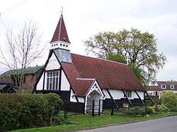 Pendock Cross Church, Pendock | |
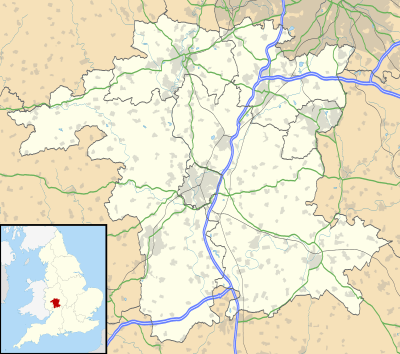 Pendock Location within Worcestershire | |
| Population | 341 (2011 Census) |
| OS grid reference | SO785325 |
| Civil parish |
|
| District |
|
| Shire county | |
| Region | |
| Country | England |
| Sovereign state | United Kingdom |
| Post town | Gloucester |
| Postcode district | GL19 |
| Police | West Mercia |
| Fire | Hereford and Worcester |
| Ambulance | West Midlands |
| UK Parliament |
|
The population was recorded at 341 at the 2011 census[2] and was 329 at the previous census in 2001.
Pendock has two churches, a shop, and a primary school — the Pendock CE Primary School is a small voluntary-controlled school with full healthy school status and a bronze eco award.
The M50 motorway passes through the parish, with the nearest junction being number 2, to the west of Pendock.
The prolific nineteenth-century writer on Worcestershire John Noake, in his 1868 Guide to Worcestershire notes that: "Rev. W. S. Symonds, the eminent geologist, is lord of the manor, patron and incumbent of the living."[3]
Pendock Cross church, also known as The Redeemer Church, was built in 1899 as a temporary mission church, but is still in use. It has an outdoor font which is stacked up on bricks.[4]
Gadfield Elm Chapel, the oldest chapel of the Church of Jesus Christ of Latter-day Saints in the world, is in the parish.[5]
The civil parish constitutes two detached parts,[6] with Lower Pendock containing the main (present-day) village with its church, shop and school situated at or near Pendock Cross(roads), and Upper Pendock containing the hamlet of Sledge Green and the old parish church (see below); the parish of Berrow cuts between the two parts of Pendock parish.[7]
Pendock Church
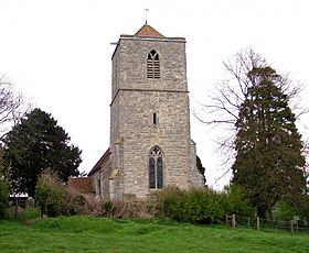
Pendock Church is a redundant Anglican church standing to the southeast of the hamlet of Sledge Green. It is designated by English Heritage as a Grade I listed building,[8] and is under the care of the Churches Conservation Trust. It stands in an isolated position overlooking and to the north of the motorway. To its north are the earthworks of a former medieval village.[9]
References
- Watts 2004, p. 466
- Neighbourhood statistics 2011 census data: Pendock CP
- "Noake's Worcestershire Page 296". users.totalise.co.uk. Retrieved 20 October 2013.
- "Worcestershire". churches-uk-ireland.org. 18 September 2013. Retrieved 20 October 2013.
- "Do you know where the oldest Mormon chapel in the world is?". BBC News. 11 November 2005. Archived from the original on 6 January 2015.
- Ordnance Survey mapping
- Parish Council
- Historic England, "Parish Church, Pendock (1098789)", National Heritage List for England, retrieved 10 September 2013
- The Church (no dedication), Pendock, Worcestershire, Churches Conservation Trust, retrieved 29 March 2011
Sources
- Watts, Victor Ernest, ed. (2004). The Cambridge Dictionary of English Place-Names. Cambridge University Press. ISBN 9781107196896.CS1 maint: ref=harv (link)
External links
| Wikimedia Commons has media related to Pendock. |