Oneonta, Alabama
Oneonta is a city in Blount County, Alabama, United States. At the 2010 census the population was 6,567.[3] The city is the county seat of Blount County. Oneonta is home to the Covered Bridge Festival.[4]
Oneonta | |
|---|---|
City | |
 Oneonta is home to the Easley Covered Bridge, a county-owned, 95-foot (29 m) town lattice truss bridge built in 1927. Its WGCB number is 01-05-12. | |
| Motto(s): A Small City with Big Ideas | |
 Location of Oneonta in Blount County, Alabama. | |
| Coordinates: 33°56′32″N 86°28′44″W | |
| Country | United States |
| State | Alabama |
| County | Blount |
| Government | |
| • Type | Council |
| • Mayor | Ross Norris |
| Area | |
| • Total | 15.71 sq mi (40.68 km2) |
| • Land | 15.65 sq mi (40.53 km2) |
| • Water | 0.06 sq mi (0.15 km2) |
| Elevation | 873 ft (266 m) |
| Population (2010) | |
| • Total | 6,567 |
| • Estimate (2019)[2] | 6,577 |
| • Density | 420.28/sq mi (162.28/km2) |
| Time zone | UTC−6 (Central (CST)) |
| • Summer (DST) | UTC−5 (CDT) |
| ZIP code | 35121 |
| Area code | 205, 659 |
| FIPS code | 01-57000 |
| GNIS feature ID | 0152813 |
| Website | www |
History
A post office called Oneonta has been in operation since 1889.[5] The city was named after Oneonta, New York, the native home of a railroad official.[6] In 1889, the county seat was transferred to Oneonta from Blountsville.[7]
During World War II, a small POW camp was operated outside of Oneonta.[8]
Geography
Oneonta is located in eastern Blount County at 33°56'32.291" North, 86°28'43.586" West (33.942303, -86.478774).[9] It is situated in Murphree Valley between Red Mountain and Sand Mountain to the northwest and Straight Mountain to the southeast.
U.S. Route 231 passes through the center of the city, leading northwest 7 miles (11 km) to Cleveland, Alabama, and southeast 14 miles (23 km) to Interstate 59 in Ashville.
According to the U.S. Census Bureau, the city has a total area of 15.3 square miles (39.5 km2), of which 15.2 square miles (39.3 km2) is land and 0.077 square miles (0.2 km2), or 0.54%, is water.[3]
Demographics
| Historical population | |||
|---|---|---|---|
| Census | Pop. | %± | |
| 1900 | 583 | — | |
| 1910 | 609 | 4.5% | |
| 1920 | 876 | 43.8% | |
| 1930 | 1,387 | 58.3% | |
| 1940 | 2,376 | 71.3% | |
| 1950 | 2,802 | 17.9% | |
| 1960 | 4,136 | 47.6% | |
| 1970 | 4,390 | 6.1% | |
| 1980 | 4,824 | 9.9% | |
| 1990 | 4,844 | 0.4% | |
| 2000 | 5,576 | 15.1% | |
| 2010 | 6,567 | 17.8% | |
| Est. 2019 | 6,577 | [2] | 0.2% |
| U.S. Decennial Census[10] 2013 Estimate[11] | |||
As of the census[12] of 2010, there were 6,567 people, 2,502 households, and 1,630 families residing in the city. The population density was 433 inhabitants per square mile (167/km2). There were 2,751 housing units at an average density of 179.8 per square mile (69.4/km2). The racial makeup of the city was 84.1% White, 6.0% Black or African American, 0.5% Native American, 0.5% Asian, 7.6% from other races, and 1.3% from two or more races. 15.9% of the population were Hispanic or Latino of any race.
There were 2,502 households out of which 28.4% had children under the age of 18 living with them, 49.9% were married couples living together, 11.0% had a female householder with no husband present, and 34.9% were non-families. 31.4% of all households were made up of individuals and 15.3% had someone living alone who was 65 years of age or older. The average household size was 2.46 and the average family size was 3.11.
In the city, the age distribution of the population shows 23.0% under the age of 18, 7.8% from 18 to 24, 24.7% from 25 to 44, 23.8% from 45 to 64, and 20.7% who were 65 years of age or older. The median age was 40.5 years. For every 100 females, there were 91.0 males. For every 100 females age 18 and over, there were 101.3 males.
The median income for a household in the city was $40,192, and the median income for a family was $50,236. Males had a median income of $41,425 versus $22,160 for females. The per capita income for the city was $18,951. About 13.0% of families and 17.9% of the population were below the poverty line, including 27.2% of those under age 18 and 16.4% of those age 65 or over.
City government
The city government is made up of Mayor Ross Norris, and a five-person city council —Hal Blackwood, Donald Bradley, Danny Robinson, Richard Phillips, and Tonya H. Rogers.
- City Manager: Ed Lowe
- City Clerk: Amanda Stanfield
- Mayor: Ross Norris
Attractions
Oneonta, Alabama is home to the Historical Covered Bridge Festival. This annual event showcases the history of the remaining covered bridges in Blount County, and includes an arts and crafts festival with entertainment and events. Also located in Oneonta is the Blount County Memorial Museum, which hosts a variety of resources for genealogy research. Palisades Park features hiking trails and public campgrounds. The Oneonta Business Association sponsors the annual summertime festival of fun known as the June Fling with over 100 booths, cruise-in, entertainment, Kidz Fun Zone, and the Singing Showdown solo vocal competition. This non-profit organization heads other projects including "Paint the Town," "Light the Town," and the Festival of Lights.
Education
Public education is provided by Oneonta City Schools. There are three schools in the city: Oneonta Elementary School (grades K through 5), Oneonta Middle School (grades 6 through 8), and Oneonta High School (grades 9 through 12). A branch of Wallace State Community College is also located in the town.
Radio stations
WCRL 1570 AM – Oldies (simulcasts on translator W237DH 95.3FM)
Notable people
- Osmond Ingram, sailor in the United States Navy during World War I who posthumously received the Medal of Honor
- Steve Patton, head coach of the Gardner–Webb University football team from 1997–2010
- Kevin Sherrer, football coach
- Joe Gibbs, co-founder of The Golf Network
References
- "2019 U.S. Gazetteer Files". United States Census Bureau. Retrieved June 29, 2020.
- "Population and Housing Unit Estimates". United States Census Bureau. May 24, 2020. Retrieved May 27, 2020.
- "Geographic Identifiers: 2010 Demographic Profile Data (G001): Oneonta city, Alabama". U.S. Census Bureau, American Factfinder. Archived from the original on February 12, 2020. Retrieved September 16, 2013.
- "26th Annual Blount County Covered Bridge Festival". Blount-Oneonta Chamber of Commerce. Archived from the original on 16 December 2010. Retrieved 7 January 2010.
- "Blount County". Jim Forte Postal History. Retrieved 30 October 2015.
- "Tenbroeck in DeKalb County was named for runaway horse". Gadsden Times. June 17, 1984. pp. B1. Retrieved 30 October 2015.
- "Blount County Courthouse in Oneonta". Encyclopedia of Alabama. October 6, 2009. Retrieved 7 January 2010.
- Hutchinson, Daniel (October 6, 2009). "World War II POW Camps in Alabama". Encyclopedia of Alabama. Retrieved 7 January 2010.
- "US Gazetteer files: 2010, 2000, and 1990". United States Census Bureau. 2011-02-12. Retrieved 2011-04-23.
- "U.S. Decennial Census". Census.gov. Retrieved June 6, 2013.
- "Annual Estimates of the Resident Population: April 1, 2010 to July 1, 2013". Retrieved June 3, 2014.
- "U.S. Census website". United States Census Bureau. Retrieved 2015-07-09.
External links
- City of Oneonta official website
- Blount County-Oneonta Chamber of Commerce
- Oneonta City Schools
- Oneonta Business Association
Municipalities and communities of Blount County, Alabama, United States | ||
|---|---|---|
| Cities | 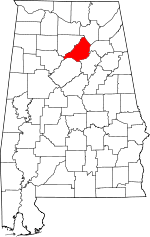 Map of Alabama highlighting Blount County | |
| Towns | ||
| CDP | ||
| Unincorporated communities | ||
| Footnotes | ‡This populated place also has portions in an adjacent county or counties | |
| Authority control |
|
|---|