Oella, Maryland
Oella is a mill town on the Patapsco River in western Baltimore County, Maryland, United States, located between Catonsville and Ellicott City. It is a 19th-century village of millworkers' homes.
Oella Historic District | |
 Long Brick Row in the center of Oella, Maryland | |
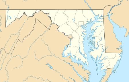  | |
| Location | Oella Ave., Glen Rd., Hollow Rd., Oella, Maryland |
|---|---|
| Coordinates | 39°16′32″N 76°47′14″W |
| Area | 130 acres (53 ha) |
| Built | 1812 |
| NRHP reference No. | 76000979[1] |
| Added to NRHP | November 7, 1976 |
History
Oella was founded in 1808 by the Union Manufacturing Company as a working class community for the company's mill workers. It was one of the earliest and most extensive cotton factories in the United States and used water-powered looms as early as 1819.
The Union Manufacturing Company was motivated by the Embargo Act of 1807 which required Baltimore merchants to manufacture finished goods in the United States rather than England. Stock in the company was issued to fund a series of industrial mills, the largest working with cotton and wool. Child and indigent labor was used reaching 150 employees in 1811.[2] After the War of 1812 ended the embargo, cotton prices fell. A fire at the largest mill on 13 December 1815 took a decade to rebuild and recover from. The Mill rebounded with water driven looms, and expanded to three mill buildings before finally dissolving in 1887 after another drop in textile prices.[3] William J. Dickey of Dickeysville (Gwynns Falls) purchased the mill in 1887, operating it as W.J. Dickey and Sons, naming the mill "Oella" after the first woman to spin cotton in America.[4]
The Oella Historic District includes the village that consists of 19th century workers housing and one late 19th century church. The only known 20th century building is the W.J. Dickey Company Mill constructed in 1919 as a rebuild after a 1918 fire. The plant was eventually used for the city.[5] A drawing from 1812 by Maximilian Godefroy shows most of the stone buildings. The brick houses date from the mid-19th century, while the frame buildings were constructed at the end of the century. The Oella Methodist Church is a simple frame building with a tower on the northeast corner, which has been converted into offices. The Patapsco River continued to provide power to generate electricity until 1972, when Hurricane Agnes flooded the power plant. That same year, the Dickey Company ceased manufacturing.[6]
It was added to the National Register of Historic Places in 1976.[1] Also listed on the National Register at Oella are the Ellicott's Mills Historic District and Mount Gilboa Chapel.[1]
Oella is along the route of the Trolley Line Number 9 Trail.
Notable person
- Benjamin Banneker (November 9, 1731 – October 19, 1806) was a free African American scientist, surveyor, almanac author and farmer. Born in Baltimore County to a free African American woman and a former slave, Banneker had little formal education and was largely self-taught. He is known for being part of a group led by Major Andrew Ellicott that surveyed the borders of the original District of Columbia, the federal capital district of the United States.[7]
- Banneker's knowledge of astronomy helped him author a commercially successful series of almanacs. He corresponded with Thomas Jefferson, drafter of the Declaration of Independence, on the topics of slavery and racial equality. Abolitionists and advocates of racial equality promoted and praised his works.[7]
Benjamin Banneker Historical Park and Museum
A park commemorating Benjamin Banneker is located in a stream valley woodland at the former site of Banneker's farm and residence at the eastern edge of the Oella community.[8] The Baltimore County Department of Recreation and Parks manages the park, which was dedicated on June 9, 1998.[9] The park, which encompasses 138 acres (56 ha) and contains archaeological sites and extensive nature trails, is the largest original African American historical site in the United States.[10] The primary focus of the park is a museum highlighting Banneker's contributions.[11]
Geology
Oella is the type locality of the Oella Formation, a Late Proterozoic or early Cambrian schist.
References
- "National Register Information System". National Register of Historic Places. National Park Service. July 9, 2010.
- Henry K Sharp. The Patapsco River Valley. p. 42.
- Henry K Sharp. The Patapsco River Valley. p. 51.
- Howard County Historical Society. Images of America. p. 34.
- "Heavy Fabrics Give Way to Light Weight Blends". The Times (Ellicott, City). 31 March 1965.
- John McGrain (1975). "National Register of Historic Places Registration: Oella Historic District" (PDF). Maryland Historical Trust. Retrieved 2016-03-01.
- (1) Bedini, Silvio A. (1999). The Life of Benjamin Banneker: The First African-American Man of Science (2nd ed.). Baltimore: Maryland Historical Society. ISBN 0-938420-59-3. LCCN 98022848. OCLC 894558859. Retrieved 2019-09-11 – via Internet Archive.
(2) Bedini, Silvio A. (2008). "Benjamin Banneker". Complete Dictionary of Scientific Biography. Encyclopedia.com. Retrieved 2012-05-08.
(3) Banneker Historical Park & Museum. "Benjamin Banneker Timeline". Benjamin Banneker Historical Park & Museum, 300 Oella Avenue, Baltimore, MD 21228 in Explore Catonsville, MD, part of the ExploreMD.us network. Ellicott City Graphic Arts Network. Archived from the original on 2013-03-16. Retrieved 2010-05-13. - (1) "Benjamin Banneker Historical Park and Museum". Catonsville, Maryland: Benjamin Banneker Historical Park and Museum. Archived from the original on 2016-10-24. Retrieved 2017-02-15.
(2) Coordinates of Benjamin Banneker Historical Park, Baltimore County, Maryland: 39°16′07″N 76°46′36″W - "Benjamin Banneker park and museum dedicated in Oella". The Baltimore Sun. 1998-06-10. Retrieved 2010-05-13.
- (1) Cummings, Elijah E., Representative (7th District). "Benjamin Banneker Historical Park & Museum". Local Legacies. Library of Congress. Retrieved 2008-08-28.
(2) "Benjamin Banneker Historical Park and Museum". Parks and Facilities. Historic Courthouse, 400 Washington Avenue, Towson, MD 21204: Government of Baltimore County, Maryland. 2012-09-25. Retrieved 2012-12-19.CS1 maint: location (link)
(3) "Benjamin Banneker Historical Park & Museum, Inc., Baltimore, Maryland: location, hours, facilities information". MuseumsUSA. Retrieved 2008-08-28.
(4) "Banneker Historical Park & Museum". Explore Catonsville, MD, part of the ExploreMD.us network]. Ellicott City Graphic Arts Network. Retrieved 2012-12-19.
(5) Balakrishnan, Aparna (2004-09-26). "Park, museum a tribute to Benjamin Banneker". The Baltimore Sun. Archived from the original on 2014-11-29. Retrieved 2015-04-01. - Coordinates of Benjamin Banneker Museum, Baltimore County, Maryland: 39°16′08″N 76°46′30″W
External links
- Oella Historic District, Baltimore County, including undated photo, at Maryland Historical Trust
- Boundary Map of Oella Historic District, Baltimore County, at Maryland Historical Trust
- Mill Houses, 929-947 Oella Avenue, Oella, Baltimore, MD at the Historic American Buildings Survey (HABS)
- Old Mill, Oella Avenue, Oella, Baltimore, MD at HABS
- Oella Homeowners Association
- Greater Oella Community Association
- Patapsco River Rock Building — July family event near Oella, MD.

| Topics |  | |
|---|---|---|
| Lists by county | ||
| Lists by city | ||
| Other lists | ||
| ||
Municipalities and communities of Baltimore County, Maryland, United States | ||
|---|---|---|
| CDPs |
|  |
| Other communities |
| |