New Philadelphia, Ohio
New Philadelphia is a city in and the county seat of Tuscarawas County, Ohio, United States.[8] The county's largest city, New Philadelphia is located on the Tuscarawas River. It is located 85 miles (137 km) south of Cleveland and 119 miles (192 km) northeast of Columbus. The population was 17,288 at the 2010 census.
New Philadelphia, Ohio | |
|---|---|
 West High Avenue in downtown New Philadelphia | |
 Location of New Philadelphia, Ohio | |
 Location of New Philadelphia in Tuscarawas County | |
| Coordinates: 40°29′22″N 81°26′50″W | |
| Country | United States |
| State | Ohio |
| County | Tuscarawas |
| Incorporated | February 12, 1833[1] |
| Government | |
| • Mayor | Joel Day[2] |
| Area | |
| • Total | 8.40 sq mi (21.74 km2) |
| • Land | 8.22 sq mi (21.29 km2) |
| • Water | 0.17 sq mi (0.45 km2) |
| Elevation | 906 ft (276 m) |
| Population | |
| • Total | 17,288 |
| • Estimate (2019)[6] | 17,410 |
| • Density | 2,118.00/sq mi (817.73/km2) |
| Time zone | UTC-5 (Eastern (EST)) |
| • Summer (DST) | UTC-4 (EDT) |
| ZIP code | 44663 |
| Area code(s) | 330 |
| FIPS code | 39-55216[7] |
| GNIS feature ID | 1065105[4] |
| Website | http://www.newphilaoh.com/ |
Because of the presence of coal and clay, early industry in the city centered on mining interests and the manufacture of steel, canned goods, roofing tile, sewer pipe, bricks, vacuum cleaners, stovepipes, carriages, flour, brooms, and pressed, stamped, and enameled goods.
New Philadelphia is a principal city in the New Philadelphia–Dover, OH Micropolitan Statistical Area, which includes all of Tuscarawas County, as well as the southern regions of Northeast Ohio.
History

The Moravian Church founded Schoenbrunn ("beautiful spring") in 1772 as a mission to the Delaware Indians. The settlement grew to include sixty dwellings and more than 300 inhabitants who drew up Ohio's first civil code and built its first Christian church and schoolhouse. Problems associated with the American Revolution prompted Schoenbrunn's closing in 1777.[9]
The founder, John Knisely, returned to Ohio in 1804 with his family and 33 other pioneers, he also hired surveyor John Wells to plot out New Philadelphia in the same grid style as Philadelphia, Pennsylvania.[10]
In 1833, New Philadelphia contained county buildings, a printing office, several stores, and five taverns.[11]
Geography
New Philadelphia is located at 40°29′22″N 81°26′50″W (40.489411, -81.447324),[12] along the Tuscarawas River.[13] It lies within the ecoregion of the Western Allegheny Plateau.[14]
According to the United States Census Bureau, the city has a total area of 8.39 square miles (21.73 km2), of which 8.22 square miles (21.29 km2) is land and 0.17 square miles (0.44 km2) is water.[15]
Layout
New Philadelphia's design was based on the design of Philadelphia, Pennsylvania. The two main streets in the city are High Avenue and Broadway, both of which were named after two main streets from Philadelphia, except, in Philadelphia, High Avenue was renamed Market Street in 1858, "the High Street" was the familiar name of the principal street in nearly every English town at the time Philadelphia was founded, and Broad Street is the closest street name in Philadelphia to Broadway. No historical records exist for a road named Broadway in Philadelphia.
Boulevard
The chief way to reach Dover is through 4th St NW, which is renamed the Boulevard in Dover. The street features four lanes with medians. Right before Dover it opens up and features a Wendy's, McDonald's, Arby's, and Burger King with a Taco Bell being slightly past the border.
Demographics

| Historical population | |||
|---|---|---|---|
| Census | Pop. | %± | |
| 1820 | 236 | — | |
| 1850 | 1,413 | — | |
| 1870 | 3,143 | — | |
| 1880 | 3,070 | −2.3% | |
| 1890 | 4,456 | 45.1% | |
| 1900 | 6,213 | 39.4% | |
| 1910 | 8,542 | 37.5% | |
| 1920 | 10,718 | 25.5% | |
| 1930 | 12,365 | 15.4% | |
| 1940 | 12,328 | −0.3% | |
| 1950 | 12,948 | 5.0% | |
| 1960 | 14,241 | 10.0% | |
| 1970 | 15,184 | 6.6% | |
| 1980 | 16,921 | 11.4% | |
| 1990 | 15,698 | −7.2% | |
| 2000 | 17,056 | 8.7% | |
| 2010 | 17,288 | 1.4% | |
| Est. 2019 | 17,410 | [6] | 0.7% |
| Sources:[7][16][17] | |||
2010 census
As of the census[5] of 2010, there were 17,288 people, 7,282 households, and 4,541 families living in the city. The population density was 2,103.2 inhabitants per square mile (812.1/km2). There were 7,909 housing units at an average density of 962.2 per square mile (371.5/km2). The racial makeup of the city was 94.0% White, 1.2% African American, 0.4% Native American, 0.6% Asian, 0.4% Pacific Islander, 1.6% from other races, and 1.8% from two or more races. Hispanic or Latino of any race were 4.2% of the population.
There were 7,282 households, of which 27.8% had children under the age of 18 living with them, 45.3% were married couples living together, 12.3% had a female householder with no husband present, 4.7% had a male householder with no wife present, and 37.6% were non-families. 31.4% of all households were made up of individuals, and 12.6% had someone living alone who was 65 years of age or older. The average household size was 2.32 and the average family size was 2.87.
The median age in the city was 40.4 years. 21.9% of residents were under the age of 18; 8.7% were between the ages of 18 and 24; 24.9% were from 25 to 44; 27.6% were from 45 to 64; and 16.8% were 65 years of age or older. The gender makeup of the city was 48.5% male and 51.5% female.
2000 census
As of the census[7] of 2000, there were 17,056 people, 7,338 households, and 4,659 families living in the city. The population density was 2,188.0 people per square mile (844.3/km2). There were 7,796 housing units at an average density of 1,000.1 per square mile (385.9/km2). The racial makeup of the city was 96.89% White, 0.97% African American, 0.18% Native American, 0.49% Asian, 0.06% Pacific Islander, 0.49% from other races, and 0.93% from two or more races. Hispanic or Latino of any race were 1.33% of the population.
There were 7,338 households, out of which 28.0% had children under the age of 18 living with them, 48.9% were married couples living together, 11.3% had a female householder with no husband present, and 36.5% were non-families. 31.7% of all households were made up of individuals, and 13.2% had someone living alone who was 65 years of age or older. The average household size was 2.30 and the average family size was 2.88.
In the city the population was spread out, with 23.0% under the age of 18, 9.4% from 18 to 24, 28.2% from 25 to 44, 23.7% from 45 to 64, and 15.8% who were 65 years of age or older. The median age was 38 years. For every 100 females, there were 90.7 males. For every 100 females age 18 and over, there were 87.1 males.
The median income for a household in the city was $33,235, and the median income for a family was $42,896. Males had a median income of $32,157 versus $20,363 for females. The per capita income for the city was $18,745. About 7.7% of families and 10.2% of the population were below the poverty line, including 12.7% of those under age 18 and 6.2% of those age 65 or over.
Tuscora Park

Tuscora Park is a municipal park that features a carousel, Ferris wheel, train and other rides, along with miniature golf and batting cages. Tuscora Park was originally built as a project of the Works Progress Administration; original stone work gates, paths and retaining walls still adorn the park. The park is now the home of the Park Place Teen Center, a facility for high school students that provides entertainment of all types. Events at the park include a Summer Showcase and the annual First Town Days festival.
The Summer Showcase is held in the Tuscora Park Amphitheater. Events at the amphitheater include Sunday church services, plays and concerts featuring local talent. On the last day of the First Town Days festival the park hosts the U.S. Air Force Band of Flight,[18] which plays in the amphitheater.
Around 1940, New Philadelphia purchased the Herschell-Spillman carousel secondhand. It is a rare all-wooden carousel. It includes 36 carved wooden jumping horses, two chariots and 428 individual lights.[19] The center panels are adorned with 14 original oil paintings. Music is provided by a Wurlitzer #153 military Band Organ. The carousel is 40 feet in diameter and weighs 10 tons. It was manufactured in 1928 by the Spillman Manufacturing Company of North Tonawanda, New York. David Miller is well known for his 40 years of service on the Tuscora Park Carousel. The First Town Days, which includes a Grand Parade and fireworks display, runs on the weekend leading up to the Fourth of July.[20]
The company that manages Tuscora Park is a non-profit, RTY Inc.[21] The organization frequently hires high school and college students to operate rides and sell tickets.
Education
Primary and secondary
Children in New Philadelphia are served by the New Philadelphia City School District. The current schools in the district are:
- Central Elementary School – 145 Ray Avenue NW, grades K-5
- East Elementary School – 470 Fair Avenue NE, grades K-5
- South Elementary School – 132 Providence Avenue SW, grades K-5
- West Elementary School – 232 Tuscarawas Avenue NW, grades K-5
- York Elementary School – 938 Stonecreek Road SW, grades K-5
- Welty Middle School – 315 Fourth Street NW, grades 6-8
- New Philadelphia High School – 343 Ray Avenue NW, grades 9-12
Postsecondary
Kent State University at Tuscarawas, a regional campus of Kent State University, is located in the city. The campus, which now covers 180 acres (73 ha) and four buildings, opened in 1968 and, as of September 2016, had an enrollment of 2,066 students.[22] The campus offers 11 bachelor's and 15 associate degree programs, and students can begin any of the nearly 300 degree programs offered by Kent State. Kent State Tuscarawas is unique in that it is locally owned, the only locally owned regional campus in Ohio.[23]
Library
New Philadelphia has the main branch of the Tuscarawas County Public Library. The Tuscarawas County Public Library System consist of five locations: The Main Library, Bolivar Branch, Strasburg Branch, Sugarcreek Branch, Tuscarawas Branch, and a Mobile Services Department. The Main Library is located at 121 Fair Avenue just off of North Broadway Street. TCPL is a member of the SEO(Serving Every Ohioan) Library Consortium, a system with nearly two-hundred public libraries.[24][25]
Notable people
- A. Victor Donahey, Ohio governor, United States senator
- William Donahey, illustrator, The Teenie Weenies
- Norman Bel Geddes, industrial designer
- Cie Grant, former National Football League player for the New Orleans Saints
- Woody Hayes, Football coach for Ohio State University
- William Helmick, Republican congressman
- Dave Leggett, football player for the Ohio State Buckeyes and the Chicago Cardinals
- John Mackey, American composer
- Bill Moffit, American composer
- William H. Nicklas, church architect
- Hugh Talbot Patrick. pioneering American neurologist
- Lenny Simonetti, professional football player
- Victor Sterki, physician, malacologist, naturalist, research associate Carnegie Museum Natural History (Pittsburgh)
- J. Foster Wilkin, Ohio Supreme Court justice
- Robert Nugen Wilkin, federal judge and Ohio Supreme Court justice
- Simon Wolf, Jewish activist
References
- "Home page". www.newphilaoh.com. Retrieved 18 April 2018.
- "Officials". City of New Philadelphia, OH. Retrieved 3 January 2016.
- "2019 U.S. Gazetteer Files". United States Census Bureau. Retrieved July 28, 2020.
- "US Board on Geographic Names". United States Geological Survey. 2007-10-25. Retrieved 2008-01-31.
- "U.S. Census website". United States Census Bureau. Retrieved 2013-01-06.
- "Population and Housing Unit Estimates". Retrieved May 21, 2020.
- "U.S. Census website". United States Census Bureau. Retrieved 2008-01-31.
- "Find a County". National Association of Counties. Retrieved 2011-06-07.
- "OHS - Places - Schoenbrunn Village". ohsweb.ohiohistory.org. Archived from the original on 7 August 2011. Retrieved 7 August 2011.
- VanFossen, Erin L., "New Philadelphia in Vintage Postcards," Arcadia Publishing, 2004, p. 21.
- Kilbourn, John (1833). The Ohio Gazetteer, or, a Topographical Dictionary. Scott and Wright. p. 343. Retrieved 12 December 2013.
- "US Gazetteer files: 2010, 2000, and 1990". United States Census Bureau. 2011-02-12. Retrieved 2011-04-23.
- DeLorme (1991). Ohio Atlas & Gazetteer. Yarmouth, Maine: DeLorme. ISBN 0-89933-233-1.
- "Level III Ecoregions of Ohio". National Health and Environmental Effects Research Laboratory. U.S. Environmental Protection Agency. Retrieved 28 September 2013.
- "US Gazetteer files 2010". United States Census Bureau. Archived from the original on 2012-01-25. Retrieved 2013-01-06.
- "Number of Inhabitants: Ohio" (PDF). 18th Census of the United States. U.S. Census Bureau. 1960. Retrieved 17 May 2020.
- "Ohio: Population and Housing Unit Counts" (PDF). U.S. Census Bureau. Retrieved 17 May 2020.
- "The United States Air Force Band of Flight Concert",PDF, accessed April 15, 2011
- Wise, Derek,"Tuscora Park Turns 100", "The Carousel News", September 21, 2007, accessed April 15, 2011
- "First Town Days Home". www.firsttowndays.com. Retrieved 18 April 2018.
- "Home page". www.rtyinc.com. Retrieved 18 April 2018.
- "Fifteenth Day Enrollment Statistics" (PDF). Kent State University. September 15, 2016. Retrieved July 18, 2017.
- "Facts". Kent State University. 2017. Archived from the original on 2017-07-19. Retrieved July 18, 2017.
- https://www.tusclibrary.org/content/hours-locations
- https://servingeveryohioan.org/home/participating-libraries/
External links
| Wikimedia Commons has media related to New Philadelphia, Ohio. |
| Wikisource has the text of the 1911 Encyclopædia Britannica article New Philadelphia. |

- City website
Municipalities and communities of Tuscarawas County, Ohio, United States | ||
|---|---|---|
| Cities | 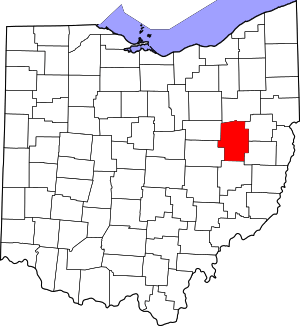 Map of Ohio highlighting Tuscarawas County | |
| Villages | ||
| Townships | ||
| CDPs | ||
| Unincorporated communities | ||
| Ghost town | ||
| Footnotes | ‡This populated place also has portions in an adjacent county or counties | |
| Authority control |
|
|---|