National Register of Historic Places listings in Washington County, Ohio
This is a list of the National Register of Historic Places listings in Washington County, Ohio.

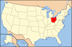
Location of Washington County in Ohio
This is intended to be a complete list of the properties and districts on the National Register of Historic Places in Washington County, Ohio, United States. The locations of National Register properties and districts for which the latitude and longitude coordinates are included below, may be seen in a Google map.[1]
There are 37 properties and districts listed on the National Register in the county, including 1 National Historic Landmark.
- This National Park Service list is complete through NPS recent listings posted August 14, 2020.[2]
Current listings
| [3] | Name on the Register[4] | Image | Date listed[5] | Location | City or town | Description |
|---|---|---|---|---|---|---|
| 1 | Charles Rice Ames House | 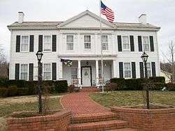 Charles Rice Ames House |
February 14, 1978 (#78002208) |
2212 Miller Ave. 39°16′59″N 81°36′21″W |
Belpre | |
| 2 | Col. Joseph Barker House |  Col. Joseph Barker House |
June 23, 1978 (#78002210) |
North of Marietta on Masonic Park Rd. 39°29′11″N 81°29′19″W |
Muskingum Township | |
| 3 | Judge Joseph Barker Jr. House | 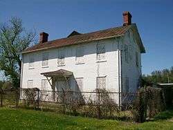 Judge Joseph Barker Jr. House |
July 26, 1979 (#79001979) |
Southwest of Newport on State Route 7 39°21′29″N 81°19′45″W |
Newport Township | |
| 4 | Becker Lumber and Manufacturing Company |  Becker Lumber and Manufacturing Company |
June 18, 1987 (#87000988) |
121 Pike St. 39°24′55″N 81°26′28″W |
Marietta | |
| 5 | Bell Covered Bridge | 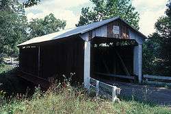 Bell Covered Bridge |
October 3, 2012 (#12000836) |
Bell Rd., north of Vincent 39°25′52″N 81°40′34″W |
Barlow Township | |
| 6 | Cisler Terrace | 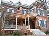 Cisler Terrace |
January 19, 1983 (#83002065) |
7th and Ephraim Cutler Sts. 39°25′18″N 81°26′58″W |
Marietta | |
| 7 | Coal Run Historic District |  Coal Run Historic District |
February 22, 1996 (#96000115) |
Roughly along Main, Maple, and Hill Sts. in Coal Run 39°34′01″N 81°35′15″W |
Waterford Township | |
| 8 | Walter Curtis House | 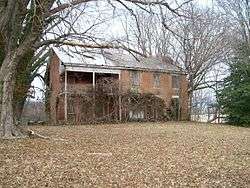 Walter Curtis House |
October 3, 1980 (#80003244) |
South of Little Hocking 39°13′17″N 81°42′39″W |
Belpre Township | |
| 9 | Col. Simeon Deming House | 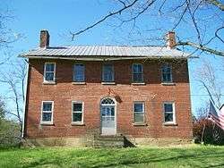 Col. Simeon Deming House |
March 24, 1980 (#80003245) |
Northeast of Watertown on Willis Rd. 39°29′21″N 81°36′35″W |
Watertown Township | |
| 10 | Erwin Hall, Marietta College |  Erwin Hall, Marietta College |
April 23, 1973 (#73001547) |
5th St. on Marietta College campus 39°25′01″N 81°27′02″W |
Marietta | |
| 11 | First Unitarian Church Of Marietta |  First Unitarian Church Of Marietta |
October 3, 1973 (#73001548) |
232 3rd St. 39°24′58″N 81°27′11″W |
Marietta | |
| 12 | Harmar Historic District | 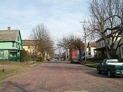 Harmar Historic District |
December 19, 1974 (#74001645) |
Roughly bounded by the Ohio and Muskingum Rivers and the rear property line of Lancaster, George, and Franklin Sts.; also roughly bounded by Lancaster, Harmar, Putnam, and Franklin Sts. and the Ohio River, Fort Harmar Dr., and the Muskingum River 39°24′35″N 81°27′46″W |
Marietta | Second set of boundaries represents a boundary increase of 1993 |
| 13 | Harra Covered Bridge | 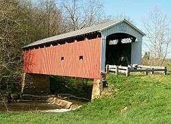 Harra Covered Bridge |
October 8, 1976 (#76001547) |
2 mi (3.2 km) northwest of Watertown on State Route 172 39°29′16″N 81°38′53″W |
Watertown Township | |
| 14 | Hildreth Covered Bridge | 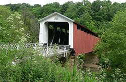 Hildreth Covered Bridge |
February 8, 1978 (#78002211) |
5 mi (8.0 km) east of Marietta off State Route 26 39°25′38″N 81°21′42″W |
Newport Township | |
| 15 | Hune Covered Bridge | 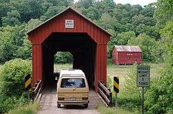 Hune Covered Bridge |
October 8, 1976 (#76001545) |
2.5 mi (4.0 km) north of Dart on State Route 26 39°30′38″N 81°15′02″W |
Lawrence Township | |
| 16 | William Hune Farm | 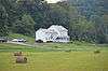 William Hune Farm |
March 28, 1991 (#91000303) |
State Route 26 north of Dart 39°30′43″N 81°14′56″W |
Lawrence Township | |
| 17 | John Kaiser House | 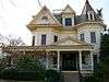 John Kaiser House |
December 10, 1993 (#93001392) |
300 Bellevue St. 39°24′56″N 81°27′59″W |
Marietta | |
| 18 | Marietta Historic District |  Marietta Historic District |
December 19, 1974 (#74001646) |
Roughly bounded by the Muskingum and Ohio Rivers and Warren, 3rd, 5th, and 6th Sts.; also roughly bounded by Marion, Montgomery, Ohio, Greene, Butler, 2nd through 9th Sts., and the Ohio and Muskingum Rivers 39°25′04″N 81°27′19″W |
Marietta | Second set of boundaries represents a boundary increase of 2001 |
| 19 | Mason House | 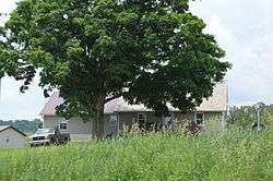 Mason House |
November 29, 1979 (#79001978) |
Township Road 393 39°33′51″N 81°35′05″W |
Waterford Township | |
| 20 | Mound Cemetery Mound | 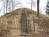 Mound Cemetery Mound |
February 23, 1973 (#73001549) |
5th and Scammel Sts. 39°25′13″N 81°27′06″W |
Marietta | Mound Cemetery, home to the Mound Cemetery Mound (aka Conus or Great Mound) and reportedly home to the largest number of American Revolutionary War officers buried in one location |
| 21 | Muskingum River Navigation Historic District |  Muskingum River Navigation Historic District |
February 9, 2007 (#07000025) |
Coshocton, Muskingum, Morgan, Washington Counties 39°28′14″N 81°29′28″W |
Numerous jurisdictions | |
| 22 | Ohio Company Land Office | 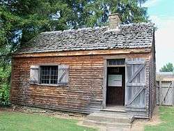 Ohio Company Land Office |
November 10, 1970 (#70000523) |
Washington and 2nd Sts., Campus Martius Museum 39°25′16″N 81°27′42″W |
Marietta | |
| 23 | Old St. Mary's School |  Old St. Mary's School |
October 3, 1989 (#89001457) |
132 S. 4th St. 39°24′52″N 81°26′49″W |
Marietta | Destroyed |
| 24 | Rufus Putnam House | 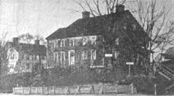 Rufus Putnam House |
November 10, 1970 (#70000524) |
Campus Martius Museum, corner of 2nd and Washington Sts. 39°25′17″N 81°27′41″W |
Marietta | |
| 25 | Rinard Covered Bridge | 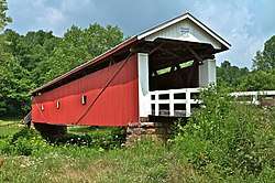 Rinard Covered Bridge |
October 8, 1976 (#76001546) |
Northeast of Wingett Run on County Road 406 39°32′12″N 81°13′23″W |
Ludlow Township | |
| 26 | Root Covered Bridge | 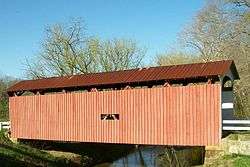 Root Covered Bridge |
March 27, 1975 (#75001552) |
0.5 mi (0.80 km) north of Decaturville on County Route 6 39°20′33″N 81°45′16″W |
Decatur Township | |
| 27 | Sawyer-Curtis House | 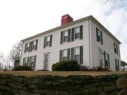 Sawyer-Curtis House |
October 18, 1984 (#84002696) |
Off U.S. Route 50 in Little Hocking 39°15′39″N 81°41′47″W |
Belpre Township | |
| 28 | Shinn Covered Bridge | .jpg) Shinn Covered Bridge |
October 8, 1976 (#76001544) |
Northeast of Bartlett off State Route 555 39°27′46″N 81°45′40″W |
Palmer Township | |
| 29 | Sixth Street Railroad Bridge | 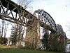 Sixth Street Railroad Bridge |
December 10, 1982 (#82001785) |
East of the 5th Street Bridge 39°16′15″N 81°33′54″W |
Belpre | Extends into Wood County, West Virginia |
| 30 | Spencer's Landing | 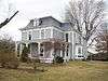 Spencer's Landing |
August 18, 1992 (#92001035) |
4 E. 5th St. 39°16′37″N 81°33′59″W |
Belpre | |
| 31 | Jonathan Sprague House | 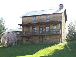 Jonathan Sprague House |
January 11, 1983 (#83002067) |
West of Lowell off State Route 60 39°33′34″N 81°34′13″W |
Adams Township | |
| 32 | Capt. Jonathan Stone House | 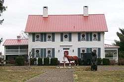 Capt. Jonathan Stone House |
February 7, 1978 (#78002209) |
612 Blennerhassett Ave. 39°16′16″N 81°34′37″W |
Belpre | |
| 33 | Vaughn-Stacy-Evans Farm Historic District | 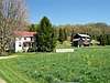 Vaughn-Stacy-Evans Farm Historic District |
September 6, 2006 (#06000764) |
7700 State Route 60, southeast of Lowell 39°30′22″N 81°27′39″W |
Muskingum Township | |
| 34 | W. P. Snyder Jr. (towboat) |  W. P. Snyder Jr. (towboat) |
November 10, 1970 (#70000522) |
On the Muskingum River at Sacra Via 39°25′13″N 81°27′48″W |
Marietta | |
| 35 | Waernicke-Hille House and Store | 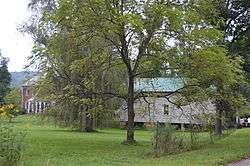 Waernicke-Hille House and Store |
November 29, 1979 (#79001977) |
Township Road 36 in Archers Fork 39°29′03″N 81°12′19″W |
Independence Township | |
| 36 | Watertown Historic District | 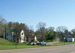 Watertown Historic District |
April 10, 1986 (#86000728) |
East of State Route 339 and north of State Route 676 39°27′59″N 81°37′57″W |
Watertown Township | |
| 37 | Wilcox-Mills House | 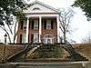 Wilcox-Mills House |
April 13, 1973 (#73001550) |
301 5th St. 39°25′04″N 81°27′05″W |
Marietta |
See also
| Wikimedia Commons has media related to National Register of Historic Places in Washington County, Ohio. |
References
- The latitude and longitude information provided in this table was derived originally from the National Register Information System, which has been found to be fairly accurate for about 99% of listings. Some locations in this table may have been corrected to current GPS standards.
- "National Register of Historic Places: Weekly List Actions". National Park Service, United States Department of the Interior. Retrieved on August 14, 2020.
- Numbers represent an ordering by significant words. Various colorings, defined here, differentiate National Historic Landmarks and historic districts from other NRHP buildings, structures, sites or objects.
- "National Register Information System". National Register of Historic Places. National Park Service. April 24, 2008.
- The eight-digit number below each date is the number assigned to each location in the National Register Information System database, which can be viewed by clicking the number.
Municipalities and communities of Washington County, Ohio, United States | ||
|---|---|---|
| Cities | Map of Ohio highlighting Washington County | |
| Villages | ||
| Townships | ||
| CDPs | ||
| Unincorporated communities |
| |
This article is issued from Wikipedia. The text is licensed under Creative Commons - Attribution - Sharealike. Additional terms may apply for the media files.