National Register of Historic Places listings in Lucas County, Ohio
This is a list of the National Register of Historic Places listings in Lucas County, Ohio.
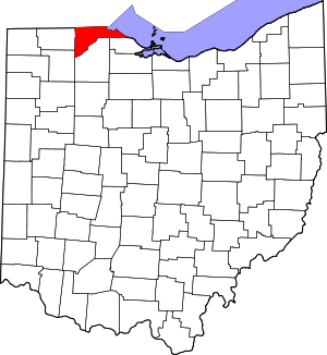
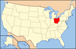
Location of Lucas County in Ohio
This is intended to be a complete list of the properties and districts on the National Register of Historic Places in Lucas County, Ohio, United States. The locations of National Register properties and districts for which the latitude and longitude coordinates are included below, may be seen in an online map.[1]
There are 90 properties and districts listed on the National Register in the county, including 2 National Historic Landmarks. Another 6 properties were once listed but have been removed.
- This National Park Service list is complete through NPS recent listings posted August 14, 2020.[2]
Current listings
| [3] | Name on the Register[4] | Image | Date listed[5] | Location | City or town | Description |
|---|---|---|---|---|---|---|
| 1 | Ashland Avenue Baptist Church | 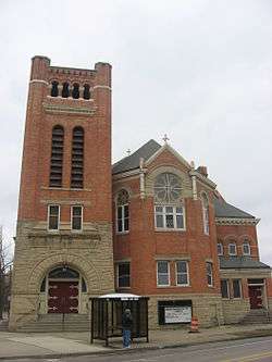 Ashland Avenue Baptist Church |
November 26, 1980 (#80003144) |
Ashland and Woodruff Sts. 41°39′38″N 83°33′00″W |
Toledo | |
| 2 | B'nai Israel Synagogue |  B'nai Israel Synagogue |
October 6, 2005 (#05001145) |
2146 N. 12th St. at Bancroft St. 41°39′50″N 83°32′23″W |
Toledo | |
| 3 | Berdan Building |  Berdan Building |
May 29, 1975 (#75001468) |
601 Washington St. 41°38′54″N 83°32′27″W |
Toledo | |
| 4 | Birckhead Place Historic District | 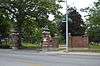 Birckhead Place Historic District |
October 13, 1983 (#83004316) |
Birckhead Pl. 41°40′30″N 83°32′42″W |
Toledo | |
| 5 | Birmingham Historic District | 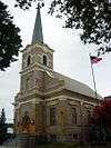 Birmingham Historic District |
August 8, 1996 (#96000834) |
Roughly bounded by Genesee, York, Esther, Magyar, Consaul, and the Conrail tracks 41°39′42″N 83°29′47″W |
Toledo | |
| 6 | R. Brand and Company | .jpg) R. Brand and Company |
May 27, 1975 (#75001469) |
120-124 St. Clair St. 41°38′57″N 83°32′10″W |
Toledo | |
| 7 | Brandville School | 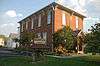 Brandville School |
June 17, 1994 (#94000595) |
1133 Grasser St. 41°37′49″N 83°29′18″W |
Oregon | |
| 8 | Bronson Place | 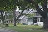 Bronson Place |
November 29, 1984 (#84000459) |
Roughly bounded by Cherry St. and Central and Franklin Aves. 41°40′41″N 83°32′52″W |
Toledo | |
| 9 | Burt's Theater | 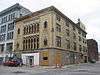 Burt's Theater |
November 1, 1977 (#77001074) |
719-723 Jefferson St. 41°39′06″N 83°32′24″W |
Toledo | |
| 10 | Bush Street Historic District | 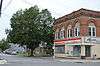 Bush Street Historic District |
June 1, 1982 (#82003609) |
Bush and Erie Sts. 41°39′52″N 83°31′12″W |
Toledo | |
| 11 | Central YMCA | 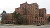 Central YMCA |
April 15, 1982 (#82003610) |
1110 Jefferson Ave. 41°39′13″N 83°32′33″W |
Toledo | |
| 12 | Columbian House | 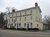 Columbian House |
December 17, 1969 (#69000146) |
River and Farnsworth Rds. 41°29′58″N 83°43′03″W |
Waterville | |
| 13 | Commodore Perry Hotel |  Commodore Perry Hotel |
October 24, 1997 (#97001240) |
505 Jefferson Ave. 41°39′02″N 83°32′15″W |
Toledo | |
| 14 | East Side Commercial Block |  East Side Commercial Block |
May 3, 1976 (#76001473) |
107-117 Main St. 41°38′54″N 83°31′22″W |
Toledo | |
| 15 | East Toledo Historic District |  East Toledo Historic District |
August 8, 1996 (#96000831) |
Roughly bounded by Front, Platt, Starr, and Spring Grove 41°37′38″N 83°30′44″W |
Toledo | |
| 16 | Eckenrode and Breisach Houses |  Eckenrode and Breisach Houses |
April 6, 1978 (#78002120) |
202 and 204 E. Dudley St. 41°33′48″N 83°39′06″W |
Maumee | |
| 17 | Englewood Historic District |  Englewood Historic District |
May 29, 1998 (#98000601) |
Roughly bounded by W. Bancroft, Lawrence, Oakwood, Hoag, and Detroit Sts. 41°39′38″N 83°33′54″W |
Toledo | |
| 18 | Fallen Timbers Battlefield |  Fallen Timbers Battlefield |
October 15, 1966 (#66000616) |
2 mi (3.2 km) west of Maumee on U.S. Route 24 41°32′39″N 83°41′51″W |
Monclova Township | |
| 19 | First Church of Christ, Scientist |  First Church of Christ, Scientist |
November 29, 1978 (#78002125) |
2704 Monroe St. 41°39′43″N 83°33′55″W |
Toledo | |
| 20 | First Presbyterian Church of Maumee Chapel | 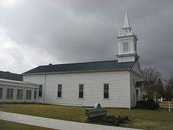 First Presbyterian Church of Maumee Chapel |
August 13, 1973 (#73001498) |
200 E. Broadway 41°33′41″N 83°39′02″W |
Maumee | |
| 21 | Forsythe-Puhl House | 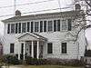 Forsythe-Puhl House |
May 18, 1989 (#89000429) |
106 E. Harrison Ave. 41°33′40″N 83°38′54″W |
Maumee | |
| 22 | Fort Industry Square | 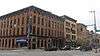 Fort Industry Square |
July 23, 1973 (#73001501) |
Bounded by Summit, Monroe, and Water Sts. and Jefferson Ave. 41°38′57″N 83°32′06″W |
Toledo | |
| 23 | Fort Miamis Site |  Fort Miamis Site |
June 18, 1975 (#75001466) |
Along the Maumee River at Fort Miamis State Memorial[6] 41°34′22″N 83°37′35″W |
Maumee | |
| 24 | Peter Gendron House | 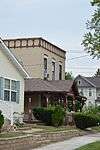 Peter Gendron House |
March 3, 1983 (#83002001) |
1413 Walnut St. 41°39′50″N 83°32′09″W |
Toledo | |
| 25 | Gillett-Shoemaker-Welsh House | 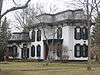 Gillett-Shoemaker-Welsh House |
July 18, 1975 (#75001474) |
133 N. 4th St. 41°30′07″N 83°43′16″W |
Waterville | |
| 26 | Governor's Inn | 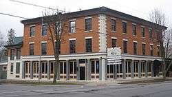 Governor's Inn |
October 18, 1974 (#74001557) |
301 River Rd. 41°33′52″N 83°38′46″W |
Maumee | |
| 27 | Peck Griswold House | 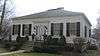 Peck Griswold House |
May 22, 1978 (#78002121) |
228 E. Broadway 41°33′42″N 83°38′59″W |
Maumee | |
| 28 | Hanson House | 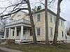 Hanson House |
May 22, 1978 (#78002122) |
405 E. Broadway 41°33′47″N 83°38′50″W |
Maumee | |
| 29 | Liberty Whitcomb Haskins House | 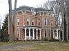 Liberty Whitcomb Haskins House |
July 1, 1975 (#75001475) |
North of Waterville at 625 Canal Rd. 41°30′34″N 83°43′09″W |
Waterville | |
| 30 | Hillcrest Hotel | 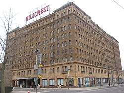 Hillcrest Hotel |
September 18, 1998 (#98001179) |
1603 Madison Ave. 41°39′23″N 83°32′46″W |
Toledo | |
| 31 | House Of Four Pillars | 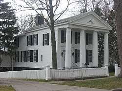 House Of Four Pillars |
July 16, 1973 (#73001499) |
322 E. Broadway 41°33′44″N 83°38′53″W |
Maumee | |
| 32 | Isaac Hull Store | 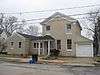 Isaac Hull Store |
March 30, 1978 (#78002123) |
114 E. Harrison St. 41°33′37″N 83°39′05″W |
Maumee | |
| 33 | Hull-Wolcott House |  Hull-Wolcott House |
January 26, 1970 (#70000506) |
1031 River Rd. 41°34′20″N 83°38′21″W |
Maumee | |
| 34 | Huron-Superior Streets Warehouse-Produce Historic District | 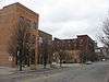 Huron-Superior Streets Warehouse-Produce Historic District |
March 24, 1993 (#93000153) |
Roughly bounded by Erie, Monroe, Superior and Market Sts. 41°38′52″N 83°32′28″W |
Toledo | |
| 35 | Interurban Bridge | 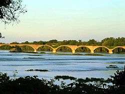 Interurban Bridge |
June 19, 1972 (#72001036) |
1 mi (1.6 km) south of Waterville over the Maumee River 41°29′11″N 83°43′42″W |
Waterville | Extends into Wood County |
| 36 | Inverness Club |  Inverness Club |
May 10, 1993 (#93000398) |
4601 Dorr St. 41°39′00″N 83°39′00″W |
Toledo | |
| 37 | Ira Apartments |  Ira Apartments |
August 15, 1996 (#96000868) |
1302 Parkside Boulevard 41°39′11″N 83°35′38″W |
Toledo | Demolished in mid-February 2007 |
| 38 | John Isham Farmstead |  John Isham Farmstead |
September 16, 1992 (#92001159) |
8460 S. River Rd. 41°28′55″N 83°44′48″W |
Waterville | |
| 39 | John Isham House | 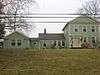 John Isham House |
August 9, 1982 (#82005388) |
8460 S. River Rd. 41°28′54″N 83°44′47″W |
Waterville | |
| 40 | Landers Brothers Company Building | December 23, 2019 (#100004779) |
443 10th St. 41°39′23″N 83°32′19″W |
Toledo | ||
| 41 | Lasalle, Koch and Company Department Store |  Lasalle, Koch and Company Department Store |
August 4, 1995 (#95001001) |
513 Adams St. at its junction with Huron St. 41°39′11″N 83°32′08″W |
Toledo | |
| 42 | Edward D. Libbey House |  Edward D. Libbey House |
May 4, 1983 (#83004379) |
2008 Scottwood Ave. 41°38′32″N 83°33′29″W |
Toledo | |
| 43 | Edward Drummond Libbey High School | 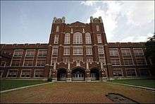 Edward Drummond Libbey High School |
September 15, 2011 (#11000672) |
1250 Western Ave. 41°38′07″N 83°34′17″W |
Toledo | |
| 44 | Lucas County Courthouse and Jail |  Lucas County Courthouse and Jail |
May 11, 1973 (#73002295) |
Courthouse Sq. and 810-814 Jackson 41°39′19″N 83°32′14″W |
Toledo | |
| 45 | Lucas County Hospital and Nurse's Home | 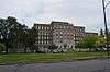 Lucas County Hospital and Nurse's Home |
October 17, 1997 (#97001224) |
2101 and 2155 Arlington Ave. 41°37′21″N 83°35′42″W |
Toledo | |
| 46 | Isaac R. Ludwig Historical Mill |  Isaac R. Ludwig Historical Mill |
June 28, 1974 (#74001558) |
Mill Rd. in Providence Park 41°24′55″N 83°51′45″W |
Providence Township | |
| 47 | Madison Avenue Historic District |  Madison Avenue Historic District |
June 26, 1998 (#86003829) |
Roughly bounded by Madison, Adams and Huron Sts. 41°39′08″N 83°32′12″W |
Toledo | |
| 48 | Maumee Historic District | 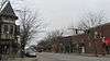 Maumee Historic District |
January 18, 1974 (#09000099) |
Roughly W. Harrison, W. Broadway, Cass, Allen, and W. Dudley 41°33′45″N 83°39′14″W |
Maumee | |
| 49 | Maumee Sidecut |  Maumee Sidecut |
April 11, 1973 (#73001500) |
North of the Maumee River, southwest of Ewing Island 41°33′30″N 83°39′36″W |
Maumee | |
| 50 | Maumee Theater | 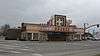 Maumee Theater |
April 1, 1998 (#98000318) |
601 Conant St. 41°33′53″N 83°39′20″W |
Maumee | |
| 51 | Maumee Uptown Historic District | 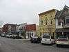 Maumee Uptown Historic District |
March 1, 1984 (#84003766) |
Conant, Wayne, and Dudley Sts. 41°33′44″N 83°39′15″W |
Maumee | |
| 52 | Monroe Street Commercial Buildings | 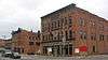 Monroe Street Commercial Buildings |
December 12, 1976 (#76001474) |
513-623 Monroe St. 41°39′00″N 83°32′24″W |
Toledo | |
| 53 | Morehouse-Downes House | 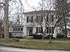 Morehouse-Downes House |
May 29, 1975 (#75001476) |
4 S. River Rd. 41°29′56″N 83°43′03″W |
Waterville | |
| 54 | Albert Neukom House | 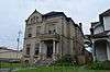 Albert Neukom House |
March 4, 1971 (#71000644) |
301 Broadway 41°38′28″N 83°32′29″W |
Toledo | |
| 55 | Ohio Theatre | 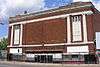 Ohio Theatre |
March 29, 2006 (#06000198) |
3114 Lagrange St. 41°40′45″N 83°32′26″W |
Toledo | |
| 56 | Old Central Post Office |  Old Central Post Office |
February 23, 1972 (#72001030) |
13th St. between Madison and Jefferson Aves. 41°39′17″N 83°32′39″W |
Toledo | |
| 57 | Old West End District |  Old West End District |
March 14, 1973 (#73001503) |
Roughly bounded by Delaware, Collingwood, and Glenwood Aves. and Grove Pl.; also roughly bounded by Glenwood, Glover, Ashland, Collingwood, and Central Aves. 41°39′45″N 83°36′41″W |
Toledo | Second set of boundaries represents a boundary increase of March 30, 1984 |
| 58 | Ontario Building | December 10, 2018 (#100003209) |
713-717 Jefferson Ave. 41°39′06″N 83°32′23″W |
Toledo | ||
| 59 | The Overmyer Building | December 23, 2019 (#100004780) |
15 South Ontario St. 41°38′55″N 83°32′34″W |
Toledo | ||
| 60 | Pray-Starkweather House | 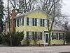 Pray-Starkweather House |
May 29, 1975 (#75001477) |
144 N. River Rd. 41°30′06″N 83°43′00″W |
Waterville | |
| 61 | Providence Historic District | 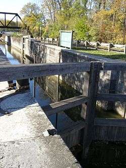 Providence Historic District |
August 13, 1975 (#75001467) |
Court and Main Sts. and Ludwig and Providence-Neopolis Rds. in Providence 41°25′07″N 83°52′24″W |
Providence Township | |
| 62 | Pythian Castle |  Pythian Castle |
February 23, 1972 (#72001032) |
801 Jefferson Ave. 41°39′07″N 83°32′25″W |
Toledo | |
| 63 | Henry Reed, Jr., House | 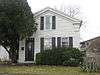 Henry Reed, Jr., House |
April 20, 1978 (#78002124) |
511-513 White St. 41°33′57″N 83°38′59″W |
Maumee | |
| 64 | Riverview |  Riverview |
July 3, 2012 (#12000394) |
200 N. St. Clair St. and 215 and 239 Summit St. 41°39′02″N 83°32′06″W |
Toledo | |
| 65 | Riverview Apartments | 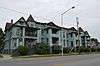 Riverview Apartments |
April 21, 1983 (#83002002) |
1829-1837 Summit St. 41°39′57″N 83°30′40″W |
Toledo | |
| 66 | St. Ann Roman Catholic Church Complex | _-_exterior.jpg) St. Ann Roman Catholic Church Complex |
May 5, 1983 (#83002003) |
1105 W. Bancroft and 1120 Horace Sts. 41°39′47″N 83°34′12″W |
Toledo | |
| 67 | St. Clair Street Historic District | 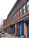 St. Clair Street Historic District |
May 29, 1975 (#75001471) |
Both sides of St. Clair St. from Perry St. to the southern side of Lafayette St.; 28 N. St Clair, 23-29 & 31 Summit 41°38′48″N 83°32′20″W |
Toledo | Second set of addresses represent a boundary adjustment in 2014. |
| 68 | St. Patrick's Catholic Church | _-_nave.jpg) St. Patrick's Catholic Church |
February 23, 1972 (#72001033) |
13th St. and Avondale Ave. 41°38′56″N 83°32′45″W |
Toledo | |
| 69 | Saint Peter and Saint Paul Historic District-Oliver's Second addition | 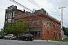 Saint Peter and Saint Paul Historic District-Oliver's Second addition |
March 13, 1987 (#87000465) |
600 and 700 blocks of S. Saint Clair St. 41°38′22″N 83°32′53″W |
Toledo | |
| 70 | Secor Hotel | .jpg) Secor Hotel |
April 30, 1976 (#76001475) |
413-423 Jefferson Ave. 41°39′01″N 83°32′13″W |
Toledo | |
| 71 | Joseph K. Secor House | 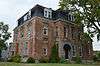 Joseph K. Secor House |
June 11, 1979 (#79003108) |
311 Bush St. 41°39′41″N 83°31′05″W |
Toledo | |
| 72 | Spitzer Building | .jpg) Spitzer Building |
April 21, 1983 (#83002004) |
514-526 Madison Ave. 41°39′08″N 83°32′11″W |
Toledo | |
| 73 | Spring Grove Historic District | 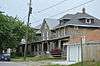 Spring Grove Historic District |
August 8, 1996 (#96000832) |
Roughly bounded by Mason, Spring Grove, Greenwood, and Conrail tracks 41°38′32″N 83°30′26″W |
Toledo | |
| 74 | Standart-Simmons Hardware Company | 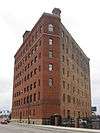 Standart-Simmons Hardware Company |
May 29, 1975 (#75001472) |
36 S. Erie St. 41°38′52″N 83°32′33″W |
Toledo | |
| 75 | Successful Sales (Oliver House Hotel) | 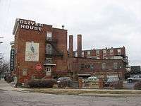 Successful Sales (Oliver House Hotel) |
May 6, 1971 (#71000645) |
27 Broadway 41°38′36″N 83°32′18″W |
Toledo | |
| 76 | Toledo Club | 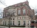 Toledo Club |
December 1, 1978 (#78002127) |
14th St. and Madison Ave. 41°39′20″N 83°32′40″W |
Toledo | |
| 77 | Toledo Harbor Light |  Toledo Harbor Light |
August 4, 1983 (#83002005) |
Toledo Harbor 41°43′04″N 83°25′17″W |
Jerusalem Township | |
| 78 | Toledo Olde Towne Historic District | 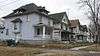 Toledo Olde Towne Historic District |
September 21, 1989 (#89001454) |
Roughly bounded by Central Ave., Cherry St., Franklin Ave., Bancroft St., and Collingwood Ave. 41°40′04″N 83°32′59″W |
Toledo | |
| 79 | Toledo Traction Company Power Station | 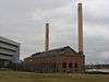 Toledo Traction Company Power Station |
June 19, 2003 (#03000555) |
300 Water St. 41°39′02″N 83°31′57″W |
Toledo | |
| 80 | Toledo Yacht Club | .jpg) Toledo Yacht Club |
December 12, 1976 (#76001476) |
Bay View Park 41°41′35″N 83°28′32″W |
Toledo | |
| 81 | Trinity Episcopal Church | 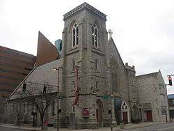 Trinity Episcopal Church |
December 29, 1983 (#83004317) |
316 Adams St. 41°39′10″N 83°32′00″W |
Toledo | |
| 82 | United States Courthouse and Custom House | 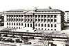 United States Courthouse and Custom House |
July 17, 2013 (#13000501) |
1716 Spielbusch Ave. 41°39′27″N 83°32′10″W |
Toledo | |
| 83 | Valentine Theater Building | 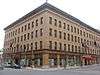 Valentine Theater Building |
May 19, 1987 (#87000686) |
405-419 Saint Clair and 402-412 Adams 41°39′11″N 83°32′01″W |
Toledo | |
| 84 | Vistula Historic District | 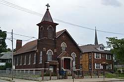 Vistula Historic District |
December 6, 1978 (#78002128) |
Roughly bounded by Champlain, Summit, Walnut and Magnolia Sts. 41°38′32″N 83°30′26″W |
Toledo | |
| 85 | Waterville Commercial District |  Waterville Commercial District |
December 12, 1976 (#76001477) |
3rd St. 41°29′59″N 83°43′12″W |
Waterville | |
| 86 | West Sister Island Light | 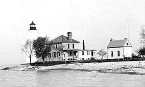 West Sister Island Light |
August 4, 1983 (#83002006) |
West Sister Island 41°44′13″N 83°06′38″W |
Jerusalem Township | |
| 87 | Westmoreland Historic District | 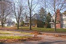 Westmoreland Historic District |
February 3, 1986 (#86000208) |
Roughly bounded by Parkside Boulevard, Bancroft St., Upton Ave., and Oakwood Ave. and Allenby Rd. 41°39′35″N 83°35′29″W |
Toledo | |
| 88 | Woodlawn Cemetery | 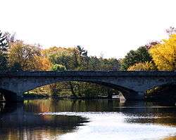 Woodlawn Cemetery |
November 19, 1998 (#98001396) |
1502 W. Central Ave. 41°40′53″N 83°34′46″W |
Toledo | |
| 89 | Dr. John A. Wright House | 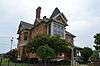 Dr. John A. Wright House |
October 5, 1978 (#78002129) |
1822 Cherry St. 41°39′58″N 83°32′22″W |
Toledo | |
| 90 | Yondota Historic District | 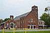 Yondota Historic District |
August 8, 1996 (#96000833) |
Roughly bounded by Oak, 2nd, Euclid, Starr, White, Delence, and Nevada 41°38′38″N 83°31′16″W |
Toledo |
Former listings
| [3] | Name on the Register | Image | Date listed | Date removed | Location | City or town | Summary |
|---|---|---|---|---|---|---|---|
| 1 | Manhattan Building | June 10, 1975 (#75001470) | May 5, 1983 | 518 Jefferson Ave. |
Toledo | ||
| 2 | Henry Philipps House | February 23, 1972 (#72001031) | 1999 | 220 Columbia St. |
Toledo | ||
| 3 | St. Paul's United Methodist Church | November 2, 1978 (#78002126) | May 5, 1983 | Madison and 13th Sts |
Toledo | ||
| 4 | Toledo City Market | February 23, 1972 (#72001035) | May 5, 1983 | 237 S. Erie St. |
Toledo | ||
| 5 | Toledo News Bee Building | February 23, 1972 (#72001034) | May 5, 1983 | 604 Jackson St. |
Toledo | Demolished in the early 1980s[7] | |
| 6 | Wheeler Block | 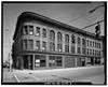 Wheeler Block |
May 29, 1975 (#75001473) | October 29, 1983 | 402 Monroe St. |
Toledo |
See also
| Wikimedia Commons has media related to National Register of Historic Places in Lucas County, Ohio. |
References
- The latitude and longitude information provided in this table was derived originally from the National Register Information System, which has been found to be fairly accurate for about 99% of listings. Some locations in this table may have been corrected to current GPS standards.
- "National Register of Historic Places: Weekly List Actions". National Park Service, United States Department of the Interior. Retrieved on August 14, 2020.
- Numbers represent an ordering by significant words. Various colorings, defined here, differentiate National Historic Landmarks and historic districts from other NRHP buildings, structures, sites or objects.
- "National Register Information System". National Register of Historic Places. National Park Service. April 24, 2008.
- The eight-digit number below each date is the number assigned to each location in the National Register Information System database, which can be viewed by clicking the number.
- U.S. Geological Survey Geographic Names Information System: Fort Miami (historical)
Municipalities and communities of Lucas County, Ohio, United States | ||
|---|---|---|
| Cities | Map of Ohio highlighting Lucas County | |
| Villages | ||
| Townships | ||
| CDPs | ||
| Unincorporated communities | ||
| Ghost towns | ||
| Footnotes | ‡This populated place also has portions in an adjacent county or counties | |
This article is issued from Wikipedia. The text is licensed under Creative Commons - Attribution - Sharealike. Additional terms may apply for the media files.