National Register of Historic Places listings in Rappahannock County, Virginia
This is a list of the National Register of Historic Places listings in Rappahannock County, Virginia.
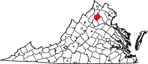
Location of Rappahannock County in Virginia
This is intended to be a complete list of the properties and districts on the National Register of Historic Places in Rappahannock County, Virginia, United States. The locations of National Register properties and districts for which the latitude and longitude coordinates are included below, may be seen in an online map.[1]
There are 19 properties and districts listed on the National Register in the county, including 1 National Historic Landmark.
- This National Park Service list is complete through NPS recent listings posted August 7, 2020.[2]
Current listings
| [3] | Name on the Register[4] | Image | Date listed[5] | Location | City or town | Description |
|---|---|---|---|---|---|---|
| 1 | Ben Venue |  Ben Venue |
December 28, 1979 (#79003075) |
Northeast of Washington on Ben Venue Rd. 38°43′19″N 78°03′59″W |
Washington | |
| 2 | Ben Venue Rural Historic District |  Ben Venue Rural Historic District |
February 2, 2016 (#15001042) |
Ben Venue Rd. and Williams Farm, Fogg Mountain, Hickerson Mountain, and Points of View Lns. 38°43′46″N 78°04′11″W |
Flint Hill | |
| 3 | Caledonia Farm |  Caledonia Farm |
December 28, 1990 (#90001996) |
Junction of Dearing and Fodderstack Rds. 38°45′46″N 78°07′37″W |
Flint Hill | |
| 4 | Calvert Mill/Washington Mill |  Calvert Mill/Washington Mill |
September 2, 1982 (#82004583) |
East of Washington on U.S. Route 211 38°42′46″N 78°09′07″W |
Washington | |
| 5 | George L. Carder House |  George L. Carder House |
December 14, 2004 (#04000715) |
456 Scrabble Rd. 38°35′59″N 78°08′15″W |
Castleton | |
| 6 | Flint Hill Baptist Church |  Flint Hill Baptist Church |
December 1, 1997 (#97001509) |
0.3 miles (0.48 km) north of the junction of U.S. Route 522 and Ben Venue Rd. 38°45′52″N 78°05′59″W |
Flint Hill | |
| 7 | Flint Hill Historic District |  Flint Hill Historic District |
January 27, 2012 (#11001070) |
Junction of U.S. Route 522 and Fodderstack, Crest Hill, and Ben Venue Rds. 38°45′46″N 78°06′00″W |
Flint Hill | |
| 8 | Laurel Mills Historic District |  Laurel Mills Historic District |
November 27, 2004 (#04001273) |
Roughly bounded by Laurel Mills Rd., the Thornton River, and Laurel Mills Farm 38°38′55″N 78°05′20″W |
Laurel Mills | |
| 9 | Locust Grove-R.E. Luttrell Farmstead |  Locust Grove-R.E. Luttrell Farmstead |
May 28, 2013 (#13000343) |
24 Bunree Ln. 38°41′24″N 77°59′30″W |
Amissville | |
| 10 | Meadow Grove Farm |  Meadow Grove Farm |
September 5, 2006 (#06000803) |
21 Meadow Grove Ln. 38°40′41″N 78°04′38″W |
Amissville | |
| 11 | John W. Miller House |  John W. Miller House |
January 3, 1991 (#90002010) |
Junction of Slate Mills and Round Hill Rds. 38°31′52″N 78°10′37″W |
Boston | |
| 12 | Montpelier |  Montpelier |
April 11, 1973 (#73002052) |
South of Sperryville on State Route 231 38°35′13″N 78°13′45″W |
Sperryville | |
| 13 | Mount Salem Baptist Meetinghouse |  Mount Salem Baptist Meetinghouse |
May 24, 1979 (#79003076) |
Southeast of Washington on Long Mountain Rd. 38°40′23″N 78°07′44″W |
Washington | |
| 14 | Scrabble School |  Scrabble School |
October 31, 2007 (#07001143) |
111 Scrabble Rd. 38°35′04″N 78°09′05″W |
Castleton | |
| 15 | Skyline Drive Historic District |  Skyline Drive Historic District |
April 28, 1997 (#97000375) |
Shenandoah National Park, from the north entrance station at Front Royal to the south entrance station at Rockfish Gap 38°37′21″N 78°19′22″W |
Luray | |
| 16 | Sperryville Historic District |  Sperryville Historic District |
February 10, 1983 (#83003300) |
U.S. Route 522, Woodward Rd., and Main and Water Sts. 38°39′26″N 78°13′37″W |
Sperryville | |
| 17 | Sunnyside |  Sunnyside |
November 27, 2004 (#04001274) |
186 Sunnyside Orchard Ln. 38°44′07″N 78°09′55″W |
Washington | |
| 18 | Washington Historic District |  Washington Historic District |
May 28, 1975 (#75002033) |
Parts of Main St., Piedmont Ave., and Calvert, Middle and Porter Sts. 38°42′51″N 78°09′34″W |
Washington | |
| 19 | Washington School |  Washington School |
January 24, 2019 (#100003349) |
267 Piedmont Ave. 38°42′47″N 78°09′53″W |
Washington |
See also
| Wikimedia Commons has media related to National Register of Historic Places in Rappahannock County, Virginia. |
References
- The latitude and longitude information provided in this table was derived originally from the National Register Information System, which has been found to be fairly accurate for about 99% of listings. Some locations in this table may have been corrected to current GPS standards.
- "National Register of Historic Places: Weekly List Actions". National Park Service, United States Department of the Interior. Retrieved on August 7, 2020.
- Numbers represent an ordering by significant words. Various colorings, defined here, differentiate National Historic Landmarks and historic districts from other NRHP buildings, structures, sites or objects.
- "National Register Information System". National Register of Historic Places. National Park Service. April 24, 2008.
- The eight-digit number below each date is the number assigned to each location in the National Register Information System database, which can be viewed by clicking the number.
Municipalities and communities of Rappahannock County, Virginia, United States | ||
|---|---|---|
| Town | Map of Virginia highlighting Rappahannock County | |
| CDPs | ||
| Unincorporated communities |
| |
| Footnotes | ‡This populated place also has portions in an adjacent county or counties | |
This article is issued from Wikipedia. The text is licensed under Creative Commons - Attribution - Sharealike. Additional terms may apply for the media files.