National Register of Historic Places listings in Central Chicago
Currently there are 124 National Register of Historic Places listings in Central Chicago, out of 374 listings in the City of Chicago. Central Chicago includes 3 of the 77 well-defined community areas of Chicago: the historic business and cultural center of Chicago known as the Loop, as well as the Near North Side and the Near South Side. The combined area is bounded by Lake Michigan on the east, the Chicago River on the west, North Avenue (1600 N.) on the north, and 26th Street (2600 S.) on the south. This area runs five and one-quarter miles from north to south and about one and one-half miles from east to west.
The Chicago central city area includes many early classic skyscrapers of the Chicago School of Architecture, such as Burnham and Root's Monadnock and the Reliance Buildings, as well as buildings from the early Modernist period, such as Ludwig Mies van der Rohe's IBM Building and 860-880 Lake Shore Drive Apartments. Chicago's earliest surviving building, the Henry B. Clarke House is on the Near South Side, close to the Prairie Avenue District, which many critics view as the jewel of residential Chicago architecture. Architect Louis Sullivan's work is represented by the Carson, Pirie, Scott and Company Building, and Auditorium Building. Though Frank Lloyd Wright worked downtown early in his career as an assistant to Sullivan - including work on the James Charnley House - his own work in the central city is represented only by a renovation of the lobby of Daniel Burnham's and John Wellborn Root's Rookery Building.
At least three sites relate to the city's role in nationwide retailing.[1] Included also are several religious buildings, six hotels,[2] and four theaters.[3]
- This National Park Service list is complete through NPS recent listings posted August 14, 2020.[4]
| NRHP-listed | |
| ∞ | NRHP-listed Historic district |
| * | National Historic Landmark and NRHP-listed |
| ∞ | National Historic Landmark and NRHP-listed Historic district |
Current listings
| [5] | Name on the Register[6] | Image | Date listed[7] | Location | Neighborhood | Description |
|---|---|---|---|---|---|---|
| 1 | Adler Planetarium |  Adler Planetarium |
February 27, 1987 (#87000819) |
1300 S. Lake Shore Drive 41°51′58″N 87°36′24″W |
Near South Side | 1930 |
| 2 | America Fore Building |  America Fore Building |
June 21, 2016 (#16000383) |
844 N. Rush Street 41°53′53″N 87°37′34″W |
Near North Side | |
| 3 | Auditorium Building, Roosevelt University | 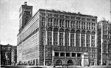 Auditorium Building, Roosevelt University |
April 17, 1970 (#70000230) |
430 S. Michigan Avenue 41°52′32″N 87°37′29″W |
Chicago Loop | 1889 |
| 4 | B.F. Goodrich Company Showroom |  B.F. Goodrich Company Showroom |
May 28, 2009 (#09000347) |
1925 S. Michigan Avenue 41°51′21″N 87°37′24″W |
Near South Side | |
| 5 | Balaban and Katz Chicago Theatre | 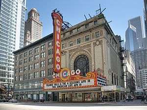 Balaban and Katz Chicago Theatre |
June 6, 1979 (#79000822) |
175 N. State Street 41°53′08″N 87°37′38″W |
Chicago Loop | 1921 |
| 6 | Blackstone Hotel | 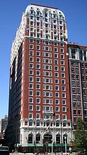 Blackstone Hotel |
May 8, 1986 (#86001005) |
80 E. Balbo Drive 41°52′24″N 87°37′28″W |
Chicago Loop | 1910 |
| 7 | Boyce Building | 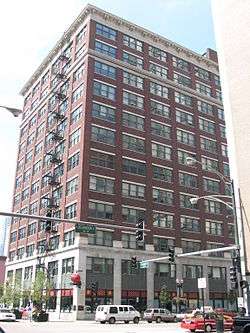 Boyce Building |
February 29, 1996 (#96000080) |
500-510 N. Dearborn Street 41°53′28″N 87°37′48″W |
Near North Side | |
| 8 | Buckingham Building |  Buckingham Building |
August 10, 2000 (#00000942) |
59-67 E. Van Buren Street 41°52′36″N 87°37′30″W |
Chicago Loop | |
| 9 | Building at 14-16 Pearson Street |  Building at 14-16 Pearson Street |
May 8, 1980 (#80001343) |
14-16 E. Pearson Street 41°53′51″N 87°37′40″W |
Near North Side | |
| 10 | Building at 257 East Delaware Place | 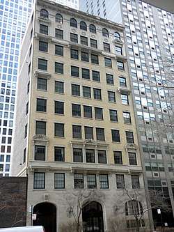 Building at 257 East Delaware Place |
June 26, 1987 (#87001113) |
257 E. Delaware Place 41°53′57″N 87°37′10″W |
Near North Side | |
| 11 | Buildings at 860-880 N. Lake Shore Drive | 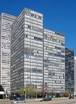 Buildings at 860-880 N. Lake Shore Drive |
August 28, 1980 (#80001344) |
860-880 N. Lake Shore Drive 41°53′55″N 87°37′08″W |
Near North Side | 1949 |
| 12 | Burlingham Building |  Burlingham Building |
February 14, 1985 (#85000264) |
104 W. Oak Street 41°54′04″N 87°37′54″W |
Near North Side | |
| 13 | Bush Temple of Music | 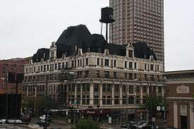 Bush Temple of Music |
December 31, 2013 (#13001001) |
100 W. Chicago Avenue, 800 N. Clark Street 41°53′49″N 87°37′54″W |
Near North Side | |
| 14 | Calumet Plant, R. R. Donnelly & Sons Company | 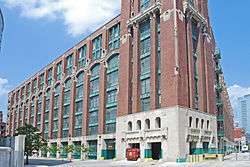 Calumet Plant, R. R. Donnelly & Sons Company |
February 17, 1983 (#83000308) |
350 E. Cermak Road 41°51′13″N 87°37′05″W |
Near South Side | |
| 15 | Carling Hotel | 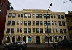 Carling Hotel |
January 24, 2017 (#100000563) |
1512 N. LaSalle Street 41°54′35″N 87°38′01″W |
Near North Side | |
| 16 | Carson, Pirie, Scott and Company Building | 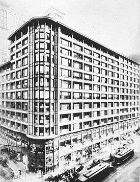 Carson, Pirie, Scott and Company Building |
April 17, 1970 (#70000231) |
1 S. State Street 41°52′54″N 87°37′39″W |
Chicago Loop | |
| 17 | Chapin and Gore Building | .jpg) Chapin and Gore Building |
June 27, 1979 (#79000823) |
63 E. Adams Street 41°52′45″N 87°37′31″W |
Chicago Loop | |
| 18 | James Charnley House | 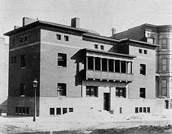 James Charnley House |
April 17, 1970 (#70000232) |
1365 N. Astor Street 41°54′28″N 87°37′40″W |
Near North Side | |
| 19 | Chicago Avenue Water Tower and Pumping Station | .jpg) Chicago Avenue Water Tower and Pumping Station |
April 23, 1975 (#75000644) |
806 N. Michigan Avenue 41°53′50″N 87°37′26″W |
Near North Side | |
| 20 | Chicago Board of Trade Building |  Chicago Board of Trade Building |
June 16, 1978 (#78003181) |
141 W. Jackson Boulevard 41°52′41″N 87°37′56″W |
Chicago Loop | |
| 21 | Chicago Club |  Chicago Club |
February 28, 2005 (#05000109) |
81 E. Van Buren Street 41°52′37″N 87°37′29″W |
Chicago Loop | 1929 Granger and Bollenbacher Romanesque Revival |
| 22 | Chicago Federal Center |  Chicago Federal Center |
March 24, 2011 (#08001165) |
Entire block bounded by S. Dearborn Street, W. Jackson Street, S. Clark Street and W. Adams Street and the contiguous half-block east of S. Dearborn Street 41°52′44″N 87°37′48″W |
Chicago Loop | |
| 23 | Chicago Harbor Lighthouse | 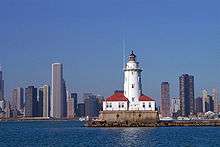 Chicago Harbor Lighthouse |
July 19, 1984 (#84000986) |
North Breakwater 41°53′22″N 87°35′26″W |
Near North Side | |
| 24 | Chicago Public Library, Central Building | 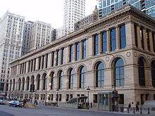 Chicago Public Library, Central Building |
July 31, 1972 (#72000449) |
78 E. Washington Street 41°53′02″N 87°37′30″W |
Chicago Loop | |
| 25 | Chicago Savings Bank Building |  Chicago Savings Bank Building |
September 5, 1975 (#75000645) |
7 W. Madison Street 41°52′54″N 87°37′42″W |
Chicago Loop | |
| 26 | Chicago Varnish Company Building | 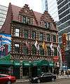 Chicago Varnish Company Building |
June 14, 2001 (#01000649) |
33 W. Kinzie Street 41°53′20″N 87°37′46″W |
Near North Side | |
| 27 | Henry B. Clarke House |  Henry B. Clarke House |
May 6, 1971 (#71000290) |
1827 S. Indiana Avenue 41°51′26″N 87°37′19″W |
Near South Side | |
| 28 | Coca Cola Company Building |  Coca Cola Company Building |
February 22, 1991 (#91000114) |
1322-1336 S. Wabash Avenue 41°51′54″N 87°37′34″W |
Near South Side | |
| 29 | Continental and Commercial National Bank |  Continental and Commercial National Bank |
February 14, 2007 (#07000064) |
208 S. LaSalle Street 41°52′45″N 87°37′56″W |
Chicago Loop | |
| 30 | Conway Building |  Conway Building |
February 9, 1984 (#84000988) |
111 W. Washington Street 41°52′58″N 87°37′53″W |
Chicago Loop | |
| 31 | Cook County Criminal Court Building | .jpg) Cook County Criminal Court Building |
November 13, 1984 (#84000281) |
54 W. Hubbard Street 41°53′25″N 87°37′49″W |
Near North Side | |
| 32 | Crane Company Building |  Crane Company Building |
January 28, 2002 (#01001538) |
836 S. Michigan Avenue 41°52′14″N 87°37′28″W |
Chicago Loop | |
| 33 | Curtiss–Wright Aeronautical University Building | 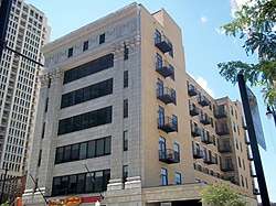 Curtiss–Wright Aeronautical University Building |
October 16, 2013 (#13000827) |
1338-1342 S. Michigan Avenue 41°51′53″N 87°37′28″W |
Near South Side | 1929-53 location of African-American aviation school |
| 34 | Dearborn Station |  Dearborn Station |
March 26, 1976 (#76000688) |
47 W. Polk Street 41°52′20″N 87°37′42″W |
Chicago Loop | |
| 35 | Delaware Building |  Delaware Building |
July 18, 1974 (#74000749) |
36 W. Randolph Street 41°53′05″N 87°37′45″W |
Chicago Loop | |
| 36 | Drake Hotel |  Drake Hotel |
May 8, 1980 (#80001345) |
140 E. Walton Street 41°54′02″N 87°37′27″W |
Near North Side | |
| 37 | Jean Baptiste Point Du Sable Homesite |  Jean Baptiste Point Du Sable Homesite |
May 11, 1976 (#76000690) |
401 N. Michigan Avenue 41°53′23″N 87°37′24″W |
Near North Side | |
| 38 | Emmel Building |  Emmel Building |
November 13, 1984 (#84000283) |
1357 N. Wells Street 41°54′26″N 87°38′03″W |
Near North Side | |
| 39 | Fairbanks, Morse and Company Building |  Fairbanks, Morse and Company Building |
November 16, 1988 (#88002233) |
900 S. Wabash Avenue 41°52′13″N 87°37′34″W |
Chicago Loop | |
| 40 | Field Museum of Natural History | 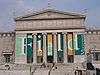 Field Museum of Natural History |
September 5, 1975 (#75000647) |
1400 S. Lake Shore Drive 41°51′59″N 87°37′01″W |
Near South Side | |
| 41 | Marshall Field Garden Apartments |  Marshall Field Garden Apartments |
December 17, 1991 (#91001691) |
1336-1452 N. Sedgwick Street, 1337-1453 N. Hudson Avenue, 400-424 W. Evergreen Street and 401-425 W. Blackhawk Street 41°54′29″N 87°38′20″W |
Near North Side | |
| 42 | Fisher Building |  Fisher Building |
March 16, 1976 (#76000691) |
343 S. Dearborn Street 41°52′37″N 87°37′44″W |
Chicago Loop | |
| 43 | Fort Dearborn Hotel |  Fort Dearborn Hotel |
November 12, 1982 (#82000390) |
401 S. LaSalle Street 41°52′36″N 87°37′52″W |
Chicago Loop | |
| 44 | Fourth Presbyterian Church of Chicago |  Fourth Presbyterian Church of Chicago |
September 5, 1975 (#75000648) |
126 E. Chestnut Street 41°53′55″N 87°37′28″W |
Near North Side | |
| 45 | Gage Group-Ascher, Keith, and Gage Buildings | 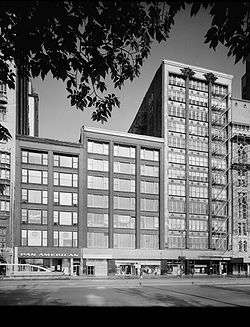 Gage Group-Ascher, Keith, and Gage Buildings |
November 14, 1985 (#85002840) |
18-30 S. Michigan Avenue 41°52′52″N 87°37′30″W |
Chicago Loop | |
| 46 | Germania Club |  Germania Club |
October 22, 1976 (#76000692) |
108 W. Germania Place 41°54′38″N 87°37′57″W |
Near North Side | |
| 47 | John J. Glessner House | 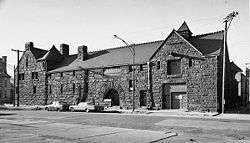 John J. Glessner House |
April 17, 1970 (#70000233) |
1800 S. Prairie Avenue 41°51′27″N 87°37′16″W |
Near South Side | |
| 48 | Gold Coast Historic District |  Gold Coast Historic District |
January 30, 1978 (#78001121) |
Roughly bounded by North Avenue, Lake Shore Drive, Clark and Oak Streets. 41°54′21″N 87°37′41″W |
Near North Side | |
| 49 | Grant Park |  Grant Park |
July 21, 1993 (#92001075) |
Roughly, from the Chicago River to E. McFetridge Drive at Lake Michigan 41°52′31″N 87°37′05″W |
Chicago Loop | |
| 50 | Raymond M. Hilliard Center Historic District |  Raymond M. Hilliard Center Historic District |
September 13, 1999 (#99001072) |
Jct. of W. Cermak Road and S. State Street 41°51′15″N 87°36′59″W |
Near South Side | |
| 51 | Holy Name Cathedral | 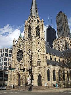 Holy Name Cathedral |
May 25, 2000 (#00000477) |
735 N. State Street 41°53′46″N 87°37′40″W |
Near North Side | |
| 52 | Hotel St. Benedict Flats |  Hotel St. Benedict Flats |
September 1, 1995 (#88003311) |
40, 42, 50 E. Chicago Avenue, 801 N. Wabash Avenue 41°53′49″N 87°37′35″W |
Near North Side | |
| 53 | IBM Building | 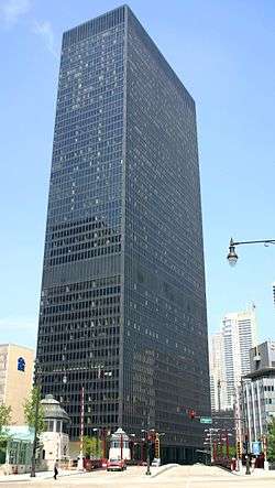 IBM Building |
March 11, 2010 (#09000166) |
330 N. Wabash Street 41°53′19″N 87°37′39″W |
Near North Side | |
| 54 | Inland Steel Building |  Inland Steel Building |
February 18, 2009 (#09000024) |
30 W. Monroe Street 41°52′51″N 87°37′44″W |
Chicago Loop | |
| 55 | Jewelers' Building | .jpg) Jewelers' Building |
August 7, 1974 (#74000752) |
15-19 S. Wabash Avenue 41°52′53″N 87°37′33″W |
Chicago Loop | |
| 56 | William W. Kimball House |  William W. Kimball House |
December 9, 1971 (#71000291) |
1801 S. Prairie Avenue 41°51′24″N 87°37′12″W |
Near South Side | |
| 57 | Lakeside Press Building |  Lakeside Press Building |
June 23, 1976 (#76000694) |
731 S. Plymouth Court 41°52′21″N 87°37′42″W |
Chicago Loop | |
| 58 | Bryan Lathrop House | _-_correct_version.jpg) Bryan Lathrop House |
February 15, 1974 (#74000753) |
120 E. Bellevue Place 41°54′06″N 87°37′31″W |
Near North Side | |
| 59 | Victor F. Lawson House YMCA |  Victor F. Lawson House YMCA |
May 8, 2017 (#100000959) |
30 W. Chicago Avenue 41°53′48″N 87°37′46″W |
Near North Side | |
| 60 | Leiter II Building |  Leiter II Building |
January 7, 1976 (#76000695) |
401 S. State Street 41°52′35″N 87°37′39″W |
Chicago Loop | |
| 61 | Loop Retail Historic District |  Loop Retail Historic District |
November 27, 1998 (#98001351) |
Roughly bounded by Lake Street, Wabash Avenue, Congress Parkway, and State Street 41°52′52″N 87°37′37″W |
Chicago Loop | |
| 62 | Ludington Building |  Ludington Building |
May 8, 1980 (#80001347) |
1104 S. Wabash Avenue 41°52′08″N 87°37′35″W |
Chicago Loop | |
| 63 | Lumber Exchange Building and Tower Addition |  Lumber Exchange Building and Tower Addition |
December 6, 2007 (#07001238) |
11 S. LaSalle Street 41°52′54″N 87°37′55″W |
Chicago Loop | |
| 64 | Albert F. Madlener House | .jpg) Albert F. Madlener House |
October 15, 1970 (#70000234) |
4 W. Burton Street 41°54′35″N 87°37′45″W |
Near North Side | |
| 65 | Manhattan Building | 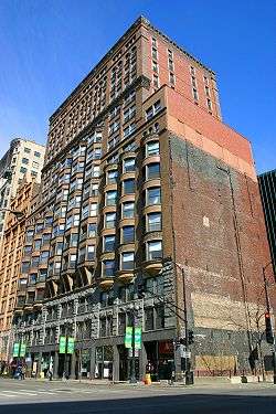 Manhattan Building |
March 16, 1976 (#76000697) |
431 S. Dearborn Street 41°52′34″N 87°37′45″W |
Chicago Loop | |
| 66 | Marquette Building |  Marquette Building |
August 17, 1973 (#73000697) |
140 S. Dearborn Street 41°52′48″N 87°37′46″W |
Chicago Loop | |
| 67 | Marshall Hotel |  Marshall Hotel |
November 27, 2017 (#100001833) |
1232 N. LaSalle Street 41°54′17″N 87°37′59″W |
Near North Side | |
| 68 | Marshall Field Company Store |  Marshall Field Company Store |
June 2, 1978 (#78001123) |
111 N. State Street 41°53′01″N 87°37′37″W |
Chicago Loop | |
| 69 | Maxwell-Briscoe Automobile Company Showroom | 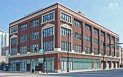 Maxwell-Briscoe Automobile Company Showroom |
November 18, 2002 (#02001349) |
1737 S. Michigan Avenue 41°51′36″N 87°37′25″W |
Near South Side | |
| 70 | Isaac N. Maynard Rowhouses | 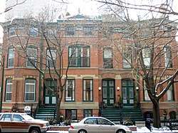 Isaac N. Maynard Rowhouses |
February 25, 2004 (#04000077) |
119,121,123 W. Delaware Place 41°54′04″N 87°37′57″W |
Near North Side | |
| 71 | McClurg Building |  McClurg Building |
August 17, 1970 (#70000235) |
218 S. Wabash Avenue 41°52′44″N 87°37′34″W |
Chicago Loop | |
| 72 | Michigan-Wacker Historic District | 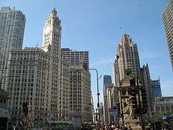 Michigan-Wacker Historic District |
November 15, 1978 (#78001124) |
Michigan Avenue and Wacker Drive and environs 41°53′19″N 87°37′29″W |
Chicago Loop | |
| 73 | Monadnock Block |  Monadnock Block |
November 20, 1970 (#70000236) |
53 W. Jackson Boulevard 41°52′41″N 87°37′46″W |
Chicago Loop | |
| 74 | Montgomery Ward Company Complex | 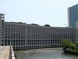 Montgomery Ward Company Complex |
June 2, 1978 (#78001125) |
619 W. Chicago Avenue 41°53′50″N 87°38′37″W |
Near North Side | |
| 75 | Motor Row Historic District | 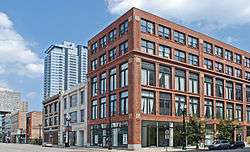 Motor Row Historic District |
November 18, 2002 (#02001387) |
Roughly bounded by E. Cermak Road, S. Indiana Avenue, E. 24th Place, and S. Wabash Avenue 41°51′10″N 87°37′26″W |
Near South Side | |
| 76 | Municipal Courts Building |  Municipal Courts Building |
August 29, 1985 (#85001912) |
116 S. Michigan Avenue 41°52′48″N 87°37′28″W |
Chicago Loop | |
| 77 | Municipal Pier |  Municipal Pier |
September 13, 1979 (#79000825) |
200 N. Streeter Drive 41°53′29″N 87°35′59″W |
Near North Side | |
| 78 | The Neuville |  The Neuville |
January 2, 2013 (#12001113) |
232 E. Walton Place 41°54′01″N 87°37′14″W |
Near North Side | |
| 79 | New Masonic Building and Oriental Theater |  New Masonic Building and Oriental Theater |
September 26, 1978 (#78003401) |
20 W. Randolph Street 41°53′04″N 87°37′41″W |
Chicago Loop | |
| 80 | Samuel Nickerson House | .jpg) Samuel Nickerson House |
November 7, 1976 (#76000700) |
40 E. Erie Street 41°53′38″N 87°37′36″W |
Near North Side | |
| 81 | North Wells Street Historic District | 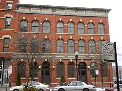 North Wells Street Historic District |
May 3, 1984 (#84001021) |
1240-1260 N. Wells Street 41°54′20″N 87°38′05″W |
Near North Side | |
| 82 | Old Chicago Historical Society Building | .jpg) Old Chicago Historical Society Building |
November 28, 1978 (#78001126) |
632 N. Dearborn Street 41°53′37″N 87°37′48″W |
Near North Side | |
| 83 | Old Colony Buildings | 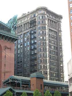 Old Colony Buildings |
January 2, 1976 (#76000701) |
407 S. Dearborn Street 41°52′34″N 87°37′45″W |
Chicago Loop | |
| 84 | Oliver Building |  Oliver Building |
December 8, 1983 (#83003563) |
159 N. Dearborn Street 41°53′06″N 87°37′45″W |
Chicago Loop | |
| 85 | One LaSalle Street Building |  One LaSalle Street Building |
November 22, 1999 (#99001378) |
1 N. LaSalle Street 41°52′55″N 87°37′56″W |
Chicago Loop | |
| 86 | Orchestra Hall | 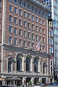 Orchestra Hall |
March 21, 1978 (#78001127) |
220 S. Michigan Avenue 41°52′43″N 87°37′29″W |
Chicago Loop | |
| 87 | Page Brothers Building | 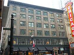 Page Brothers Building |
June 5, 1975 (#75000649) |
177-91 N. State Street 41°53′08″N 87°37′39″W |
Chicago Loop | |
| 88 | Palmolive Building |  Palmolive Building |
August 21, 2003 (#03000784) |
919 N. Michigan Avenue 41°53′59″N 87°37′26″W |
Near North Side | |
| 89 | Peck and Hills Furniture Company Warehouse |  Peck and Hills Furniture Company Warehouse |
May 18, 2015 (#15000225) |
909 W. Bliss Street 41°54′04″N 87°39′04″W |
Near North Side | |
| 90 | Peoples Gas Building |  Peoples Gas Building |
November 13, 1984 (#84000293) |
122 S. Michigan Avenue 41°52′47″N 87°37′29″W |
Chicago Loop | |
| 91 | Pontiac Building | 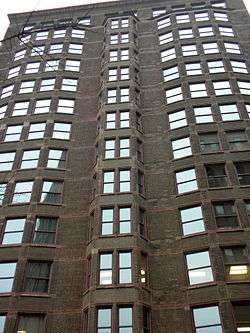 Pontiac Building |
March 16, 1976 (#76000702) |
542 S. Dearborn Street 41°52′29″N 87°37′44″W |
Chicago Loop | |
| 92 | Prairie Avenue District | Prairie Avenue District |
November 15, 1972 (#72000452) |
S. Prairie Avenue on either side of E. 18th Street, about 1 block in 41°51′26″N 87°37′19″W |
Near South Side | |
| 93 | Quigley Preparatory Seminary |  Quigley Preparatory Seminary |
February 16, 1996 (#96000093) |
103 E. Chestnut Street 41°53′52″N 87°37′33″W |
Near North Side | |
| 94 | Quinn Chapel of the A.M.E. Church | .gif) Quinn Chapel of the A.M.E. Church |
September 4, 1979 (#79000827) |
2401 S. Wabash Avenue 41°50′56″N 87°37′30″W |
Near South Side | |
| 95 | Railway Exchange Building | _Building.jpg) Railway Exchange Building |
June 3, 1982 (#82002530) |
80 E. Jackson Boulevard and 224 S. Michigan Avenue 41°52′42″N 87°37′28″W |
Chicago Loop | |
| 96 | Harriet F. Rees House | 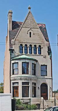 Harriet F. Rees House |
May 22, 2007 (#07000458) |
2017 S. Prairie Avenue 41°51′14″N 87°37′15″W |
Near South Side | Moved from 2110 S. Prairie Avenue in 2014 |
| 97 | Reid House |  Reid House |
August 21, 2003 (#03000783) |
2013 S. Prairie Avenue 41°51′19″N 87°37′12″W |
Near South Side | |
| 98 | Reid Murdoch Building |  Reid Murdoch Building |
August 28, 1975 (#75000650) |
325 N. LaSalle Street 41°53′17″N 87°37′54″W |
Near North Side | |
| 99 | Reliance Building | .jpg) Reliance Building |
October 15, 1970 (#70000237) |
32 N. State Street 41°52′58″N 87°37′42″W |
Chicago Loop | |
| 100 | Rookery Building | 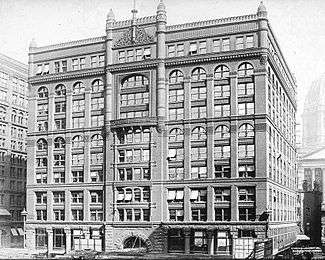 Rookery Building |
April 17, 1970 (#70000238) |
209 S. LaSalle Street 41°52′45″N 87°37′56″W |
Chicago Loop | |
| 101 | A. M. Rothschild & Company Store | 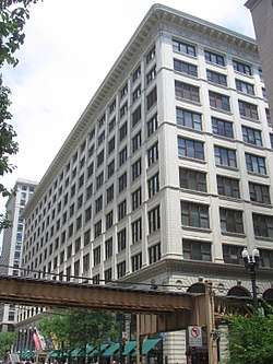 A. M. Rothschild & Company Store |
November 27, 1989 (#89002025) |
333 S. State Street 41°52′39″N 87°37′38″W |
Chicago Loop | |
| 102 | St. Luke's Hospital Complex |  St. Luke's Hospital Complex |
November 24, 1982 (#82000392) |
1435 S. Michigan Avenue, 1400 Block S. Indiana Avenue 41°51′47″N 87°37′23″W |
Near South Side | |
| 103 | Second Presbyterian Church |  Second Presbyterian Church |
December 27, 1974 (#74000754) |
1936 S. Michigan Avenue 41°51′21″N 87°37′28″W |
Near South Side | |
| 104 | John G. Shedd Aquarium |  John G. Shedd Aquarium |
February 27, 1987 (#87000820) |
1200 S. Lake Shore Drive 41°52′04″N 87°36′50″W |
Near South Side | |
| 105 | Silversmith Building | 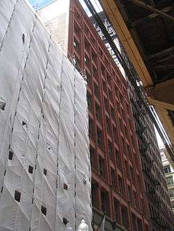 Silversmith Building |
May 16, 1997 (#97000435) |
10 S. Wabash Avenue 41°52′52″N 87°37′35″W |
Chicago Loop | |
| 106 | Singer Building | 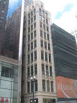 Singer Building |
February 10, 1983 (#83000314) |
120 S. State Street 41°52′48″N 87°37′41″W |
Chicago Loop | |
| 107 | Somerset Hotel |  Somerset Hotel |
March 3, 2000 (#00000153) |
1152-1154 S. Wabash Avenue 41°52′04″N 87°37′34″W |
Chicago Loop | |
| 108 | South Dearborn Street-Printing House Row Historic District |  South Dearborn Street-Printing House Row Historic District |
January 7, 1976 (#76000705) |
343, 407, 431 S. Dearborn Street and 53 W. Jackson Boulevard 41°52′42″N 87°37′41″W |
Chicago Loop | |
| 109 | South Loop Printing House District |  South Loop Printing House District |
March 2, 1978 (#78001130) |
Roughly bounded by W. Taylor Street, W. Polk Street, S. Wells Street, W. Congress Parkway and S. State Street 41°52′26″N 87°37′51″W |
Chicago Loop | |
| 110 | The Steuben Club |  The Steuben Club |
May 22, 2007 (#07000457) |
188 W. Randolph Street 41°53′04″N 87°38′01″W |
Chicago Loop | |
| 111 | Studebaker Building |  Studebaker Building |
August 11, 1975 (#75000653) |
410-418 S. Michigan Avenue 41°52′34″N 87°37′29″W |
Chicago Loop | |
| 112 | Swedish Club of Chicago |  Swedish Club of Chicago |
December 2, 1985 (#85003031) |
1258 N. LaSalle Street 41°54′20″N 87°38′00″W |
Near North Side | |
| 113 | Tree Studio Building and Annexes |  Tree Studio Building and Annexes |
December 16, 1974 (#74000756) |
4 E. Ohio Street 41°53′34″N 87°37′40″W |
Near North Side | |
| 114 | Trustees System Service Building |  Trustees System Service Building |
September 3, 1998 (#98001132) |
201 N. Wells Street 41°53′10″N 87°38′01″W |
Chicago Loop | |
| 115 | Mark Twain Hotel |  Mark Twain Hotel |
May 8, 2017 (#100000961) |
111 W. Division Street 41°54′14″N 87°37′55″W |
Near North Side | |
| 116 | Vesta Accumulator Company Building |  Vesta Accumulator Company Building |
January 2, 2013 (#12001115) |
2100 S. Indiana Avenue 41°51′15″N 87°37′22″W |
Near South Side | |
| 117 | William Waller House |  William Waller House |
November 21, 1980 (#80001346) |
1012 N. Dearborn Street 41°54′03″N 87°37′49″W |
Near North Side | |
| 118 | Washington Square | 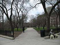 Washington Square |
May 20, 1991 (#91000566) |
901 N. Clark Street 41°53′58″N 87°37′50″W |
Near North Side | |
| 119 | Washington Square Historic District | 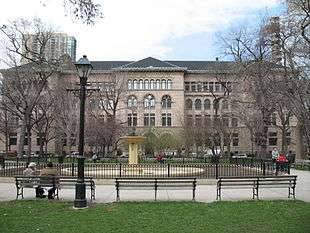 Washington Square Historic District |
August 21, 2003 (#03000786) |
Washington Square, N. Dearborn Street, from W. Walton Street to W. Chicago Avenue 41°53′56″N 87°37′49″W |
Near North Side | |
| 120 | West Burton Place Historic District |  West Burton Place Historic District |
December 6, 2007 (#07001239) |
143-161 W Burton Place 41°54′32″N 87°38′02″W |
Near North Side | |
| 121 | West Loop–LaSalle Street Historic District |  West Loop–LaSalle Street Historic District |
June 1, 2013 (#12001238) |
Roughly bounded by W. Wacker Drive N. & S. Wells Street, W. Van Buren Street and N. & S. Clark Street; 330 S. Wells & 212 W. Van Buren Sts. 41°52′50″N 87°37′56″W |
Chicago Loop | Second set of addresses represents a boundary increase on 2017-07-24 |
| 122 | Wheeler-Kohn House |  Wheeler-Kohn House |
August 12, 1999 (#99000975) |
2018 S. Calumet Avenue 41°51′18″N 87°37′10″W |
Near South Side | |
| 123 | Wooden Alley | 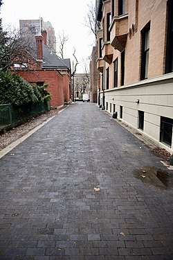 Wooden Alley |
May 22, 2002 (#02000543) |
1535 N between N. Astor Street and N. State Street 41°54′37″N 87°37′42″W |
Near North Side | |
| 124 | YMCA Hotel | 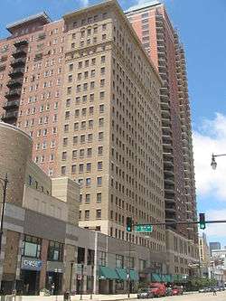 YMCA Hotel |
August 30, 1989 (#89001202) |
820-828 S. Wabash Avenue 41°52′17″N 87°37′34″W |
Chicago Loop |
Former listing
| [5] | Name on the Register | Image | Date listed | Date removed | Location | Summary |
|---|---|---|---|---|---|---|
| 1 | Chicago Stock Exchange Building |  Chicago Stock Exchange Building |
1970 (#70000911) | December 7, 1971 | 30 N. LaSalle St. |
Demolished in 1972.[8] |
| 2 | Grand Central Passenger Station | 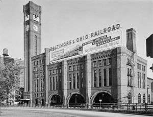 Grand Central Passenger Station |
Unknown (#71001084) | 1971 | S. Wells and Harrison |
Demolished in 1971. |
| 3 | Leiter I Building | Leiter I Building |
Unknown (#70000910) | 1972 | 200--208 W. Monroe St. |
Demolished in 1972 |
| 4 | McCarthy Building | June 16, 1976 (#76000698) | December 8, 1995 | Washington and Dearborn Sts. |
Demolished | |
| 5 | New Michigan Hotel | .tif.jpg) New Michigan Hotel |
Unavailable (#83003562) | March 14, 2002 | 2135 S. Michigan Avenue |
Originally the Lexington Hotel; the building was demolished in 1996.[9] |
| 6 | Soldier Field |  Soldier Field |
August 9, 1984 (#84001052) | February 17, 2006 | 425 E. 14th Street 41°51′45″N 87°36′59″W |
Near South Side. Designation removed due to extensive renovations. |
| 7 | Unity Building | 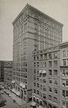 Unity Building |
September 6, 1979 (#79000829) | December 8, 1995 | 127 N. Dearborn St. |
Demolished in 1989 |
| 8 | Western Methodist Book Concern Building | September 11, 1975 (#75000654) | December 8, 1995 | 12 W. Washington St. |
See also
- List of Chicago Landmarks (the historic places listed as Chicago Landmarks are protected by city ordinance)
- National Register of Historic Places listings in Cook County, Illinois
- List of National Historic Landmarks in Illinois
References
- The retailing sites are: Montgomery Ward Company Complex, Marshall Field Company Store, and Carson, Pirie, Scott and Company Building
- Hotels: 6 sites have "hotel" in their name.
- The four NRHP sites that are theaters are: the Auditorium Building, Balaban and Katz Chicago Theatre, the New Masonic Building and Oriental Theater and Orchestra Hall,
- "National Register of Historic Places: Weekly List Actions". National Park Service, United States Department of the Interior. Retrieved on August 14, 2020.
- Numbers represent an ordering by significant words. Various colorings, defined here, differentiate National Historic Landmarks and historic districts from other NRHP buildings, structures, sites or objects.
- "National Register Information System". National Register of Historic Places. National Park Service. April 24, 2008.
- The eight-digit number below each date is the number assigned to each location in the National Register Information System database, which can be viewed by clicking the number.
- 36 FR 23258
- "The Lexington Hotel". Buildings. The South Loop Historical Society. Archived from the original on 11 December 2011. Retrieved 15 September 2012.
External links
| Wikimedia Commons has media related to National Register of Historic Places in Chicago. |
- Chicago Listing on the National Register of Historic Places, August 5, 2011, City of Chicago, Rahm Emanuel, Mayor.
- NPS Focus database, National Park Service.
| By topic | |
|---|---|
| |
| Topics | |
|---|---|
| Lists by state |
|
| Lists by insular areas | |
| Lists by associated state | |
| Other areas | |
| Related | |
| |