National Parks of Ukraine
National nature parks of Ukraine are preservation territories that are part of the Nature-Preservation Fund of Ukraine. The total area protected by national parks is approximately 1,111,600 hectares (11,116 km2), for an average of 22,685 hectares (226.85 km2) but a median of only 14,836 hectares (148.36 km2) at Zalissya. The largest national park is Upper Pobozhia in Khmelnytskyi Oblast: at over 100,000 hectares (1,000 km2). The smallest park is Derman-Ostroh National Nature Park, at less than 5,500 hectares (55 km2).
This category of the Nature-Preservation Fund was mainly established after the fall of the Soviet Union. There were very few parks in Ukraine and most of them were in the West.
List
| # | Name | Photo | Location | Official website (Ukrainian) | Area (ha) | Year | Description |
|---|---|---|---|---|---|---|---|
| 1 | Azov-Syvash | 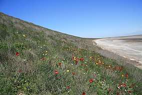 |
Kherson Oblast 46.102°N 34.385°E |
Азово-Сиваський | 52154 | 1993 | Located on Byriuchyi Island in the northwestern Azov Sea. The park was created to protect the unique coastal environment of the northwestern Azov. It is particularly important as a stop on the flyway for migratory birds, with over a million birds visiting each year.[1] |
| 2 | Buzk's Gard | 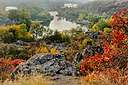 |
Mykolaiv Oblast 48.040°N 30.947°E |
Бузький Гард | 6138 | 2009 | Covers an area along the Southern Bug River in south-central Ukraine. At this point, the Southern Bug River cuts through the southern edge of the Ukrainian Shield (a block of Archean basement rock).[2] |
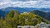
| 3 | Carpathian | 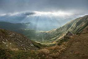 |
Ivano-Frankivsk Oblast 48.300°N 24.584°E |
Карпатський | 50303 | 1980 | Carpathian National Nature Park is the first national park of Ukraine and one of the biggest national parks of this country.[3] |
| 4 | Charming Harbor | 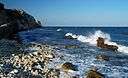 |
Crimea 45.500°N 32.700°E |
Чарівна гавань | 6270 | 2009 | Covers a coastal sector of the Tarkhankut Peninsula (itself a part of the Crimean peninsula) on the Black Sea. The park protects and exhibits steppe landscape as it descends to the seacoast in a semi-arid environment and with dramatic cliffs and rock formations.[4] |
| 5 | Cheremosh | 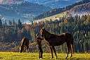 |
Chernivtsi Oblast 47.995°N 25.096°E |
Черемоський | 7118 | 2009 | A collection of three reserves in the northeastern section of the Carpathian Mountains, located in southwestern Ukraine. The park highlights the highly varied geology of the northeastern Carpathians, as well as the deep spruce forests of the region.[5] |
| 6 | Derman-Ostroh | 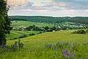 |
Rivne Oblast 50.329°N 26.520°E |
Дермансько-Острозький | 1648 | 2009 | Sits in a river valley that separates the southern edge of the Polesian Lowland, and the northern edge of the Podolian Upland in northwestern Ukraine. The terrain is a mixture of pine-oak forest and marshy river lowlands.[6] |
| 7 | Desna-Starogutsky | 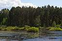 |
Sumy Oblast 52.166°N 33.417°E |
Деснянсько-Старогутський | 16215 | 1999 | Covers a middle section of the Desna River in northeastern Ukraine, representing the variety of wetland and mixed forest landscapes of the eastern Polesia region. The park contains two sections, one on the floodplains of the Desna, the other in the southern region of the Bryansk forest on the Russian border.[7] |
| 8 | Dniester Canyon | 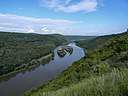 |
Ternopil Oblast 48.650°N 25.735°E |
Дністровський каньйон | 10830 | 2010 | Follows Dniester Canyon, the largest canyon in Ukraine, along the middle course of the Dniester River. It protects a relatively undeveloped portion of the Ukrainian forest-steppe landscape, about 75 km east of the Carpathian Mountains in western Ukraine. The canyon is known for its varied geological formations, including two of the longest caves in the world.[8] |
| 9 | Dvorichanskyi | 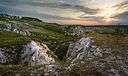 |
Kharkiv Oblast 49.852°N 37.733°E |
Дворічанський | 3132 | 2009 | Set on the border of the steppe and forest-steppe on the banks of the river Oskil, the south-east part of Ukraine.[9] |
| 10 | Dzharylhak |  |
Kherson Oblast 46.017°N 32.933°E |
Джарилгацький | 10000 | 2009 | Covers Dzharylhach Island and the adjacent Karkinit Bay in the northern reaches of the Black Sea. Famous for clean sandy beaches and mineral springs in its many small lakes, Dzharylhach is the largest island in the Black Sea. Portions of the park have been protected nature reserves for almost 100 years.[10] |
| 11 | Great Meadow |  |
Zaporizhia Oblast 47.382°N 34.987°E |
Великий Луг | 16756 | 2006 | Covers historic steppe terrain in southeast Ukraine. It is on the south bank of the Dnieper River's Kakhovka Reservoir, which was created by the Dnieper Hydroelectric Station. The meadows and reed beds on the shore support one of the largest transmigration spots for birds in Eastern Europe.[11] |
| 12 | Halych |  |
Ivano-Frankivsk Oblast 49.139°N 24.732°E |
Галицький | 14685 | 2004 | Highlights forest, steppe, meadow and wetlands of the borderlands between the Ukrainian Carpathians and the southwestern part of the East European Plain.[12] |
| 13 | Hetman |  |
Sumy Oblast 50.487°N 34.983°E |
Гетьманський | 23360 | 2009 | The park begins at the border with Russia as the Vorskla River runs west and south, and follows the river for all 122 km of its length through Sumy Oblast. There are some short breaks between sectors for roads or built-up villages. There terrain is mostly flat, with some hills and ravines.[13] |
| 14 | Holosiivskyi |  |
Kiev 50.450°N 30.524°E |
Голосі́ївський | 4525 | 2007 | A protected remnant of forest surrounded by the urban area of the city of Kiev, Ukraine. It is located on the Kiev hills, in the Dniester-Dnieper forest-steppe province, North-Dnieper lowland and steppe zone of Left-Bank Dnieper province. |
| 15 | Holy Mountains |  |
Donetsk Oblast 48.917°N 37.783°E |
Святі Гори | 40609 | 1997 | Located along the chalk cliffs and river terraces of the Donets River in Eastern Ukraine. The park's boundaries are a patchwork of forested areas stretching along the banks of the Donets. The Holy Mountains of Ukraine contain many archaeological, natural, historical, and recreational sites.[14] |
| 16 | Homolsh Woods |  |
Kharkiv Oblast 49.583°N 36.333°E |
Гомільша́нські ліси | 14315 | 2004 | Covers established forests in the Donets River valley. The site has been a protected area for a very long time, beginning with Peter the Great designating local territory as a 'protected ship grove' for wood to build ships. The site also has high ecological value as forest-steppe land.[15] |
| 17 | Hutsulshchyna | 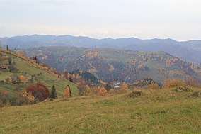 |
Ivano-Frankivsk Oblast 48.321°N 25.093°E |
Гуцульщина | 32271 | 2002 | Located in the Western Ukraine's Carpathian Mountains. |
| 18 | Ichnya | 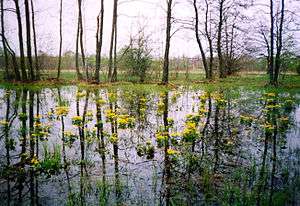 |
Chernihiv Oblast 50.809°N 32.292°E |
Ічнянський | 9666 | 2004 | Covers forest-steppe terrain in the Uday River basin, about 120 km northeast of Kiev.[16] |
| 19 | Ivory Coast | 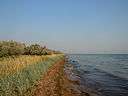 |
Mykolaiv Oblast 46.533°N 31.567°E |
Білобережжя Святослава | 35223 | 2009 | 'White beaches Svyatosloav') is situated on the north coast of the Black Sea is southern Ukraine. It covers portions of Dnieper–Bug estuary, the Kinburn Peninsula just south of the estuary, and Yahorlyk Bay a shallow bay of the Black Sea itself. Adjacent to the site along the coast is the Black Sea Biosphere Reserve.[17] |
| 20 | Karmelyukove Podillya |  |
Vinnytsia oblast 48.399°N 29.260°E |
Кармелюкове Поділля | 16518 | 2009 | Located in southwest Ukraine on the forested southern slopes of the Ukrainian Shield.[18] |
| 21 | Khotyn | 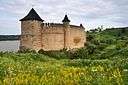 |
Chernivtsi Oblast 48.500°N 26.167°E |
Хотинський | 9400 | 2010 | Covers a segment of the Dniester River Canyon and the Dniester River Reservoir. It is located in the west of the country on the border with Romania. The famous Khotyn Fortress is located within the territory.[19] |
| 22 | Kremenets | 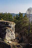 |
Ternopil Oblast 50.051°N 25.619°E |
Кременецькі гори | 6951 | 2009 | A cluster of mountains and ridges in the Hologoro-Kremenetskiy range of the Podolian Upland in west central Ukraine.[20] |
| 23 | Lower Dniester | 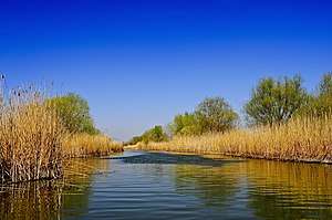 |
Odessa Oblast 46.412°N 30.210°E |
Нижньодністровський | 21311 | 2008 | A large portion of the Dniester River Estuary where it enters the Black Sea in southwestern Ukraine. The floodplains and waterways are important to nesting and wintering waterfowl. They are also important for spawning fish: over 70 species of fish in 20 groups are recorded in the park.[21] |
| 24 | Lower Polissia | 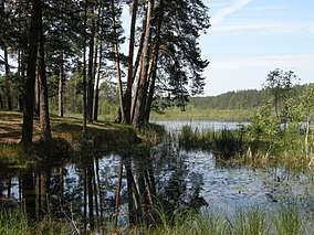 |
Khmelnytskyi Oblast 50.218°N 26.837°E |
Мале Полісся | 9515 | 2013 | A section of the Polissia region, the park includes several lakes and wetland areas as well as parts of river valleys Gorin, Vilia, Gnylyi Rih.[22] |
| 25 | Lower Sula |  |
Poltava Oblast 49.608°N 33.191°E |
Нижньосульський | 16879 | 2010 | Covers the lower reaches of the Sula River as it enters the Kremenchuk Reservoir, 120 km southeast of Kiev. The extensive marshes, swamps, and other wetlands of the area are important habitats for fish, waterfowl, and floodplain plants.[23] |
| 26 | Meotida |  |
Donetsk Oblast 47.115°N 38.080°E |
Меотида | 20720 | 2009 | A stretch of coastline, and interior estuaries and coastal lands, on the northern edge of the Sea of Azov in Ukraine. The administration of the park itself has been disrupted by hostilities in the area. Previously, the protected regions of the park supported important populations of migratory waterfowl and over 100 species of nesting birds. |
| 27 | Mezynsky |  |
Chernihiv Oblast 51.719°N 32.287°E |
Мезинський | 31035 | 2006 | Forest and floodplain terraces of the Desna River in the northern part of the country. The park was created to balance the protection of sensitive ecological and archaeological sites, recreation, and rural agriculture.[24] |
| 28 | Northern Podillya |  |
Lviv Oblast 49.917°N 25.100°E |
Північне Поділля | 15588 | 2010 | Covers a variety of individual protected sites in the northwest Podolian Upland of Ukraine. The park provides protection to, and recreation in, representative ecological and cultural sites of the area, including Hornbean-Beech forested uplands, swamp-marsh floodplains, geologically significant karst features, and historical sites that include three castles and a number of WW1 and WW2 sites.[25] |
| 29 | Podilski Tovtry | 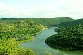 |
Khmelnytskyi Oblast 46.581°N 32.535°E |
Поді́льські То́втри | 80178 | 2015 | Representative of the natural landscape of the Podillia region.[26] |
| 30 | Oleshky | 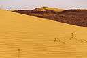 |
Kherson Oblast 46.550°N 32.923°E |
Олешківські піски | 8020 | 2010 | |
| 31 | Pryazovskyi | 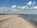 |
Zaporizhia Oblast 46.840°N 35.359°E |
Приазовський | 78127 | 2010 | The second largest national park of Ukraine, covering the estuaries, coastal plains seaside landforms around the Molochna River estuary the Utlyuksky estuary, on the northwest coast of the Sea of Azov.[27] |
| 32 | Prypiat-Stokhid | 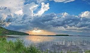 |
Volyn Oblast 51.828°N 25.283°E |
Прип'ять-Стохід | 39316 | 2007 | Created in 2007 to protect and unify a series of natural complexes of the Pripyat River and Stokhid River valleys in northwestern Ukraine. The park provides protection, research areas, and recreation related to the meadows and wetlands of the Polissia region.[28] |
| 33 | Pyryatyn |  |
Poltava Oblast 50.236°N 32.501°E |
Пирятинський | 12028 | 2009 | Covers a portion of the Uday River valley in the north central part of the country. It provides nature conservation and recreation on the terraces and floodplains of the river.[29] |
| 34 | Shatsky |  |
Volyn Oblast 51.517°N 23.820°E |
Шацький | 32515 | 1983 | Established in 1983 to preserve, reconstitute and to use effectively Volyn Polissia natural complexes and objects of special environmental, recreational, educational and aesthetic value. |
| 36 | Skole Beskids |  |
Lviv Oblast 49.200°N 23.210°E |
Сколівські Бескиди | 35684 | 1999 | Covers the Skole Beskids Range of the Carpathian Mountains on the western edge of Ukraine. It was created in 1999 to protect the beech and beech-fir forests of Carpathians, and to provide for environmental, ecological, aesthetic, educational and recreational uses.[30] |
| 37 | Sloboda |  |
Kharkiv Oblast 50.086°N 35.216°E |
Слобожанський | 5244 | 2009 | Covers a forest-steppe region at the confluence of the Merla and Merchik Rivers in the East Poltava Highlands of eastern Ukraine. The park features an extensive complex of marshes, swamps, and other wetlands.[31] |
| 38 | Synevir | 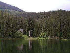 |
Zakarpattia Oblast,br/>48.500°N 23.700°E | Синевир | 40400 | 1989 | Located in Zakarpattia Oblast, in southwest of the country.[32] |
| 39 | Synyohora | 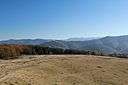 |
Ivano-Frankivsk Oblast 48.621°N 24.221°E |
Синьогора | 10866 | 2009 | transition to full National Park status was uncertain as of 2017, with portions of the park are closed to the public.[33] |
| 40 | Tsumanska Puscha |  |
Volyn Oblast 50.888°N 25.853°E |
ЦУМАНСЬКА ПУЩА | 33475 | 2010 | |
| 41 | Tuzly Lagoons | 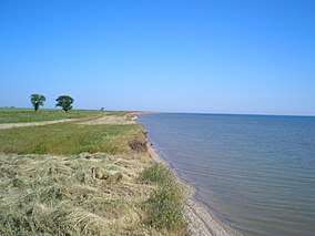 |
Odessa Oblast 45.783°N 30.000°E |
Тузловські лимани | 10866 | 2009 | Includes the group of Tuzly Lagoons: which consist of parts of the larger lagoons Shahany, Alibey, Burnas; and the small lagoons Solone Ozero, Khadzhyder, Karachaus, Budury, Martaza, Mahala, Malyi Sasyk, and Dzhantshey.[34] |
| 42 | Upper Pobozhia | 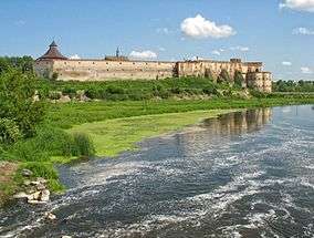 |
Khmelnitsky Oblast 49.436°N 27.419°E |
Верхнє Побужжя | 108000 | 2013 | |
| 43 | Uzhanian | 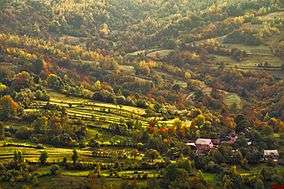 |
Zakarpattia Oblast 49.023°N 22.600°E |
Ужанський | 39159 | 1999 | Also part of the East Carpathian Biosphere Reserve. The park was created to protect pristine beech forest of the Carpathians. |
| 44 | Verkhovyna | 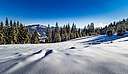 |
Ivano-Frankivsk Oblast 48.161°N 24.945°E |
Верховинський | 12023 | 2010 | Covers the highest reaches of the Cheremosh River, in the Carpathian Mountains.[35] |
| 45 | Vyzhnytsia | 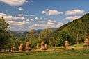 |
Chernivtsi Oblast 48.157°N 25.306°E |
Вижницький | 7928 | 1995 | Located in the Ukrainian Carpathians, Vyzhnytsia Park represents a lowland part of the Carpathians with a fairly mild climate. The area is forested in beech and fir trees. |
| 46 | White Lake |  |
Kiev Oblast 49.896°N 31.578°E |
Білоозерський (No site) |
7014 | 2009 | As of 2014, the park appeared to be closed to the public and the legal status unclear.[36] |
| 47 | Yavorivskyi |  |
Lviv Oblast 49.983°N 23.616°E |
Яворівський | 7079 | 1998 | A narrow range of hills 75 km (47 mi) long, which rises sharply to the north of the Lesser Polissya. |
| 48 | Zacharovany Krai |  |
Zakarpattia Oblast 48.353°N 23.074°E |
Зачарований край | 6101 | 2009 | |
| 49 | Zalissya |  |
Kiev Oblast 50.667°N 30.850°E |
Залісся | 14836 | 2009 | Covers a large forest on the left bank of the Desna River about 20 km northeast of Kiev. As of 2017, the area is open for limited public access, but is primarily administered as a protected area for the "reception and stay of senior officials", other state uses, and the protection of plant and animal life.[37] |
See also
- Lists of Nature Reserves of Ukraine
- Nature park
- Categories of protected areas of Ukraine
References
- "Azov-Syvash NNP" (in Ukrainian). State Management of Affairs (Ukraine). Retrieved August 27, 2019.
- "Buzk's Gard" (in Ukrainian). Ministry of Ecology and Natural Resources (Ukraine). Retrieved August 27, 2019.
- "Carpathian". Ministry of Ecology and Natural Resources (Ukraine). Retrieved August 27, 2019.
- "Tarkhanhut National Park (Russian Official Site)" (in Russian). Tarkhanhut Park. Retrieved February 27, 2019.
- "Cheremosh National Nature Park" (in Ukrainian). Official Park Website. Retrieved September 24, 2018.
- "Derman-Ostroh National Nature Park" (in Ukrainian). Official Park Site. Retrieved January 10, 2019.
- "Desna-Starogutsky National Nature Park" (in Ukrainian). Park Site. Retrieved September 22, 2018.
- "Dniester Canyon National Nature Park". Park Site. Retrieved February 27, 2019.
- "Dvorichanskyi National Nature Park". Park Site. Archived from the original on October 16, 2013. Retrieved August 29, 2019.
- "Dzharylhak National Nature Park" (in Ukrainian). Official Park Site. Retrieved January 10, 2019.
- "National Nature Park Great Meadow" (in Ukrainian). Official Park Site. Retrieved January 10, 2019.
- "Halych National Nature Park" (in Ukrainian). Halych NNP (Official Site). Retrieved June 3, 2019.
- "Hetman National Nature Park" (in Ukrainian). Official Park Site. Retrieved January 10, 2019.
- "National Nature Park Holy Mountains" (in Ukrainian). Official Park Site. Retrieved January 10, 2019.
- "Homolsh Woods National Nature Park" (in Ukrainian). Official Park Site. Retrieved June 12, 2019.
- "Ichnya National Nature Park" (in Ukrainian). Official Park Site. Retrieved January 10, 2019.
- "National Nature Park Ivory Coast of Sviatoslav" (in Ukrainian). Official Park Site. Retrieved January 10, 2019.
- "Karmelyukove Podillya" (in Ukrainian). Official Park Website. Retrieved July 5, 2019.
- "Khotyn National Nature Park" (in Ukrainian). Official Park Site. Retrieved January 10, 2019.
- "Kremenets Mountains National Nature Park" (in Ukrainian). Official Park Website. Retrieved September 24, 2018.
- "Lower Dniester National Nature Park" (in Ukrainian). Official Park Site. Retrieved January 10, 2019.
- "Lower Polissia Dniester National Nature Park" (in Ukrainian). Official Park Site. Retrieved August 30, 2019.
- "Lower Sula National Nature Park" (in Ukrainian). Official Park Site. Retrieved June 16, 2019.
- "Mezynsky National Nature Park" (in Ukrainian). Official Park Site. Retrieved June 12, 2019.
- "Northern Podilia" (in Ukrainian). Official Park Site. Retrieved May 11, 2019.
- "Podilski Tovtry" (in Ukrainian). Official Park Site. Retrieved May 11, 2019.
- "Pryazovskyi" (in Ukrainian). Official Park Site. Retrieved May 11, 2019.
- "National Nature Park Prypiat-Stokhid" (in Ukrainian). Official Park Site. Retrieved January 10, 2019.
- "Pyryatyn National Nature Park" (in Ukrainian). Official Park Site. Retrieved June 9, 2019.
- "National Nature Park Skole Beskids" (in Ukrainian). Official Park Site. Retrieved January 10, 2019.
- "Sloboda National Nature Park" (in Ukrainian). Official Park Site. Retrieved June 16, 2019.
- "Synevir National Nature Park" (in Ukrainian). Official Park Site. Retrieved June 16, 2019.
- "Status report" (in Ukrainian). State Affairs release. Retrieved August 30, 2019.
- "Tuzli National Nature Park" (in Ukrainian). Official Park Site. Retrieved June 16, 2019.
- "Verkhovyna National Nature Park" (in Ukrainian). Official Park Site. Retrieved January 10, 2019.
- "Belozersky NNP: Treasures Lost" (in Ukrainian). DOP. Retrieved September 1, 2019.
- "National Nature Park Zalissya" (in Ukrainian). Official Park Site. Retrieved June 15, 2019.
External links
| Wikimedia Commons has media related to National parks of Ukraine. |
Ukraine articles | |||||||
|---|---|---|---|---|---|---|---|
| History |  | ||||||
| Geography | |||||||
| Politics |
| ||||||
| Economy | |||||||
| Society |
| ||||||
| |||||||
This article is issued from Wikipedia. The text is licensed under Creative Commons - Attribution - Sharealike. Additional terms may apply for the media files.