Naples (CDP), Maine
Naples is a census-designated place (CDP) in the town of Naples in Cumberland County, Maine, United States. The population of the CDP was 428 at the 2010 census.[1]
Naples, Maine | |
|---|---|
_highlighted.svg.png) Location in Cumberland County and the state of Maine. | |
| Coordinates: 43°58′17″N 70°36′37″W | |
| Country | United States |
| State | Maine |
| County | Cumberland |
| Town | Naples |
| Area | |
| • Total | 3.4 sq mi (8.7 km2) |
| • Land | 2.6 sq mi (6.7 km2) |
| • Water | 0.8 sq mi (2.0 km2) |
| Elevation | 300 ft (90 m) |
| Population (2010) | |
| • Total | 428 |
| • Density | 130/sq mi (49/km2) |
| Time zone | UTC-5 (Eastern (EST)) |
| • Summer (DST) | UTC-4 (EDT) |
| Area code(s) | 207 |
It is part of the Portland–South Portland–Biddeford, Maine Metropolitan Statistical Area.
Geography
Naples is located at 43°58′17″N 70°36′37″W, at the south end of Long Lake and north end of Brandy Pond. According to the United States Census Bureau, the Naples CDP has a total area of 3.4 square miles (8.7 km2), of which 2.6 square miles (6.7 km2) is land and 0.77 square miles (2.0 km2), or 22.72%, is water, consisting primarily of the north end of Brandy Pond.[2]
U.S. Route 302 passes through Naples, heading northwest to Bridgton and southeast to Windham and Portland. Maine State Route 11 intersects US 302, heading south to the western shore of Sebago Lake and northeast towards Poland and Mechanic Falls. Maine State Route 35 leaves US 302 in Naples and heads north to Harrison.
References
- "Profile of General Population and Housing Characteristics: 2010 Demographic Profile Data (DP-1): Naples CDP, Maine". United States Census Bureau. Retrieved June 14, 2012.
- "Geographic Identifiers: 2010 Demographic Profile Data (G001): Littlejohn Island CDP, Maine". United States Census Bureau. Retrieved June 14, 2012.
Municipalities and communities of Cumberland County, Maine, United States | ||
|---|---|---|
| Cities | 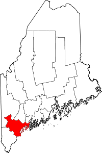 Cumberland County map | |
| Towns | ||
| CDPs | ||
| Other villages |
| |