Murghob District
Murghob District or Nohiya-i Murghob (Kyrgyz: Мургаб району, Tajik: Ноҳияи Мурғоб) is a district in Tajikistan, occupying the eastern two-thirds of the Gorno-Badakhshan Autonomous Province (GBAO). The area of Murghob is 38,440 km2, covering 27 percent of Tajikistan's soil. Morḡāb District borders on Kyrgyzstan to the north, China to the east, and Afghanistan to the south.[1]
Murghob District Kyrgyz: Мургаб району | |
|---|---|
| Ноҳияи Мурғоб | |
 | |
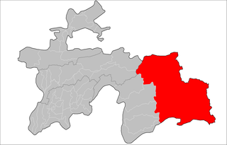 Location of Murghob District in Tajikistan | |
| Country | |
| Province | Gorno-Badakhshan Autonomous Province |
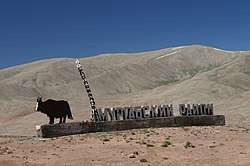
| Capital | Murghob |
| Area | |
| • Total | 38,442.2 km2 (14,842.6 sq mi) |
| Population (2008) | |
| • Total | 16,900 |
| as of 1 January 2008 | |
| Time zone | UTC+5 (TJT) |
| Postal code | 736600 |
| Area code(s) | +992 3554 |
Administrative divisions
The district is divided administratively into jamoats. They are as follows (and population).[2]
| Jamoats of Murghob District | |
| Jamoat | Population |
|---|---|
| Alichur | 1788 |
| Gajo Berdiev | |
| Karakul | 3532 |
| Murghob | 6365 |
| Qizilrabot | 1471 |
| Rangkul | 1165 |
Geography
It borders on Afghanistan to the south, China's Xinjiang region to the east, and Kyrgyzstan to the north. Within Tajikistan it borders to the west on four other GBAO districts and on the Region of Republican Subordination.[3] Its administrative capital is Murghob (also known as Murghab). The population in Murghob district is 16,900 of which 4,000 were in Murghab town (1 January 2008 estimate).[4]
The land is mostly a desolate plateau with scattered mountains, especially toward the east and south. The highest mountains are around the Fedchenko Glacier in the northwest and along the Pamir River in the south. The population is totally Kyrgyz. Formerly the land was used mostly as summer pasture ('jailoo'). The Pamir Highway curves from the southwest to the northeast. The four major lakes are Karakul in the northeast and three river lakes: Sarez Lake on the Bartang River, Yashil Kul on the Gunt River, and Zorkul on the Pamir River.
The districts eastern border shares the Sarikol Range with China.
References
- Borjian, Habib, “Morḡāb” , Encyclopaedia Iranica. Online 2013. .
- "List of Jamoats". UN Coordination, Tajikistan. Archived from the original on July 16, 2011. Retrieved April 4, 2009.
- Republic of Tajikistan, map showing administrative division as of January 1, 2004, "Tojikkoinot" Cartographic Press, Dushanbe
- Population of the Republic of Tajikistan as of 1 January 2008, State Committee of Statistics, Dushanbe, 2008 (in Russian)
| Districts | 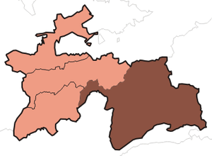 | |
|---|---|---|
| Main cities and towns | ||
| Geography |
| |