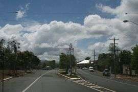
Mount Molloy, Queensland
Mount Molloy is a historic mining and timber town and locality lying 55 kilometres (34 mi) north of Cairns in Queensland, Australia.[2][3] It is within the local government area of Shire of Mareeba (between 2008 and 2013, it was within the Tablelands Region).
| Mount Molloy Queensland | |||||||||||||||
|---|---|---|---|---|---|---|---|---|---|---|---|---|---|---|---|
 Mt Molloy | |||||||||||||||
 Mount Molloy | |||||||||||||||
| Coordinates | 16°32′S 145°20′E | ||||||||||||||
| Population | 273 (2011 census)[1] | ||||||||||||||
| Postcode(s) | 4871 | ||||||||||||||
| Location | |||||||||||||||
| LGA(s) | Shire of Mareeba | ||||||||||||||
| State electorate(s) | Cook | ||||||||||||||
| Federal Division(s) | Leichhardt | ||||||||||||||
| |||||||||||||||
History
Djabugay (also knowen as Djabuganjdji, Tjupakai) is a language of Far North Queensland, particularly the area around the Kuranda Range and Barron River Catchment. The Djabugay language region includes the landscape within the local government boundaries of Cairns Regional Council.[4]
At its height Mount Molloy was a copper mine in the 1890s. It was commonly used as camping grounds and Chinese market gardeners used to grow grain and other foodstuffs for the miners nearby.
A private railway was constructed to Mount Molloy, junctioning from the Cairns to Mareeba line at Biboohra, opening in August 1908. It was built by Mount Molloy Limited to serve its smelters. The line was transferred to Queensland Railways on 1 March 1917 following the liquidation of the company and was extended to Rumula on 5 December 1926. The branch closed on 1 May 1964.[5]
Molloy Post Office opened by July 1905 and was renamed Mount Molloy in 1982.[6]
Mount Molloy was named after Patrick Molloy, an early teamster for a stock route and the person who discovered copper at what was to become Mount Molloy.
Today the dominant industry of Mount Molloy is now cattle grazing and consists of a few shops and an old hotel.
The Mount Molloy State School opened on 23 July 1906[7] and is located on 30-40 Fraser Road.[7] It is a Prep to Year 6 co-educational school.[7]
At the 2011 census, the town and surrounding area had a population of 273.[1]
Geography
Nearby towns are Julatten, Mount Carbine and Mount Mulligan. Quaid Road terminates south of Mount Molloy. A majority of the eastern half of Mount Molloy is protected within Kuranda National Park. Mount Molloy lies within both the Mitchell River and Barron River water catchment areas.
Heritage listings
Mount Molloy has a number of heritage-listed sites, including:
- Bakers Road: James Venture Mulligan's Grave[8]
- corner of Santowski Crescent and the Peninsular Development Road: Johnston's Sawmill Steam Plant[9]
Community groups
The Mount Molloy branch of the Queensland Country Women's Association meets at the CWA Hall at 31 Main Street (Mulligan Highway).[10]
References
- Australian Bureau of Statistics (31 October 2012). "Mount Molloy (State Suburb)". 2011 Census QuickStats. Retrieved 19 July 2014.

- "Mount Molloy - town (entry 23095)". Queensland Place Names. Queensland Government. Retrieved 13 June 2016.
- "Mount Molloy - locality (entry 48785)". Queensland Place Names. Queensland Government. Retrieved 13 June 2016.
-

- The Rumula Branch Milne, Rod Australian Railway Historical Society Bulletin, October, 1993 pp243-248
- Premier Postal History. "Post Office List". Premier Postal Auctions. Retrieved 10 May 2014.
- "Opening and closing dates of Queensland Schools". Queensland Government. Retrieved 18 April 2019.
- "James Venture Mulligan's Grave, Mt Molloy Cemetery (entry 600684)". Queensland Heritage Register. Queensland Heritage Council. Retrieved 14 July 2013.
- "JM Johnston's Sawmill (former) Steam Plant (entry 602776)". Queensland Heritage Register. Queensland Heritage Council. Retrieved 14 July 2013.
- "Branch Locations". Queensland Country Women's Association. Archived from the original on 26 December 2018. Retrieved 26 December 2018.
External links
| Wikimedia Commons has media related to Mount Molloy, Queensland. |