Modale, Iowa
Modale is a city in Harrison County, Iowa, United States. The population was 283 at the 2010 census.
Modale, Iowa | |
|---|---|
 Downtown Modale, Iowa | |
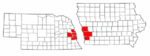
 Location of Modale, Iowa | |
| Coordinates: 41°37′12″N 96°0′40″W | |
| Country | |
| State | |
| County | Harrison |
| Area | |
| • Total | 1.05 sq mi (2.72 km2) |
| • Land | 1.05 sq mi (2.72 km2) |
| • Water | 0.00 sq mi (0.00 km2) |
| Elevation | 1,010 ft (308 m) |
| Population | |
| • Total | 283 |
| • Estimate (2019)[3] | 264 |
| • Density | 251.91/sq mi (97.23/km2) |
| Time zone | UTC-6 (Central (CST)) |
| • Summer (DST) | UTC-5 (CDT) |
| ZIP code | 51556 |
| Area code(s) | 712 |
| FIPS code | 19-52995 |
| GNIS feature ID | 0459158 |
History
Modale was originally called Martinsdale, and under the latter name was laid out in 1872 by Benjamin Martin, and named for him.[4] The present name of Modale, so named from the city's setting in a dale near the Missouri River, was adopted when a railroad depot was first built.[4][5]
Geography
Modale is located at 41°37′12″N 96°0′40″W (41.620083, -96.011221).[6]
According to the United States Census Bureau, the city has a total area of 1.05 square miles (2.72 km2), all of it land.[7]
Demographics
| Year | Pop. | ±% |
|---|---|---|
| 1890 | 288 | — |
| 1900 | 383 | +33.0% |
| 1910 | 387 | +1.0% |
| 1920 | 381 | −1.6% |
| 1930 | 359 | −5.8% |
| 1940 | 385 | +7.2% |
| 1950 | 283 | −26.5% |
| 1960 | 276 | −2.5% |
| 1970 | 297 | +7.6% |
| 1980 | 373 | +25.6% |
| 1990 | 289 | −22.5% |
| 2000 | 303 | +4.8% |
| 2010 | 283 | −6.6% |
| 2019 | 264 | −6.7% |
| Source:"U.S. Census website". United States Census Bureau. Retrieved 2020-03-29. and Iowa Data Center Source: | ||
2010 census
As of the census[2] of 2010, there were 283 people, 116 households, and 74 families living in the city. The population density was 269.5 inhabitants per square mile (104.1/km2). There were 146 housing units at an average density of 139.0 per square mile (53.7/km2). The racial makeup of the city was 98.2% White, 0.7% Native American, 0.7% Asian, and 0.4% from two or more races. Hispanic or Latino of any race were 0.4% of the population.
There were 116 households of which 30.2% had children under the age of 18 living with them, 51.7% were married couples living together, 6.0% had a female householder with no husband present, 6.0% had a male householder with no wife present, and 36.2% were non-families. 31.0% of all households were made up of individuals and 17.3% had someone living alone who was 65 years of age or older. The average household size was 2.44 and the average family size was 3.05.
The median age in the city was 40.5 years. 25.8% of residents were under the age of 18; 5.2% were between the ages of 18 and 24; 23.6% were from 25 to 44; 29.3% were from 45 to 64; and 15.9% were 65 years of age or older. The gender makeup of the city was 48.1% male and 51.9% female.
2000 census
As of the census[9] of 2000, there were 303 people, 139 households, and 89 families living in the city. The population density was 280.0 people per square mile (108.3/km2). There were 155 housing units at an average density of 143.3 per square mile (55.4/km2). The racial makeup of the city was 95.05% White, 1.32% Native American, and 3.63% from two or more races.
There were 139 households out of which 25.2% had children under the age of 18 living with them, 56.1% were married couples living together, 5.8% had a female householder with no husband present, and 35.3% were non-families. 34.5% of all households were made up of individuals and 17.3% had someone living alone who was 65 years of age or older. The average household size was 2.18 and the average family size was 2.74.
Age/Gender Breakdown: 22.1% under the age of 18, 7.3% from 18 to 24, 26.4% from 25 to 44, 25.1% from 45 to 64, and 19.1% who were 65 years of age or older. The median age was 41 years. For every 100 females, there were 110.4 males. For every 100 females age 18 and over, there were 96.7 males.
The median income for a household in the city was $34,688, and the median income for a family was $39,432. Males had a median income of $30,417 versus $22,500 for females. The per capita income for the city was $19,111. About 6.7% of families and 10.0% of the population were below the poverty line, including 19.4% of those under the age of eighteen and 12.5% of those sixty five or over.
Education
It is within the West Harrison Community School District.[10]
Notable people
- Myra Keaton, mother of actor and director Buster Keaton, was born in Modale.
References
- "2019 U.S. Gazetteer Files". United States Census Bureau. Retrieved July 17, 2020.
- "U.S. Census website". United States Census Bureau. Retrieved 2012-05-11.
- "Population and Housing Unit Estimates". United States Census Bureau. May 24, 2020. Retrieved May 27, 2020.
- History of Western Iowa, Its Settlement and Growth. Western Publishing Company. 1882. pp. 298.
- Chicago and North Western Railway Company (1908). A History of the Origin of the Place Names Connected with the Chicago & North Western and Chicago, St. Paul, Minneapolis & Omaha Railways. p. 103.
- "US Gazetteer files: 2010, 2000, and 1990". United States Census Bureau. 2011-02-12. Retrieved 2011-04-23.
- "US Gazetteer files 2010". United States Census Bureau. Archived from the original on 2011-02-20. Retrieved 2012-05-11.
- "Census of Population and Housing". Census.gov. Retrieved June 4, 2015.
- "U.S. Census website". United States Census Bureau. Retrieved 2008-01-31.
- "West Harrison." Iowa Department of Education. Retrieved on July 16, 2018.
Metropolitan area of Omaha–Council Bluffs | ||||||
|---|---|---|---|---|---|---|
| Primary cities |
|  | ||||
| Cities over 10,000 (per 2010 Census) |
| |||||
| Cities of 5,000 to 10,000 (per 2010 Census) |
| |||||
| Cities of 1,000 to 5,000 (per 2010 Census) |
| |||||
| Census-designated places |
| |||||
| Cities and villages of fewer than 1,000 (per 2010 Census) |
| |||||
| Counties |
| |||||
Municipalities and communities of Harrison County, Iowa, United States | ||
|---|---|---|
| Cities | Map of Iowa highlighting Harrison County | |
| Townships | ||
| CDPs | ||
| Other unincorporated communities | ||
| Footnotes | ‡This populated place also has portions in an adjacent county or counties | |
| Authority control |
|
|---|