Mississippi Highway 8
Mississippi Highway 8 (MS 8) runs east–west from U.S. Highway 278 (US 278) northeast of Aberdeen, to MS 1 in Rosedale.
| ||||
|---|---|---|---|---|
| Route information | ||||
| Maintained by MDOT | ||||
| Length | 160.932 mi[1] (258.995 km) | |||
| Major junctions | ||||
| West end | ||||
| East end | ||||
| Location | ||||
| Counties | Bolivar, Sunflower, Leflore, Grenada, Calhoun, Chickasaw, Monroe | |||
| Highway system | ||||
| ||||

Points of interest
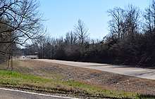
Highway 8 in Grenada County
Locales on route
From east to west
Major intersections
| County | Location | mi | km | Destinations | Notes |
|---|---|---|---|---|---|
| Bolivar | Rosedale | Western terminus | |||
| | Northern terminus of MS 817 | ||||
| Cleveland | |||||
| Sunflower | Ruleville | ||||
| Leflore | | ||||
| Grenada | Oxberry | West end of MS 35 overlap | |||
| Holcomb | West end of MS 7 overlap | ||||
| East end of MS 35 overlap | |||||
| Grenada | East end of MS 7 overlap; I-55 exit 206 | ||||
| Southern terminus of MS 333 Scenic | |||||
| Calhoun | | West end of MS 9 overlap | |||
| Calhoun City | East end of MS 9 overlap; traffic circle around city park | ||||
| Vardaman | |||||
| Chickasaw | Houston | Interchange | |||
| Northern terminus of MS 389 | |||||
| | Natchez Trace | Interchange | |||
| Trebloc | |||||
| Monroe | | Interchange | |||
| Aberdeen | Interchange; west end of US 45 overlap | ||||
| West end of MS 25 overlap | |||||
| Southern terminus of MS 145 | |||||
| Interchange; east end of US 45 overlap | |||||
| | East end of MS 25 overlap | ||||
| Wise Gap | Eastern terminus | ||||
1.000 mi = 1.609 km; 1.000 km = 0.621 mi
| |||||
See also
- Mississippi Highway 335
- List of Mississippi state highways
References
- "Mississippi Public Roads Selected Statistics" (PDF). Mississippi Department of Transportation. 2008. Archived from the original (PDF) on 2010-12-03. Retrieved 2010-06-03.
This article is issued from Wikipedia. The text is licensed under Creative Commons - Attribution - Sharealike. Additional terms may apply for the media files.