Minnewaukan, North Dakota
Minnewaukan is a city in Benson County, North Dakota, United States.[5] It serves as the county seat and is fourth largest city in the county, after Fort Totten, Leeds, and Maddock. The population was 224 at the 2010 census.[6] Minnewaukan was founded in 1884.
Minnewaukan, North Dakota | |
|---|---|
 Minnewaukan, North Dakota | |
| Motto(s): "Little City By The Big Lake" | |
 Location of Minnewaukan, North Dakota | |
| Coordinates: 48°4′N 99°15′W | |
| Country | United States |
| State | North Dakota |
| County | Benson |
| Area | |
| • Total | 0.48 sq mi (1.25 km2) |
| • Land | 0.48 sq mi (1.25 km2) |
| • Water | 0.00 sq mi (0.00 km2) |
| Elevation | 1,463 ft (446 m) |
| Population | |
| • Total | 224 |
| • Estimate (2019)[3] | 225 |
| • Density | 465.84/sq mi (179.73/km2) |
| Time zone | UTC-6 (Central (CST)) |
| • Summer (DST) | UTC-5 (CDT) |
| ZIP code | 58351 |
| Area code(s) | 701 |
| FIPS code | 38-53220 |
| GNIS feature ID | 1034197[4] |
| Website | minnewaukan.com |
Geography
Minnewaukan is located at 48°4′N 99°15′W (48.0713, -99.2506).[7]
According to the United States Census Bureau, the city has a total area of 0.27 square miles (0.70 km2), all of it land.[8]
Demographics
| Historical population | |||
|---|---|---|---|
| Census | Pop. | %± | |
| 1900 | 432 | — | |
| 1910 | 510 | 18.1% | |
| 1920 | 564 | 10.6% | |
| 1930 | 480 | −14.9% | |
| 1940 | 521 | 8.5% | |
| 1950 | 443 | −15.0% | |
| 1960 | 420 | −5.2% | |
| 1970 | 496 | 18.1% | |
| 1980 | 461 | −7.1% | |
| 1990 | 401 | −13.0% | |
| 2000 | 318 | −20.7% | |
| 2010 | 224 | −29.6% | |
| Est. 2019 | 225 | [3] | 0.4% |
| U.S. Decennial Census[9] 2018 Estimate[10] | |||
2010 census
As of the census[2] of 2010, there were 224 people, 116 households, and 64 families living in the city. The population density was 829.6 inhabitants per square mile (320.3/km2). There were 178 housing units at an average density of 659.3 per square mile (254.6/km2). The racial makeup of the city was 84.8% White, 11.2% Native American, 0.9% from other races, and 3.1% from two or more races. Hispanic or Latino of any race were 1.3% of the population.
There were 116 households, of which 12.9% had children under the age of 18 living with them, 47.4% were married couples living together, 5.2% had a female householder with no husband present, 2.6% had a male householder with no wife present, and 44.8% were non-families. 37.9% of all households were made up of individuals, and 9.4% had someone living alone who was 65 years of age or older. The average household size was 1.93 and the average family size was 2.53.
The median age in the city was 50.7 years. 12.1% of residents were under the age of 18; 4.4% were between the ages of 18 and 24; 24.5% were from 25 to 44; 39.2% were from 45 to 64; and 19.6% were 65 years of age or older. The gender makeup of the city was 50.4% male and 49.6% female.
2000 census
As of the census[11] of 2000, there were 318 people, 148 households, and 87 families living in the city. The population density was 1,157.0 people per square mile (454.7/km2). There were 199 housing units at an average density of 724.1 per square mile (284.6/km2). The racial makeup of the city was 86.16% White, 9.75% Native American, 1.26% from other races, and 2.83% from two or more races. Hispanic or Latino of any race were 1.57% of the population.
There were 148 households, out of which 26.4% had children under the age of 18 living with them, 48.0% were married couples living together, 3.4% had a female householder with no husband present, and 41.2% were non-families. 37.2% of all households were made up of individuals, and 15.5% had someone living alone who was 65 years of age or older. The average household size was 2.15 and the average family size was 2.83.[11]
In the city, the population was spread out, with 22.3% under the age of 18, 4.1% from 18 to 24, 26.4% from 25 to 44, 28.9% from 45 to 64, and 18.2% who were 65 years of age or older. The median age was 42 years. For every 100 females, there were 107.8 males. For every 100 females age 18 and over, there were 105.8 males.[12]
The median income for a household in the city was $27,250, and the median income for a family was $37,000. Males had a median income of $30,833 versus $17,500 for females. The per capita income for the city was $16,076. About 5.4% of families and 8.5% of the population were below the poverty line, including 16.2% of those under age 18 and 3.1% of those age 65 or over.[11]
Notable people
- Maxwell Anderson, playwright
- Quentin Anderson, literary critic and cultural historian at Columbia University
References
- "2019 U.S. Gazetteer Files". United States Census Bureau. Retrieved July 27, 2020.
- "U.S. Census website". United States Census Bureau. Retrieved June 14, 2012.
- "Population and Housing Unit Estimates". United States Census Bureau. May 24, 2020. Retrieved May 27, 2020.
- "US Board on Geographic Names". United States Geological Survey. October 25, 2007. Retrieved January 31, 2008.
- "Find a County". National Association of Counties. Retrieved 2011-06-07.
- "2010 Census Redistricting Data (Public Law 94-171) Summary File". American FactFinder. United States Census Bureau. Retrieved May 2, 2011.
- "Minnewaukan". Geographic Names Information System. United States Geological Survey. Retrieved May 3, 2009.
- "US Gazetteer files 2010". United States Census Bureau. Archived from the original on January 12, 2012. Retrieved June 14, 2012.
- United States Census Bureau. "Census of Population and Housing". Retrieved June 17, 2014.
- "Population Estimates". United States Census Bureau. Retrieved June 25, 2019.
- U.S. Census Bureau. Census 2000. "Census Demographic Profiles, Minnewaukan, North Dakota" (PDF). CenStats Databases. Retrieved 2009-01-31.
- U.S. Census Bureau. Census 2000. "QT-P1. Age Groups and Sex, Minnewaukan, North Dakota". American FactFinder. <http://factfinder.census.gov>. Retrieved 2009-01-31.
External links
Municipalities and communities of Benson County, North Dakota, United States | ||
|---|---|---|
| Cities | 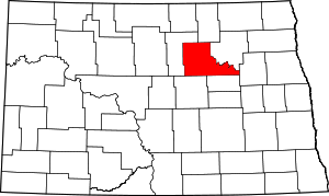 Map of North Dakota highlighting Benson County | |
| Townships |
| |
| CDP | ||
| Unincorporated communities | ||
| Authority control |
|
|---|