Maud, Oklahoma
Maud is a town on the boundary between Pottawatomie and Seminole counties in the U.S. state of Oklahoma. The population was 1,048 at the 2010 census, a 7.8 percent decrease from 1,136 at the 2000 census.[5] The town was named for Maud Stearns, a sister to the wives of two men who owned the first general store.[6]
Maud, Oklahoma | |
|---|---|
 Location of Maud, Oklahoma | |
| Coordinates: 35°7′55″N 96°46′39″W | |
| Country | United States |
| State | Oklahoma |
| Counties | Pottawatomie, Seminole |
| Government | |
| • Type | Aldermanic |
| • Mayor | Russell Dillon |
| • Councilmembers | Larry Barker, Lee Davis, Kurtis Dustman and Virginia Stephens |
| Area | |
| • Total | 1.07 sq mi (2.76 km2) |
| • Land | 1.07 sq mi (2.76 km2) |
| • Water | 0.00 sq mi (0.00 km2) |
| Elevation | 968 ft (295 m) |
| Population (2010) | |
| • Total | 1,048 |
| • Estimate (2019)[2] | 1,061 |
| • Density | 994.38/sq mi (384.05/km2) |
| Time zone | UTC-6 (Central (CST)) |
| • Summer (DST) | UTC-5 (CDT) |
| ZIP code | 74854 |
| Area code(s) | 405 |
| FIPS code | 40-46900[3] |
| GNIS feature ID | 1095177[4] |
History
This community was established by 1890 on the dividing line between Oklahoma Territory and Indian Territory. In 1890, a barbed-wire fence was built along the street now called Broadway from the North Canadian River to the Canadian River to keep the Native Americans out of Oklahoma Territory. However, the fence failed to prevent the illegal sale of alcohol to residents of Indian Territory.[6]
A post office was established on April 16, 1896. In January 1898, a mob lynched two Seminole teenagers, Marcus McGeisey and Palmer Simpson, by burning them alive near this same post office, in retaliation for their alleged murder of a white woman.[7] Newspapers reported that the charred bodies remained chained to an oak tree for several days after the mob murdered them.[8] Unlike in most lynchings, some members of the mob were actually convicted of participating in the violence. When one of these men was released from the federal penitentiary in Leavenworth in 1906, a celebratory crowd welcomed him home to Maud.[9]
A railroad station was built by the Missouri, Kansas and Texas Railway in 1903. The first newspaper, Maud Monitor, appeared in 1904, and the city was incorporated July 21, 1905. The 1910 census showed a population of 503.[6]
Maud became a boom town in the early 1920s because oil was discovered nearby. The peak population was estimated at ten thousand. The boom was short-lived and the population was only 4,326 at the 1930 census.[6]
Geography
Maud is located at 35°7′55″N 96°46′39″W (35.131809, -96.777527).[10] According to the United States Census Bureau, the city has a total area of 1.0 square miles (2.58 km2), all land.
Demographics
| Historical population | |||
|---|---|---|---|
| Census | Pop. | %± | |
| 1910 | 503 | — | |
| 1920 | 637 | 26.6% | |
| 1930 | 4,326 | 579.1% | |
| 1940 | 2,036 | −52.9% | |
| 1950 | 1,389 | −31.8% | |
| 1960 | 1,137 | −18.1% | |
| 1970 | 1,143 | 0.5% | |
| 1980 | 1,444 | 26.3% | |
| 1990 | 1,204 | −16.6% | |
| 2000 | 1,136 | −5.6% | |
| 2010 | 1,048 | −7.7% | |
| Est. 2019 | 1,061 | [2] | 1.2% |
| U.S. Decennial Census[11] | |||
As of the census[3] of 2000, there were 1,136 people, 435 households, and 301 families residing in the city. The population density was 1,174.3 people per square mile (452.2/km2). There were 523 housing units at an average density of 540.6 per square mile (208.2/km2). The racial makeup of the city was 78.52% White, 0.18% African American, 13.73% Native American, 0.26% Asian, 0.18% Pacific Islander, 0.26% from other races, and 6.87% from two or more races. Hispanic or Latino of any race were 2.55% of the population.
There were 435 households, out of which 36.6% had children under the age of 18 living with them, 51.3% were married couples living together, 14.7% had a female householder with no husband present, and 30.8% were non-families. 27.4% of all households were made up of individuals, and 15.4% had someone living alone who was 65 years of age or older. The average household size was 2.52 and the average family size was 3.07.
In the city, the population was spread out, with 28.1% under the age of 18, 9.0% from 18 to 24, 26.1% from 25 to 44, 19.8% from 45 to 64, and 17.0% who were 65 years of age or older. The median age was 36 years. For every 100 females, there were 85.3 males. For every 100 females age 18 and over, there were 80.4 males.
The median income for a household in the city was $22,604, and the median income for a family was $27,847. Males had a median income of $26,944 versus $15,625 for females. The per capita income for the city was $12,719. About 19.2% of families and 22.7% of the population were below the poverty line, including 25.0% of those under age 18 and 21.3% of those age 65 or over.
Notable people
- Jim Acree high school football coach.
- Edmond Harjo, the last surviving Seminole Code Talker during World War II and a 2013 recipient of the Congressional Gold Medal, resided within or near Maud for most of his life.[12]
- Wanda Jackson, pioneering rockabilly singer, known as the "Queen of Rockabilly," who has a street (Wanda Jackson Boulevard) named after her.[13]
References
- "2019 U.S. Gazetteer Files". United States Census Bureau. Retrieved July 28, 2020.
- "Population and Housing Unit Estimates". United States Census Bureau. May 24, 2020. Retrieved May 27, 2020.
- "U.S. Census website". United States Census Bureau. Retrieved 2008-01-31.
- "US Board on Geographic Names". United States Geological Survey. 2007-10-25. Retrieved 2008-01-31.
- CensusViewer:Population of the City of Maud, Oklahoma
- Donna Stacy, "Maud." Encyclopedia of Oklahoma History and Culture. Retrieved May 22, 2012.
- Littlefield, Daniel F. (1996). Seminole Burning: A Story of Racial Violence. Jackson: University of Mississippi Press.
- "Chains Hold Human Bones Against Post". The Atlanta Constitution. 10 January 1898.
- Littlefield, Daniel (1996). Seminole Burning. Jackson: University of Mississippi Press. pp. 3–4.
- "US Gazetteer files: 2010, 2000, and 1990". United States Census Bureau. 2011-02-12. Retrieved 2011-04-23.
- "Census of Population and Housing". Census.gov. Retrieved June 4, 2015.
- "Seminole code talker Edmond Harjo dies at 96". Tulsa World. 2014-04-13. Retrieved 2014-04-27.
- " Abandoned Oklahoma:Maud, OK." Retrieved August 3, 2014.
Municipalities and communities of Pottawatomie County, Oklahoma, United States | ||
|---|---|---|
| Cities | 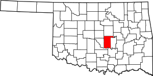 Pottawatomie County map | |
| Towns | ||
| CDP | ||
| Other unincorporated communities | ||
| Ghost towns | ||
| Footnotes | ‡This populated place also has portions in an adjacent county or counties | |
Municipalities and communities of Seminole County, Oklahoma, United States | ||
|---|---|---|
| Cities | 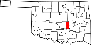 Seminole County map | |
| Towns | ||
| Unincorporated communities |
| |
| Indian reservations | ||
| Footnotes | ‡This populated place also has portions in an adjacent county or counties | |
| Authority control |
|
|---|