Mangʻit
Mangʻit (Uzbek: Mangʻit, Манғит; Karakalpak: Mańǵıt, Маңғыт; Russian: Мангит) is the seat of Amudaryo District in the autonomous republic of Karakalpakstan within Uzbekistan. It is located on the border with Turkmenistan, about 10 kilometres (6 mi) northeast of the Turkmen town of Gubadag and about 10 kilometres (6 mi) west of the Amu Darya river. It is 50 kilometres (31 mi) southeast of Nukus, the Karakalpak capital.
Mangʻit Mangʻit | |
|---|---|
City | |
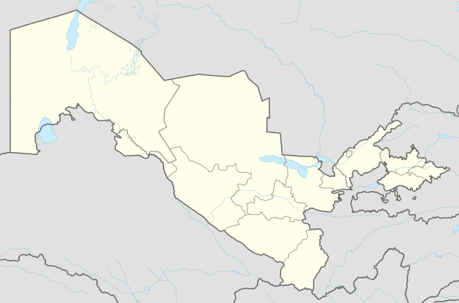 Mangʻit Location in Uzbekistan | |
| Coordinates: 42°07′N 60°04′E | |
| Country | |
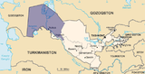
| Autonomous republic | |
| District | Amudaryo District |
| City | 1957 |
| Elevation | 85 m (279 ft) |
| Population (2004) | |
| • Total | 30,700 |
| Time zone | UTC+5 (UZT) |
History
Mang‘it was the site of battles during the Russian army's Khivan campaign of 1873. The first battle was slightly north of Mang‘it in the morning of 20 May 1873 when Russian troops advancing south under General Nikolai Aleksandrovich Veryovkin were attacked Yomut Turkmen forces.[1] After several fierce skirmishes, the Russians drove off the Turkmen cavalry, which retreated toward Mang‘it.[2] Russian forces entered Mang‘it at 3 p.m. that day to find that the Yomuts had left. Russian troops did kill several Uzbek inhabitants who had remained and fired upon the invading force from the windows of houses in the town.[2]
Soviet Mang‘it was formally founded on 18 December 1957 and gained city status in 1973. As with much of the region, the economy is based on growing and processing cotton. The primary employers are a cotton ginning plant, household services, spinning and sewing shops, Mangit hydroelectric power plant, the gas district and printers. Mang‘it has general education schools, libraries, clubs and cultural centers, hospitals and other medical facilities.
Demographics
| Population of Mang‘it | |||||||
|---|---|---|---|---|---|---|---|
| Year | 1979 | 1989 | 1991 | 2002 | 2004 | 2005 | 2009 |
| Pop. | 16,731 | 22,949 | 23,900 | 31,500 | 30,700 | 32,800 | 35,568 |
| ±% | — | +37.2% | +4.1% | +31.8% | −2.5% | +6.8% | +8.4% |
| Source: 1989: All-Union Population Census Archived 2012-02-04 at WebCite; 1991: Great Encyclopedic Dictionary; 2004: Encyclopaedic Dictionary | |||||||
Climate
| ||||||||||||||||||||||||||||||||||||||||||||||||||||||||||||||||||||||||||||||||||||||||||||||||||||||||||||||||||||||||||||
References
- Schmidt 1876, pp. 95–97.
- Schmidt 1876, p. 97.
- "NASA Earth Observations Data Set Index". NASA. Retrieved 30 January 2016.
Sources
- Schmidt, Emil (1876), The Russian Expedition to Khiva in 1873, Calcutta: Foreign Department Press
Capital: Nukus | ||
| Districts and seats |
|  |