Lower Kalskag, Alaska
Lower Kalskag (Central Yupik: Qalqaq; Russian: Лоуэр-Калскаг) is a city in Bethel Census Area, Alaska, United States. It is twenty-six miles west of Aniak. At the 2010 census the population was 282, up from 267 in 2000.
Lower Kalskag, Alaska Qalqaq | |
|---|---|
City | |
 The historic St. Seraphim Chapel | |
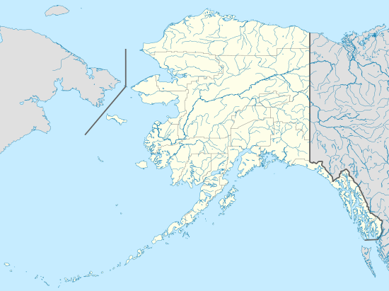 Lower Kalskag, Alaska Location in Alaska | |
| Coordinates: 61°30′49″N 160°21′33″W | |
| Country | United States |
| State | Alaska |
| Census Area | Bethel |
| Incorporated | 1969[1] |
| Government | |
| • Mayor | Crim Evan[2] |
| • State senator | Lyman Hoffman (D) |
| • State rep. | Tiffany Zulkosky (R) |
| Area | |
| • Total | 1.75 sq mi (4.53 km2) |
| • Land | 1.24 sq mi (3.22 km2) |
| • Water | 0.51 sq mi (1.31 km2) |
| Elevation | 26 ft (8 m) |
| Population (2010) | |
| • Total | 282 |
| • Estimate (2019)[4] | 314 |
| • Density | 252.41/sq mi (97.44/km2) |
| Time zone | UTC-9 (Alaska (AKST)) |
| • Summer (DST) | UTC-8 (AKDT) |
| ZIP code | 99626 |
| Area code | 907 |
| FIPS code | 02-45460 |
| GNIS feature ID | 1405763 |
Geography
Lower Kalskag is located at 61°30′49″N 160°21′33″W (61.513735, -160.359050).[5]
According to the United States Census Bureau, the city has a total area of 1.7 square miles (4.4 km2), of which, 1.3 square miles (3.4 km2) of it is land and 0.4 square miles (1.0 km2) of it (25.58%) is water.
Lower Kalskag, referred to by the locals as just "Lower", is linked to Upper Kalskag (Upper) by a single two mile maintained gravel/dirt road.
Lower Kalskag is accessible only by small plane, boat, and vehicles via the river "ice road" (Winter only).
Demographics
| Historical population | |||
|---|---|---|---|
| Census | Pop. | %± | |
| 1940 | 76 | — | |
| 1950 | 88 | 15.8% | |
| 1960 | 122 | 38.6% | |
| 1970 | 183 | 50.0% | |
| 1980 | 246 | 34.4% | |
| 1990 | 291 | 18.3% | |
| 2000 | 267 | −8.2% | |
| 2010 | 282 | 5.6% | |
| Est. 2019 | 314 | [4] | 11.3% |
| U.S. Decennial Census[6] | |||
Lower Kalskag first appeared on the 1940 U.S. Census erroneously[7] as the unincorporated village of Kalskag. In 1950, it reported as Lower Kalskag. It formally incorporated in 1969.
As of the census[8] of 2000, there were 267 people, 66 households, and 54 families residing in the city. The population density was 208.2 people per square mile (80.5/km2). There were 79 housing units at an average density of 61.6 per square mile (23.8/km2). The racial makeup of the city was 4.49% White, 88.76% Native American, and 6.74% from two or more races.
There were 66 households, out of which 62.1% had children under the age of 18 living with them, 47.0% were married couples living together, 24.2% had a female householder with no husband present, and 16.7% were non-families. 15.2% of all households were made up of individuals, and 1.5% had someone living alone who was 65 years of age or older. The average household size was 4.05 and the average family size was 4.53.
In the city, the population was spread out, with 44.9% under the age of 18, 13.5% from 18 to 24, 22.1% from 25 to 44, 15.4% from 45 to 64, and 4.1% who were 65 years of age or older. The median age was 21 years. For every 100 females, there were 96.3 males. For every 100 females age 18 and over, there were 98.6 males.
The median income for a household in the city was $25,625, and the median income for a family was $27,500. Males had a median income of $16,667 versus $36,250 for females. The per capita income for the city was $7,654. About 36.7% of families and 40.6% of the population were below the poverty line, including 51.4% of those under the age of eighteen and 35.7% of those 65 or over.
References
- 1996 Alaska Municipal Officials Directory. Juneau: Alaska Municipal League/Alaska Department of Community and Regional Affairs. January 1996. p. 92.
- 2015 Alaska Municipal Officials Directory. Juneau: Alaska Municipal League. 2015. p. 98.
- "2019 U.S. Gazetteer Files". United States Census Bureau. Retrieved June 30, 2020.
- "Population and Housing Unit Estimates". United States Census Bureau. May 24, 2020. Retrieved May 27, 2020.
- "US Gazetteer files: 2010, 2000, and 1990". United States Census Bureau. 2011-02-12. Retrieved 2011-04-23.
- "Census of Population and Housing". Census.gov. Retrieved June 4, 2015.
- http://edu.georgetowntc.com/our-courses/nuna-land/upper-kalskag-2/historical-information-page.html#previous-photo
- "U.S. Census website". United States Census Bureau. Retrieved 2008-01-31.
Municipalities and communities of Bethel Census Area, Alaska, United States | ||
|---|---|---|
| Cities | 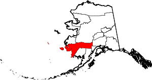 Bethel Census Area map | |
| CDPs | ||
| Unincorporated communities | ||
| Ghost towns | ||
| Authority control |
|
|---|