Eek, Alaska
Eek (Central Yupik: Iik) is a city in Bethel Census Area, Alaska, United States. At the 2010 census the population was 296.
Eek Ekvicuaq | |
|---|---|
City | |
 Eek, AK from a bush plane | |
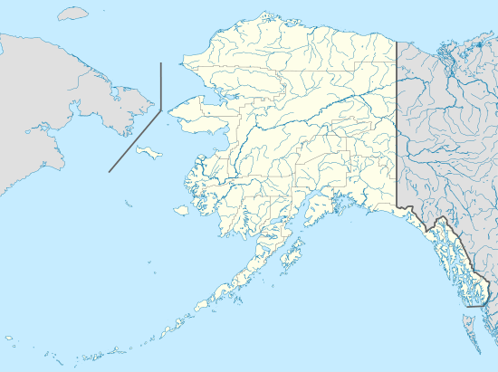 Eek Location in Alaska | |
| Coordinates: 60°13′7″N 162°1′33″W | |
| Country | |
| State | |
| Census Area | Bethel |
| Incorporated | July 9, 1970[1] |
| Government | |
| • Mayor | Carlie Beebe[2] |
| • State senator | Lyman Hoffman (D-C)[3] |
| • State rep. | Tiffany Zulkosky (D) |
| Area | |
| • Total | 0.74 sq mi (1.92 km2) |
| • Land | 0.65 sq mi (1.68 km2) |
| • Water | 0.09 sq mi (0.24 km2) |
| Elevation | 3 ft (1 m) |
| Population (2010) | |
| • Total | 296 |
| • Estimate (2019)[5] | 315 |
| • Density | 486.11/sq mi (187.77/km2) |
| Time zone | UTC-9 (Alaska (AKST)) |
| • Summer (DST) | UTC-8 (AKDT) |
| ZIP codes | 99578 |
| Area code | 907 |
| FIPS code | 02-21040 |
| GNIS feature ID | 1401666 |
Toponymy
Eek is derived from an Eskimo word meaning "two eyes".[6] It has frequently been noted on lists of unusual place names.[7]
Geography
Eek is located at 60°13′7″N 162°1′33″W (60.218662, -162.025928).[8]
According to the United States Census Bureau, the city has a total area of 1.0-square-mile (2.6 km2), of which 0.9-square-mile (2.3 km2) is land and 0.1-square-mile (0.26 km2) (12.38%) is water.
Services
Eek is serviced by one airport, due southwest of the village. A second (former) airport east of the village is the current site of a cellular transmission tower, but the runway remains in marginally usable condition and is occasionally used by private aircraft. A town dock provides access to the Eek River, which feeds into the Kuskokwim providing access to most surrounding villages by boat. During winter months many residents utilize travel by snow machine and trails are laid out between the villages in the area. Trails from Eek run to Quinhagak to the south, Tuntutuliak to the west and the Bethel area to the north.
Education
Lower Kuskokwim School District operates the Eek School, a bilingual PreK-12 school. As of 2018 it has 120 students.[9]
Demographics
| Historical population | |||
|---|---|---|---|
| Census | Pop. | %± | |
| 1920 | 119 | — | |
| 1930 | 100 | −16.0% | |
| 1940 | 170 | 70.0% | |
| 1950 | 141 | −17.1% | |
| 1960 | 200 | 41.8% | |
| 1970 | 186 | −7.0% | |
| 1980 | 228 | 22.6% | |
| 1990 | 254 | 11.4% | |
| 2000 | 280 | 10.2% | |
| 2010 | 296 | 5.7% | |
| Est. 2019 | 315 | [5] | 6.4% |
| U.S. Decennial Census[10] | |||
Eek Village was originally located on the Apokak River and moved to its present location in the late 1920s, after flooding and erosion caused the people to relocate. In 1900 Census, the village was known as "Apokagamiut" and had 118 residents. by 1910, the number of residents declined to 68. Eek appeared on the 1920 U.S. Census as an unincorporated village. In the 1930 Census, the village was enumerated in the Alaska Territory Fourth Judicial District, Bethel District, 0015. with 100 Residents in 18 households. It was formally incorporated in 1970.
As of the census[11] of 2000, there were 280 people, 76 households, and 57 families residing in the city. The population density was 307.2 people per square mile (118.8/km²). There were 83 housing units at an average density of 91.1 per square mile (35.2/km²). The racial makeup of the city was 3.21% White, 95.71% Alaska Native/Yupik, and 1.07% from two or more races. 0.36% of the population were Hispanic or Latino of any race.
There were 76 households out of which 43.4% had children under the age of 18 living with them, 50.0% were married couples living together, 19.7% had a female householder with no husband present, and 25.0% were non-families. 25.0% of all households were made up of individuals and 5.3% had someone living alone who was 65 years of age or older. The average household size was 3.68 and the average family size was 4.54.
In the city, the age distribution of the population shows 41.1% under the age of 18, 10.4% from 18 to 24, 27.9% from 25 to 44, 14.3% from 45 to 64, and 6.4% who were 65 years of age or older. The median age was 24 years. For every 100 females, there were 120.5 males. For every 100 females age 18 and over, there were 117.1 males.
The median income for a household in the city was $17,500, and the median income for a family was $27,500. The per capita income for the city was $8,957. About 32.7% of families and 28.8% of the population were below the poverty line, including 30.5% of those under the age of 18 and 10.0% of those 65 or over.
A development has occurred that provides Internet access available to the community. Community access points, in conjunction with the USDA Telecommunications Grant to provider UUI, are in place in 11 villages across the Yukon Kuskokwim Delta.
References
- "Directory of Borough and City Officials 1974". Alaska Local Government. Juneau: Alaska Department of Community and Regional Affairs. XIII (2): 31. January 1974.
- 2015 Alaska Municipal Officials Directory. Juneau: Alaska Municipal League. 2015. p. 56.
- "Senator Lyman Hoffman". Alaska Senate Majority. Alaskasenate.org. Retrieved November 16, 2019.
- "2019 U.S. Gazetteer Files". United States Census Bureau. Retrieved June 30, 2020.
- "Population and Housing Unit Estimates". United States Census Bureau. May 24, 2020. Retrieved May 27, 2020.
- Bright, William (2004). Native American Placenames of the United States. University of Oklahoma Press. p. 141. ISBN 978-0-8061-3598-4.
- Parker, Quentin (2010). Welcome to Horneytown, North Carolina, Population: 15: An insider's guide to 201 of the world's weirdest and wildest places. Adams Media. pp. ix.
- "US Gazetteer files: 2010, 2000, and 1990". United States Census Bureau. 2011-02-12. Retrieved 2011-04-23.
- "Eek School." Eek School. Retrieved on July 13, 2018.
- "Census of Population and Housing". Census.gov. Retrieved June 4, 2015.
- "U.S. Census website". United States Census Bureau. Retrieved 2008-01-31.
Municipalities and communities of Bethel Census Area, Alaska, United States | ||
|---|---|---|
| Cities | 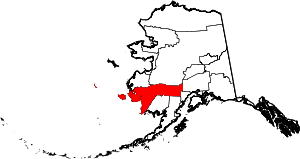 Bethel Census Area map | |
| CDPs | ||
| Unincorporated communities | ||
| Ghost towns | ||