List of state routes in Arizona
The U.S. state of Arizona's State Routes are usually abbreviated as SR.
| Arizona State Highway System | |
|---|---|
   Example signage from the Arizona State Highway System | |
| System information | |
| Maintained by ADOT and local jurisdictions | |
| Length | 3,189.12 mi[1][2] (5,132.39 km) Length represents Arizona State Routes and Interstate Business Routes |
| Formed | September 9, 1927 |
| Highway names | |
| Interstates | Interstate X (I-X) |
| US Highways | U.S. Route X (US X) |
| State | State Route X (SR X) |
| System links | |
| |
History
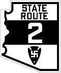
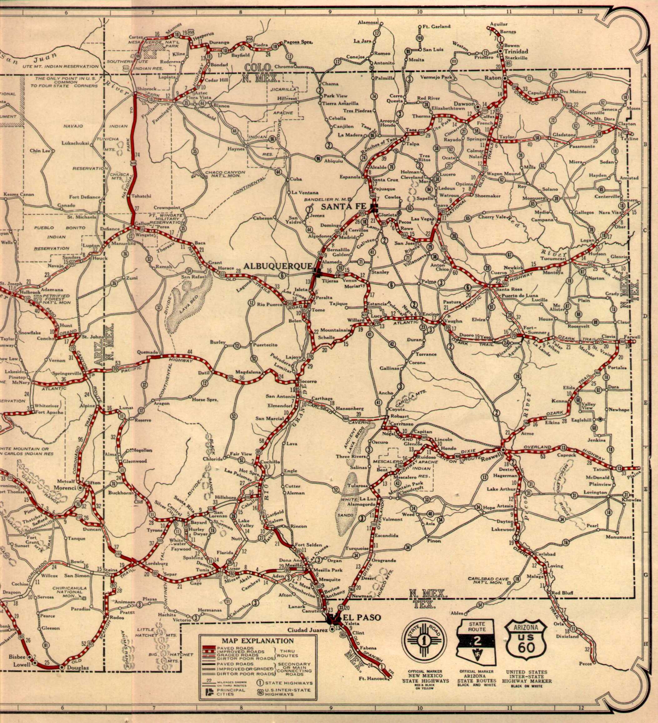
The Arizona State Highway system was introduced on September 9, 1927, by the State Highway Commission (formed on August 11 of the same year). It incorporated the new federal aid system and also the U.S. Highway system. The 1927 plan included 27 state routes, most of which were simply dirt roads. Until 1942, the state route marker signs contained a Native American swastika that were used by Navajos, but were removed after the U.S.'s entry into World War II against Nazi Germany which had a reversed swastika as its emblem and became strongly negatively associated with the Nazis.
The modern system was introduced and adopted in the 1950s.
Designations and nomenclatures
The Arizona Department of Transportation (ADOT) internally recognizes Interstate Highways, U.S. Highways and Arizona Highways as all being separate types of highway designations. State highways within Arizona are referred to as Arizona State Routes or State Routes, with the prefix "SR" being used for abbreviations.[2][4] ADOT also recognizes seven different types of suffixed routes for the U.S. Highways and State Routes.[5] The recognized suffixes consist of the following with "(Number)" filling in for a numeric designation:
- Alternate (A) – Referred to as "State Route (Number)A" and abbreviated as "SR (Number)A".
- Business Route (B) – Referred to as "State Business Route (Number)" and abbreviated as "SR (Number)B" or "SR (Number) Bus.".
- Loop Route (L) – Referred to as "State Loop Route (Number)" and abbreviated as "SR (Number)L". Despite often having "Loop" within their titles, SR 101, SR 202 and SR 303 are not considered "Loop Routes" by ADOT, nor are Interstate Business Loops.[5] To date, SR 89L has been the only Loop Route recognized by ADOT.[6]
- Spur (S) – Referred to as "State Route (Number) Spur" and abbreviated as "SR (Number)S" or "SR (Number) Spur".
- Truck (T) - Referred to as "State Route (Number) Truck" and abbreviated as "SR (Number) Truck".
- Temporary (X) - Publicly referred to as "State Route (Number) Temporary" or "State Route (Number)T" and abbreviated "SR (Number)T".[7] Internally referred to as "State Route (Number)X" and abbreviated "SR (Number)X".[2]
- Wye Leg (Y) - Referred to as "State Route (Number)Y" and abbreviated "SR (Number)Y".
U.S. Highways can also use the same suffixes listed above. Usually the suffixed routes are recognized by ADOT as U.S. Highways. For example, the Alternate route of U.S. Route 89 (US 89) is referred to as U.S. Route 89A (US 89A) instead of State Route 89A (SR 89A). The only exception to this rule is SR 93X, which is a suffixed route of US 93.[1] Suffixed routes for Interstates are a different story. Although the suffixed routes are signed with Interstate green Business shields, they are recognized by ADOT as suffixed State Routes. In the field, Interstate 10 business routes are signed as Interstate 10 Business Loop or Interstate 10 Business Spur, while they are referred to by ADOT as "State Business Route 10" (SR 10B) and "State Route 10 Spur" (SR 10 Spur). The same principle applies with business routes for all other Interstates in Arizona.[4]
Designations listed under Highway Logs and GIS data however, use the Arizona Transportation Information System (ATIS) nomenclature. The ATIS designation for a non-suffixed state route is "S (Number)". The number at the end is always three digits long. As such, all two digit routes are referred to under the ATIS terminology as "S 0(Number)".[4] SR 260 and SR 79 are known under ATIS nomenclature as "S 260" and "S 079" respectively. U.S. Highways replace the prefix "S" used by State Routes under the ATIS nomenclature with "U" while Interstate Highways use the prefix "I".[1] Suffixed routes under ATIS always have the internally applied suffix between the prefix.[4] State Business Route 79 under ATIS nomenclature is referred to as "SB079" and SR 93X is "SX093".[1]
State Routes
| Number | Length (mi) | Length (km) | Southern or western terminus | Northern or eastern terminus | Formed | Removed | Notes |
|---|---|---|---|---|---|---|---|
| 1.42 | 2.29 | Loop 202 in Mesa | Ellsworth Road in Mesa | 2014 | current | ||
| — | — | Future I-11 in Palo Verde | Loop 202 in Phoenix | proposed | — | I-10 reliever | |
| 16.70 | 26.88 | I-10 / Loop 202 in Phoenix | Loop 101 in Phoenix | 1987 | current | Freeway | |
| 76.51 | 123.13 | US 60 near Show Low | NM 53 near Zuni Pueblo | 1935 | current | ||
| 4.0 | 6.4 | US 93 north of Kingman | Chloride | 1936 | 1971 | ||
| — | — | Petrified Forest National Park | U.S. Route 260 | 1932 | 1951 | ||
| — | — | U.S. Route 66 in Sanders | U.S. 164 | 1961 | 1981 | ||
| 108.31 | 174.31 | I-40 in Williams | US 89 near Cameron | 1932 | current | ||
| — | — | Payson | Winslow | 1936 | 1967 | ||
| 66.59 | 107.17 | I-40 in Kingman | Coconino-Yavapai county line | 1984 | current | ADOT signs eastern terminus at I-40 near Seligman | |
| 43.40 | 69.85 | Bright Angel Point near North Rim | US 89A near Jacob Lake | 1941 | current | ||
| 27.88 | 44.87 | SR 95 in Bullhead City | US 93 near Kingman | 1941 | current | ||
| 33.87 | 54.51 | I-17 near Cordes Lakes | SR 89 in Prescott | 1938 | current | Formerly extended to Phoenix but was replaced by I-17 | |
| — | — | US 180 near Safford | US 60 in Eagar | 1927 | 1936 | ||
| 24.16 | 38.88 | US 60 near Aguila | SR 89 near Congress | 1936 | current | ||
| 36.74 | 59.13 | SR 95 near Parker | US 60 in Hope | 1930 | current | ||
| 46.79 | 75.30 | US 60 near Show Low | SR 260 near Pinetop | 1927 | current | ||
| — | — | Ehrenberg | Wickenburg | 1927 | 1931 | ||
| 31.02 | 49.92 | US 60 near Morristown | I-17 in Phoenix | 1964 | current | an earlier one existed from 1927-1932 | |
| 19.39 | 31.21 | US 70 in Duncan | US 191 / SR 78 near Clifton | 1932 | current | ||
| — | — | Benson Peppersauce Wash | Pomerene SR 77 |
1927 | 1931 | ||
| 238.71 | 384.17 | I-10 in Tucson | BIA Route 6 at the Navajo Nation boundary | 1941 | current | ||
| 19.50 | 31.38 | US 191 / SR 75 in Three Way | NM 78 at the Arizona-New Mexico state line | 1959 | current | ||
| — | — | Prescott | Flagstaff | 1927 | 1941 | ||
| 58.40 | 93.99 | SR 77 near Tucson | US 60 near Gold Canyon | 1992 | current | older routes existed 1934-1941 and 1950-1968 | |
| 2.05 | 3.30 | SR 79 in Florence | SR 79 in Florence | 1992 | current | ||
| 120.23 | 193.49 | SR 10 Bus. near Benson | NM 80 near Animas | 1989 | current | Former US 80 | |
| — | — | Safford | Douglas | 1927 | 1938 | ||
| — | — | U.S. Route 180 / U.S. Route 191 between St. Johns and Springerville | Lyman Lake State Park | 1962 | 2003 | ||
| 65.74 | 105.80 | SR 19 Bus. in Nogales | SR 80 near Tombstone | 1927 | current | ||
| 53.63 | 86.31 | Parker Canyon Lake | I-10 near Tucson | 1927 | current | ||
| 6.08 | 9.78 | State Route 84 on Casa Grande Highway (now West Miracle Mile) in Tucson | US 80, US 89 and SR 84 at 6th Avenue and Benson Highway in South Tucson | 1951 | 1963 | branch of State Route 84 | |
| 40.94 | 65.89 | I-8 near Stanfield | I-10 near Picacho | 1927 | current | ADOT signs its eastern end at SR 287 / SR 387 in Casa Grande | |
| 117.87 | 189.69 | Fed. 8 at Mexican border in Lukeville | I-10 in Buckeye | 1936 | current | ||
| 118.12 | 190.10 | SR 85 in Why | 16th Avenue in Tucson | 1930 | current | ||
| 287.28 | 462.33 | SR 84 (unsigned) near Eloy | SR 264 near Second Mesa | 1927 | current | ADOT signs its southern end at I-10 near Picacho | |
| 45.68 | 73.51 | US 60 in Apache Junction | SR 188 near Roosevelt | 1927 | current | ||
| — | — | U.S. Route 89 in Page, Arizona | U.S. Route 89 in Page | — | 2006 | Loop for State Route 89 | |
| 104.53 | 168.22 | US 93 near Wickenburg | I-40 near Williams | 1992 | current | ||
| 83.85 | 134.94 | SR 89 in Prescott | SR 40 Bus. in Flagstaff | 1992 | current | Formerly US 89A | |
| 46.77 | 75.27 | SR 80 near Tombstone | I-10 in Benson | 1957 | current | ||
| SR 90 Spur | 0.42 | 0.68 | Fort Huachuca eastern gate in Sierra Vista | Buffalo Soldier Trail in Sierra Vista | 1974 | current | Unsigned spur route of SR 90. |
| 33.91 | 54.57 | SR 90 near Sierra Vista | SR 80 in Bisbee | 1935 | current | ||
| 247.13 | 397.72 | Fed. 15 in Nogales | US 93/US 89 near Wickenburg (Formerly US 66 in Kingman) | 1946 | 1991 | ||
| SR 93X | 2.13 | 3.43 | Hoover Dam Access Road in Nevada at Hoover Dam | US 93 near Hoover Dam | 2010 | current | Remnant of the US 93 pre-Hoover Dam Bypass alignment. Completely unrelated to former SR 93. |
| 116.46 | 187.42 | SR 10 Bus. / US 95 in Quartzsite | SR 163 near Bullhead City | 1936 | current | ||
| SR 95 Spur | — | — | SR 95 in Parker | SR 62 near Parker | — | — | Unsigned; signed as SR 95 Truck |
| 21.79 | 35.07 | SR 97 near Bagdad | CR 15 (Yavapai County) in Hillside | 1962 | current | ADOT signs its western terminus at Old Dick Road in Bagdad | |
| 10.91 | 17.56 | US 93 near Congress | SR 96 near Bagdad | 1962 | current | ||
| 66.89 | 107.65 | US 89 in Page | US 160 near Tonalea | 1974 | current | ||
| 44.31 | 71.31 | Forest Service Road 34 south of Winslow | BIA Route 15 near Leupp | 1970 | current | ||
| 60.98 | 98.14 | I-10 in Tolleson | Loop 202 in Chandler | 1988 | current | ||
| 3.93 | 6.32 | I-10 / US 60 in Phoenix | McDowell Road in Phoenix | 1957 | current | ||
| 2.12 | 3.41 | University Drive in Phoenix | Washington Street | 1985 | 2007 | ||
| — | — | Payson | Show Low | 1955 | 1969 | ||
| — | — | U.S. 66 and U.S. 89 in Flagstaff | State Route 64 in Valle | 1960 | 1962 | ||
| — | — | U.S. Route 66 | Walnut Canyon National Monument | 1957 | 1970 | ||
| 15.16 | 24.40 | SR 69 in Dewey | I-17 in Camp Verde | 1971 | current | ||
| 4.01 | 6.45 | Peridot | San Carlos | 1955 | 2003 | ||
| 4.01 | 6.45 | Peridot | San Carlos | 2003 | current | ||
| SR 172 | — | — | SR 72 in Parker | Parker Dam | 1958 | 1962 | |
| SR 173 | — | — | Show Low | McNary Jct. | 1946 | 1972 | |
| — | — | San Manuel | Benson | 1967 | 1970 | ||
| 31.69 | 51.00 | SR 77 in Winkelman | US 60 in Superior | 1953 | current | ||
| 14.49 | 23.32 | I-17 near Lake Montezuma | SR 89A in Sedona | 1962 | current | ||
| 11.18 | 17.99 | SR 61 in Concho | US 180 near Concho | 1974 | current | ||
| 26.80 | 43.13 | US 191 near Pearce | Chiricahua National Monument near Willcox | 1970 | current | ||
| 33.39 | 53.74 | I-10 / US 191 in Willcox | SR 181 near Willcox | 1955 | current | ||
| 5.43 | 8.74 | SR 387 near Casa Grande | SR 87 near Sacaton | 1944 | current | ||
| 60.85 | 97.93 | US 60 near Globe | SR 87 near Rye | 1959 | current | ||
| 3.75 | 6.04 | Fed. 15D at Mariposa Port of Entry on United States-Mexico border | SR 19 Bus. in Nogales | 1956 | current | ||
| 22.08 | 35.53 | Avenue E½ near San Luis | I-8 in Yuma | 2009 | current | ||
| 57.17 | 92.01 | I-10 / SR 51 in Phoenix | 40th Street / Pecos Road in Ahwatukee | 1990 | current | ||
| Loop 202 Spur | 1.22 | 1.96 | Phoenix Sky Harbor International Airport in Phoenix | Loop 202 in Phoenix | 1993 | current | Unsigned |
| 3.96 | 6.37 | Broadway Boulevard in Tucson | Golf Links Road in Tucson | 1998 | current | ||
| 20.27 | 32.62 | Near Mobile | SR 347 in Maricopa | 1986 | current | ||
| 217.78 | 350.48 | SR 89A in Cottonwood | US 180 / US 191 in Eagar | 1970 | current | ||
| 17.92 | 28.84 | SR 273 near Crescent Lake | SR 260 in Eagar | 1991 | current | ||
| 154.35 | 248.40 | US 160 in Tuba City | NM 264 near Window Rock | 1961 | current | ||
| 19.18 | 30.87 | Fort Grant Road near Fort Grant | US 191 near Safford | 1957 | current | ||
| 19.26 | 31.00 | Three Forks Road near Big Lake | SR 260 near McNary | 1957 | current | ||
| 30.66 | 49.34 | SR 260 near Heber | SR 77 in Snowflake | 1962 | current | ||
| 12.26 | 19.73 | U.S. Route 89A in Cottonwood | Camp Verde | 1955 | 1989 | ||
| — | — | Interstate 8 in Yuma | Interstate 8 business loop | 1976 | 2007 | ||
| 45.04 | 72.48 | United States-Mexico border in Sasabe | SR 86 in Three Points | 1955 | current | ||
| 32.07 | 51.61 | SR 84 / SR 387 in Casa Grande | SR 79 in Florence | 1932 | current | ||
| 52.56 | 84.59 | SR 188 near Theodore Roosevelt Lake | Chamberlain Trail near Young | 1959 | current | ||
| 10.33 | 16.62 | Peña Blanca Lake | I-19 near Nogales | 1960 | current | ||
| 35.25 | 56.73 | I-10 in Goodyear | I-17 near Peoria | 1991 | current | ||
| 28.69 | 46.17 | SR 84 near Stanfield | I-10 near Chandler | 1997 | current | ||
| — | — | Tempe | Apache Junction | 1970 | 1992 | ||
| — | — | Teec Nos Pos | Four Corners at the New Mexico state line | 1962 | 1964 | ||
| 28.33 | 45.59 | Near Mount Graham | US 191 at Swift Trail Junction | 1960 | current | ||
| 4.46 | 7.18 | Spring Street in Greer | SR 260 near Eagar | 1961 | current | ||
| 33.83 | 54.44 | SR 277 near Heber | SR 77 near Holbrook | 1971 | current | ||
| 11.88 | 19.12 | Near Kitt Peak National Observatory | SR 86 near Sells | 1967 | current | ||
| 15.71 | 25.28 | SR 84 / SR 287 in Casa Grande | SR 87 near Coolidge | 1967 | current | ||
| 32.60 | 52.46 | SR-59 in Colorado City | US 89A in Fredonia | 1960 | current | ||
| — | — | Kayenta | Mexican Hat at the Utah state line | 1962 | 1970 | ||
| 9.91 | 15.95 | SR 260 near Mount Graham | Near Hawley Lake | 1967 | current | ||
| — | — | Teec Nos Pos | New Mexico state line | 1965 | 1989 | ||
| 9.16 | 14.74 | US 160 near Tuba City | Near Navajo National Monument | 1970 | current | ||
| 6.10 | 9.82 | I-10 near Casa Blanca | SR 87 near Sun Lakes | 1985 | current | ||
| — | — | Nogales | New Mexico state line near Gallup | 1956 | 1965 | ||
| SR 989 | 2.04 | 3.28 | Oro Valley | SR 77 in Oro Valley | 1993 | current | Unsigned |
Unbuilt routes
Some routes listed here were eventually constructed using other route numbers.
- State Route 50
- State Route 110
- State Route 117
- State Route 176
- State Route 216
- State Route 217
- State Route 218
- State Route 220
- State Route 317
- State Route 380
- State Route 417
- State Route 487
- State Route 489
- State Route 510
- State Route 517
- State Route 589
- State Route 710
- State Route 801
- State Route 802
- State Route 810
- State Route 910
- State Route 982
- State Route 983
Arizona Parkways, Historic and Scenic Roads

Currently, the Arizona Department of Transportation recognizes 26 state designated routes under the Parkways, Historic and Scenic Roads Program. Four are Historic Roads, 17 are Scenic Roads and five are Parkways.[8][9][10]
Parkways


Historic Roads

.svg.png)
.svg.png)
.svg.png)
Scenic Roads


See also


References
- Arizona DOT Highway Log
- Arizona DOT Right-of-Way Resolutions (Works Consulting LLC)
- Roadway Inventory Management Section, Multimodal Planning Division (December 31, 2013). "2013 State Highway System Log" (PDF). Arizona Department of Transportation. Retrieved October 15, 2019.
- Arizona Department of Transportation, Multimodal Planning Division (2015). State Highway System (ArcGIS) (Map). Arizona Department of Transportation. Retrieved August 1, 2018.
- "map". Road atlas. Rand McNally. 1927.
- "Short ADOT ATIS Nomenclature" (PDF). Arizona Department of Transportation. October 25, 2000. Retrieved August 6, 2019 – via Pima County Government GIS Services. Cite journal requires
|journal=(help) - "ATIS Nomenclature" (PDF). GPS Tools for Arc View. Arizona Department of Transportation. August 2, 2000. pp. 57 to 64.
- Transportation Planning Division, Data Bureau (December 15, 1998). "1998 State Highway System Log" (PDF). Arizona Department of Transportation. Retrieved October 15, 2019.
- Arizona Department of Transportation. "ADOT Right-of-Way Resolution 1955-P-181". Arizona Department of Transportation. Retrieved July 1, 2019.
- Arizona Department of Transportation (2014). "Arizona Parkways, Historic and Scenic Roads" (PDF). Phoenix: Arizona Department of Transportation. Retrieved September 11, 2018.
- "Arizona Scenic Roads Map" (PDF). Phoenix, Arizona: Arizona Department of Transportation. Retrieved 2018-09-12.
- Davis, Shaq (2018-09-21). "Arizona's portion of U.S. Route 80, opened in 1926, wins 'Historic Road' status". Arizona Daily Star. Tucson, Arizona: Tucson.com. Retrieved 2018-09-21.