Arizona State Route 95
State Route 95, also known as SR 95, is a north–south state highway along the western edge of Arizona that is split into two sections.
_(crop).jpg)
| ||||
|---|---|---|---|---|
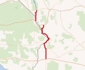
SR 95 highlighted in red | ||||
| Route information | ||||
| Maintained by ADOT | ||||
| Length | 116.46 mi[1] (187.42 km) | |||
| Existed | May 26, 1936–present | |||
| Major junctions | ||||
| South end | ||||
| North end | ||||
| Highway system | ||||
| ||||

Route description
The southern segment begins in Quartzsite at its junction with U.S. Route 95, traveling north to Parker then following the Colorado River until past Lake Havasu City, and finally intersecting Interstate 40. The northern segment (the Mohave Valley Highway) begins at the Colorado River bridge across from Needles, then goes directly northbound to Bullhead City, terminating at its junction with State Route 68 north of town.[1]
There is a short SR 95 Truck at Parker, formerly a section of Arizona State Route 72, connecting to California State Highway 62. Another spur, SR 95S, exists at Parker Dam, and is signed as a spur from the mainline but is unmarked along the spur itself. In Lake Havasu City, SR 95 also provides access to London Bridge.[1]
As the primary north–south highway through much of the Arizona side of the Colorado River, SR 95 is an important thoroughfare for residents in the cities and towns of that area.[1]
History
State Route 95 (SR 95) was first designated on May 26, 1936 over a former county road between San Luis and Yuma. On June 20, 1938, SR 95 was extended north through Quartzsite to SR 72 in Bouse.[2] The road south of Quartzsite to San Luis was renumbered as part of U.S. Route 95 on June 27, 1960.[3] The road to Bouse was turned over to Yuma County to maintain in 1953-1955. Parts of SR 95 around the town of Parker were part of SR 72 until 1962. SR 95 also replaced SR 172 north of Parker. The part of SR 72 northwest of Parker became a spur of SR 95.
Junction list
| County | Location | mi[1] | km | Destinations | Notes | ||
|---|---|---|---|---|---|---|---|
| La Paz | Quartzsite | 0.00 | 0.00 | Southern terminus; I-10 BL is former US 60 / US 70; highway continues as US 95 south (Central Avenue south) | |||
| Parker | 22.63 | 36.42 | |||||
| 34.86 | 56.10 | ||||||
| | 49.84 | 80.21 | |||||
| Bill Williams River | 52.81 | 84.99 | Bill Williams Memorial Bridge | ||||
| Mohave | | 58.73 | 94.52 | SR 95 Spur – Cattail Cove State Park | |||
| | 92.81 | 149.36 | Northern end of southern segment; I-40 exit 9 | ||||
| Gap in route | |||||||
| | 111.43 | 179.33 | Colorado River bridge at California state line | Southern end of northern segment | |||
| Bullhead City | 134.90 | 217.10 | Bullhead Pkwy. serves Laughlin/Bullhead International Airport | ||||
| Colorado River | 135.10 | 217.42 | Laughlin Bridge; Arizona–Nevada line | ||||
| Continuation into Nevada | |||||||
| 1.000 mi = 1.609 km; 1.000 km = 0.621 mi | |||||||
References
- Arizona Department of Transportation. "2008 ADOT Highway Log" (PDF). Retrieved 2008-04-09.
- Pry, Mark; Andersen, Fred (December 2011). "Arizona Transportation History" (PDF). Technical Report. Arizona Department of Transportation. pp. 61–67. Retrieved 24 August 2018.CS1 maint: multiple names: authors list (link)
- Weingroff, Richard (June 27, 2017). "U.S. 95 and Idaho's North and South Highway". Federal Highway Administration. Retrieved August 1, 2019.