Lee, Illinois
Lee is a village in DeKalb County and Lee County, Illinois, United States. The population was 337 at the 2010 census, up from 313 at the 2000 census.
Lee | |
|---|---|
Village | |
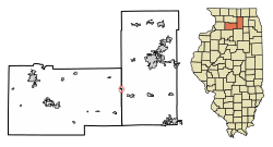 Location of Lee in DeKalb County, Illinois. | |
.svg.png) Location of Illinois in the United States | |
| Coordinates: 41°47′39″N 88°56′27″W | |
| Country | United States |
| State | Illinois |
| County | DeKalb |
| Area | |
| • Total | 0.20 sq mi (0.51 km2) |
| • Land | 0.20 sq mi (0.51 km2) |
| • Water | 0.00 sq mi (0.00 km2) |
| Population (2010) | |
| • Total | 337 |
| • Estimate (2019)[2] | 327 |
| • Density | 1,651.52/sq mi (636.54/km2) |
| Time zone | UTC-6 (CST) |
| • Summer (DST) | UTC-5 (CDT) |
| ZIP Code(s) | 60530 |
| Area code(s) | 815 & 779 |
| FIPS code | 17-42587 |
| Wikimedia Commons | Lee, Illinois |
Geography
Lee is located on the border of DeKalb and Lee counties at 41°47′39″N 88°56′27″W (41.794240, -88.940951).[3] Viking Avenue, the main street of the village, follows the county line. It is 15 miles (24 km) southeast of Rochelle and 17 miles (27 km) southwest of DeKalb.
According to the 2010 census, the village has a total area of 0.16 square miles (0.41 km2), all land.[4]
History
Lee is noted for its strong ties to Norwegian American culture. In fact, all of the streets in the village have Norwegian names. In 1974, in honor of the town's centennial, a contest was held to rename the streets and Mary Ellen Prestegaard's entry was chosen. She ran a shop in the village called the Hardanger Hus that sold Norwegian gifts. Many of the original citizens of the community came from the Hardanger region of Norway, and there are still many community members that can trace their ancestry back to that region.
Demographics
| Historical population | |||
|---|---|---|---|
| Census | Pop. | %± | |
| 1880 | 218 | — | |
| 1890 | 264 | 21.1% | |
| 1900 | 287 | 8.7% | |
| 1910 | 303 | 5.6% | |
| 1920 | 289 | −4.6% | |
| 1930 | 269 | −6.9% | |
| 1940 | 257 | −4.5% | |
| 1950 | 251 | −2.3% | |
| 1960 | 228 | −9.2% | |
| 1970 | 252 | 10.5% | |
| 1980 | 304 | 20.6% | |
| 1990 | 319 | 4.9% | |
| 2000 | 313 | −1.9% | |
| 2010 | 337 | 7.7% | |
| Est. 2019 | 327 | [2] | −3.0% |
| U.S. Decennial Census[5] | |||
At the 2000 census there were 313 people, 118 households, and 77 families in the village. The population density was 1,404.2 people per square mile (549.3/km2). There were 125 housing units at an average density of 560.8 per square mile (219.4/km2). The racial makeup of the village was 95.53% White, 0.32% Native American, 0.64% Asian, 2.24% from other races, and 1.28% from two or more races. Hispanic or Latino of any race were 2.88%.[6]
Of the 118 households 37.3% had children under the age of 18 living with them, 53.4% were married couples living together, 9.3% had a female householder with no husband present, and 33.9% were non-families. 29.7% of households were one person and 11.0% were one person aged 65 or older. The average household size was 2.65 and the average family size was 3.36.
The age distribution was 31.3% under the age of 18, 8.6% from 18 to 24, 32.3% from 25 to 44, 17.3% from 45 to 64, and 10.5% 65 or older. The median age was 31 years. For every 100 females, there were 111.5 males. For every 100 females age 18 and over, there were 115.0 males.
The median household income was $42,813 and the median family income was $55,833. Males had a median income of $37,917 versus $29,063 for females. The per capita income for the village was $19,709. About 9.8% of families and 11.5% of the population were below the poverty line, including 24.2% of those under age 18 and 12.0% of those age 65 or over.
References
- "2019 U.S. Gazetteer Files". United States Census Bureau. Retrieved July 14, 2020.
- "Population and Housing Unit Estimates". United States Census Bureau. May 24, 2020. Retrieved May 27, 2020.
- "US Gazetteer files: 2010, 2000, and 1990". United States Census Bureau. 2011-02-12. Retrieved 2011-04-23.
- "2010 Census U.S. Gazetteer Files for Places – Illinois". United States Census. Retrieved 2012-10-13.
- "Census of Population and Housing". Census.gov. Retrieved June 4, 2016.
- "U.S. Census website". United States Census Bureau. Retrieved 2008-01-31.
Municipalities and communities of DeKalb County, Illinois, United States | ||
|---|---|---|
| Cities | Map of Illinois highlighting DeKalb County | |
| Town | ||
| Villages | ||
| Townships | ||
| Unincorporated communities | ||
| Ghost towns | ||
| Footnotes | ‡This populated place also has portions in an adjacent county or counties | |
Municipalities and communities of Lee County, Illinois, United States | ||
|---|---|---|
| Cities | Map of Illinois highlighting Lee County | |
| Villages | ||
| Townships | ||
| Unincorporated communities | ||
| Footnotes | ‡This populated place also has portions in an adjacent county or counties | |