Le Dévoluy
Le Dévoluy is a commune in the Hautes-Alpes department in Provence-Alpes-Côte d'Azur region in southeastern France. It is the result of the merger, on 1 January 2013, of the four communes of Agnières-en-Dévoluy, La Cluse, Saint-Disdier, and Saint-Étienne-en-Dévoluy.
Le Dévoluy | |
|---|---|
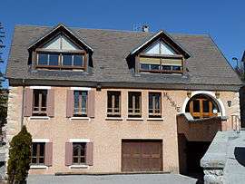 The town hall of Le Dévoluy | |
Location of Le Dévoluy 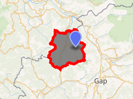
| |
 Le Dévoluy 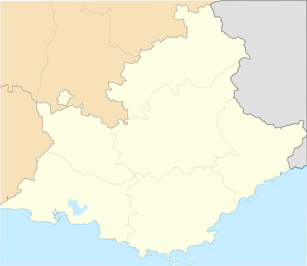 Le Dévoluy | |
| Coordinates: 44°41′36″N 5°56′31″E | |
| Country | France |
| Region | Provence-Alpes-Côte d'Azur |
| Department | Hautes-Alpes |
| Arrondissement | Gap |
| Canton | Veynes |
| Intercommunality | Buëch Dévoluy |
| Government | |
| • Mayor (2015–2020) | Jacqueline Puget |
| Area 1 | 186.37 km2 (71.96 sq mi) |
| Population (2017-01-01)[1] | 966 |
| • Density | 5.2/km2 (13/sq mi) |
| Time zone | UTC+01:00 (CET) |
| • Summer (DST) | UTC+02:00 (CEST) |
| INSEE/Postal code | 05139 /05250 |
| Elevation | 1,134–2,652 m (3,720–8,701 ft) (avg. 1,263 m or 4,144 ft) |
| 1 French Land Register data, which excludes lakes, ponds, glaciers > 1 km2 (0.386 sq mi or 247 acres) and river estuaries. | |
SuperDévoluy, a ski resort, is part of the commune.
Population
| Year | Pop. | ±% |
|---|---|---|
| 2012
2013 2014 | 1013
1011 1006 | — |
Geography
Location
Saint-Étienne-en-Dévoluy is located 28km northeast of the railroad hub of Veynes.
At 18,637 hectares, it is the second largest commune in the area, right behind Névache.
Terrain and Geology
The town covers the entirety of the Dévoluy range .
Dévoluy is known for its' numerous underground cavities, the chourums , and its' suitability for speleology.
The European larch, or common larch (Larix decidua) is particularly present in the commune.
References
- "Populations légales 2017". INSEE. Retrieved 6 January 2020.
| Wikimedia Commons has media related to Dévoluy (Hautes-Alpes). |
This article is issued from Wikipedia. The text is licensed under Creative Commons - Attribution - Sharealike. Additional terms may apply for the media files.