Lake Loramie State Park
Lake Loramie State Park is a public recreation area located on the northeast side of Fort Loramie, Ohio. It occupies 407 acres (165 ha) on 1,655-acre (670 ha) Lake Loramie[3] and is operated by the Ohio Department of Natural Resources.[4]
| Lake Loramie State Park | |
|---|---|
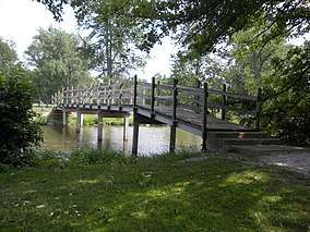 The Lake Loramie Bridge | |
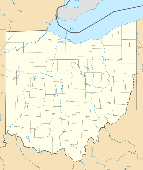 Location in Ohio | |
| Location | Shelby, Auglaize, Ohio, United States |
| Coordinates | 40°22′20″N 84°20′16″W[1] |
| Area | 407 acres (165 ha) |
| Elevation | 958 ft (292 m)[1] |
| Established | 1949[2] |
| Governing body | Ohio Department of Natural Resources |
| Website | Lake Loramie State Park |
History
Lake Loramie was named after French-Canadian trader Pierre-Louis de Lorimier (Anglicized to Peter Loramie), who established a trading post at the mouth of Loramie Creek in 1769. Lake Loramie was constructed in 1844–45 as a storage reservoir supplying water to the Miami-Erie Canal system. In 1949, Lake Loramie was turned over the Division of Parks and Recreation of the Ohio Department of Natural Resources.[2]
Recreation
The park offers fishing and boating. Crappie, bluegill, channel catfish, bullheads, carp and largemouth bass can be found in the lake. Camping facilities include electric sites, rent-a-camp sites, and cabins.[5]
Activities and amenities
- "Lake Loramie State Park". Geographic Names Information System. United States Geological Survey.
- "Lake Loramie State Park: History". Ohio Department of Natural Resources. Retrieved November 16, 2017.
- "Lake Loramie". Ohio Department of Natural Resources Division of Wildlife. Retrieved November 16, 2017.
- "Lake Loramie State Park". Ohio Department of Natural Resources. Retrieved November 16, 2017.
- "Lake Loramie State Park: Activities". Ohio Department of Natural Resources. Retrieved November 16, 2017.
External links
- Lake Loramie State Park Ohio Department of Natural Resources
- Lake Loramie State Park Map Ohio Department of Natural Resources
| Wikimedia Commons has media related to Lake Loramie State Park. |
| Wikivoyage has a travel guide for Ohio State Parks that includes Lake Loramie State Park. |