Auglaize County, Ohio
Auglaize County /ˈɔːɡleɪz/[2] is a county located in the northwestern portion of the U.S. state of Ohio. As of the 2010 census, the population was 45,949.[3] Its county seat is Wapakoneta.[4]
Auglaize County | |
|---|---|
 County courthouse in Wapakoneta | |
 Seal | |
 Location within the U.S. state of Ohio | |
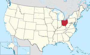 Ohio's location within the U.S. | |
| Coordinates: 40°34′N 84°13′W | |
| Country | |
| State | |
| Founded | February 14, 1848[1] |
| Named for | Auglaize River |
| Seat | Wapakoneta |
| Largest city | Wapakoneta |
| Area | |
| • Total | 402 sq mi (1,040 km2) |
| • Land | 401 sq mi (1,040 km2) |
| • Water | 0.5 sq mi (1 km2) 0.1%% |
| Population | |
| • Estimate (2019) | 45,656 |
| • Density | 114/sq mi (44/km2) |
| Time zone | UTC−5 (Eastern) |
| • Summer (DST) | UTC−4 (EDT) |
| Congressional district | 4th |
| Website | www |
The county is named for the Auglaize River. Some sources say it is a corruption of the French description of the clay (glaise) water (eau),[5] whereas others say it comes from a Native American word meaning 'fallen timbers'.[1][6] Another weak possibility according to Lakehistory.info is that it could have been the French term la glace [*aux glaces?], which means 'mirror', or 'ice' ['at the ices'?].[7]
There is something to be said for the unattested eau glaise 'clay water' (as if 'dirty water'), like attested terre glaise 'clay soil', but both Ramsey[8] and Stewart[9] agree that Auglaize (and variants, implying "*aux glaises") is American French for 'at the lick(s)', literally 'at the clays', where wild beasts came to lick salt and minerals from the soil, and fulfilling the lacuna in standard French for a "salt lick." The spelling "glaize" is archaic (as in Cotgrave's French-English dictionary of 1611). In addition, in Arkansas there is a creek and mountain Glazypeau, from French glaise à Paul 'Paul's lick'. The assumed indigenous American (Algonquian) "'fallen timbers' or 'overgrown with brush'" has no support without any attested etymons supplied and would not match phonetically in the case of Shawnee.
Auglaize County comprises the Wapakoneta, OH Micropolitan Statistical Area, which is also included in the Lima-Van Wert-Celina, OH Combined Statistical Area.
Geography
According to the U.S. Census Bureau, the county has a total area of 402 square miles (1,040 km2), of which 401 square miles (1,040 km2) is land and 0.5 square miles (1.3 km2) (0.1%) is water.[10] It is the second-smallest county in Ohio by total area.
The county is crossed by the Auglaize River and the Miami and Erie Canal. The headwaters of the Saint Marys River, the Great Miami River and the Scioto River as well as portions of Grand Lake St. Marys and Lake Loramie are located within the county.[11]
Adjacent counties
- Allen County - north
- Hardin County - east
- Logan County - southeast
- Shelby County - south
- Darke County - southwest
- Mercer County - west
- Van Wert County - northwest
Demographics
| Historical population | |||
|---|---|---|---|
| Census | Pop. | %± | |
| 1850 | 11,338 | — | |
| 1860 | 17,187 | 51.6% | |
| 1870 | 20,041 | 16.6% | |
| 1880 | 25,444 | 27.0% | |
| 1890 | 28,100 | 10.4% | |
| 1900 | 31,192 | 11.0% | |
| 1910 | 31,246 | 0.2% | |
| 1920 | 29,527 | −5.5% | |
| 1930 | 28,034 | −5.1% | |
| 1940 | 28,037 | 0.0% | |
| 1950 | 30,637 | 9.3% | |
| 1960 | 36,147 | 18.0% | |
| 1970 | 38,602 | 6.8% | |
| 1980 | 42,554 | 10.2% | |
| 1990 | 44,585 | 4.8% | |
| 2000 | 46,611 | 4.5% | |
| 2010 | 45,949 | −1.4% | |
| Est. 2019 | 45,656 | [12] | −0.6% |
| U.S. Decennial Census[13] 1790-1960[14] 1900-1990[15] 1990-2000[16] 2010-2019[3] | |||
2000 census
As of the census[17] of 2000, there were 46,611 people, 17,376 households, and 12,771 families residing in the county. The population density was 116 people per square mile (45/km²). There were 18,470 housing units at an average density of 46 per square mile (18/km²). The racial makeup of the county was 98.12% White, 0.24% Black or African American, 0.18% Native American, 0.41% Asian, 0.03% Pacific Islander, 0.20% from other races, and 0.83% from two or more races. 0.67% of the population were Hispanic or Latino of any race. 59.5% were of German, 10.9% American, 6.9% Irish and 6.3% English ancestry according to Census 2000. 97.9% spoke English and 1.2% Spanish as their first language.
There were 17,376 households out of which 35.30% had children under the age of 18 living with them, 62.10% were married couples living together, 7.80% had a female householder with no husband present, and 26.50% were non-families. 23.30% of all households were made up of individuals and 10.50% had someone living alone who was 65 years of age or older. The average household size was 2.62 and the average family size was 3.11.
In the county, the population was spread out with 27.60% under the age of 18, 7.80% from 18 to 24, 28.20% from 25 to 44, 22.00% from 45 to 64, and 14.40% who were 65 years of age or older. The median age was 36 years. For every 100 females, there were 96.50 males. For every 100 females age 18 and over, there were 93.10 males.
The median income for a household in the county was $43,367, and the median income for a family was $50,024. Males had a median income of $37,024 versus $23,809 for females. The per capita income for the county was $19,593. About 4.90% of families and 6.20% of the population were below the poverty line, including 7.20% of those under age 18 and 6.40% of those age 65 or over.
2010 census
As of the 2010 United States Census, there were 45,949 people, 17,972 households, and 12,749 families residing in the county.[18] The population density was 114.5 inhabitants per square mile (44.2/km2). There were 19,585 housing units at an average density of 48.8 per square mile (18.8/km2).[19] The racial makeup of the county was 97.8% white, 0.4% Asian, 0.3% black or African American, 0.2% American Indian, 0.3% from other races, and 0.9% from two or more races. Those of Hispanic or Latino origin made up 1.2% of the population.[18] In terms of ancestry, 53.0% were German, 12.6% were Irish, 8.9% were American, and 8.0% were English.[20]
Of the 17,972 households, 32.8% had children under the age of 18 living with them, 57.9% were married couples living together, 8.5% had a female householder with no husband present, 29.1% were non-families, and 25.3% of all households were made up of individuals. The average household size was 2.53 and the average family size was 3.02. The median age was 40.0 years.[18]
The median income for a household in the county was $52,018 and the median income for a family was $60,318. Males had a median income of $44,267 versus $30,591 for females. The per capita income for the county was $25,290. About 5.8% of families and 7.2% of the population were below the poverty line, including 9.5% of those under age 18 and 4.6% of those age 65 or over.[21]
Politics
Prior to 1920, Auglaize County consistently voted for Democratic Party candidates in presidential elections. From 1920 onward, Democrats have only won the county three times total in presidential elections, all in years where the party won nationally by a landslide.
| Year | Republican | Democratic | Third parties |
|---|---|---|---|
| 2016 | 78.4% 18,658 | 16.7% 3,980 | 4.9% 1,156 |
| 2012 | 73.2% 17,169 | 24.9% 5,831 | 1.9% 449 |
| 2008 | 69.7% 16,414 | 28.6% 6,738 | 1.7% 407 |
| 2004 | 73.9% 17,016 | 25.6% 5,903 | 0.5% 115 |
| 2000 | 69.2% 13,770 | 28.0% 5,564 | 2.8% 558 |
| 1996 | 51.8% 10,169 | 33.9% 6,652 | 14.3% 2,811 |
| 1992 | 51.5% 10,455 | 24.4% 4,960 | 24.1% 4,891 |
| 1988 | 73.4% 13,562 | 25.7% 4,756 | 0.9% 161 |
| 1984 | 77.7% 14,766 | 21.6% 4,102 | 0.7% 132 |
| 1980 | 65.3% 11,537 | 28.4% 5,022 | 6.2% 1,098 |
| 1976 | 61.2% 9,772 | 36.6% 5,840 | 2.2% 353 |
| 1972 | 69.8% 11,900 | 27.1% 4,617 | 3.1% 530 |
| 1968 | 57.0% 9,368 | 33.7% 5,550 | 9.3% 1,529 |
| 1964 | 48.0% 7,954 | 52.0% 8,632 | |
| 1960 | 64.0% 11,183 | 36.0% 6,282 | |
| 1956 | 72.1% 11,453 | 27.9% 4,438 | |
| 1952 | 67.3% 10,599 | 32.7% 5,149 | |
| 1948 | 54.5% 6,818 | 45.3% 5,670 | 0.3% 34 |
| 1944 | 64.8% 8,980 | 35.3% 4,888 | |
| 1940 | 61.1% 8,953 | 38.9% 5,704 | |
| 1936 | 38.6% 5,526 | 54.8% 7,835 | 6.6% 944 |
| 1932 | 38.2% 5,039 | 60.8% 8,036 | 1.0% 135 |
| 1928 | 60.9% 7,794 | 38.7% 4,954 | 0.4% 50 |
| 1924 | 51.9% 5,507 | 37.2% 3,952 | 10.9% 1,159 |
| 1920 | 57.5% 6,752 | 40.8% 4,792 | 1.8% 208 |
| 1916 | 38.5% 2,763 | 57.5% 4,124 | 4.0% 288 |
| 1912 | 21.0% 1,401 | 55.8% 3,726 | 23.2% 1,549 |
| 1908 | 38.6% 3,001 | 59.4% 4,622 | 2.1% 161 |
| 1904 | 44.6% 3,049 | 53.0% 3,619 | 2.4% 163 |
| 1900 | 37.1% 2,895 | 61.6% 4,812 | 1.3% 99 |
| 1896 | 36.8% 2,900 | 62.6% 4,939 | 0.7% 52 |
| 1892 | 33.7% 2,113 | 60.2% 3,774 | 6.2% 386 |
| 1888 | 35.6% 2,212 | 63.1% 3,928 | 1.3% 83 |
| 1884 | 34.2% 2,026 | 65.6% 3,882 | 0.2% 14 |
| 1880 | 33.7% 1,837 | 66.0% 3,599 | 0.3% 15 |
| 1876 | 29.9% 1,521 | 70.0% 3,560 | 0.1% 6 |
| 1872 | 31.1% 1,180 | 66.9% 2,535 | 2.0% 77 |
| 1868 | 31.4% 1,266 | 68.5% 2,754 | |
| 1864 | 33.1% 1,180 | 66.8% 2,377 | |
| 1860 | 36.0% 1,088 | 60.9% 1,836 | 3.0% 91 |
| 1856 | 35.0% 912 | 61.6% 1,604 | 3.3% 88 |
Government

Auglaize County is governed by an elected Board of Commissioners.
Courthouse
The county's first courthouse, built in 1851 at a cost of $11,499, was in use until 1894, when the current Courthouse first opened to the public. Occupying an entire city block, the Courthouse and its adjacent powerhouse cost the then-princely sum of $259,481.00. Some 85 men took 18 months for its construction, commencing on July 2, 1893. Built of Berea sandstone with tile floors, the Courthouse was highly fire-resistant. The boilers for heating and power generation, a significant cause of fire at the time, were located in a separate powerhouse. Also there were the steam-driven dynamos that produced the electricity which, along with steam for heating and hot water, was fed to the building via an underground conduit. The Courthouse marked its centennial in 1994, and continues in its role as seat of the county's courts,[23] along with the much newer West Municipal Court in St. Mary's.[24]
Economy
Auglaize County's economy is based in manufacturing.[25] Employers with more than 400 employees are Crown Equipment Corporation, Joint Township District Memorial Hospital, the Minster Machine Company, Setex, Inc, AAP-St. Mary's Corporation (a division of Hitachi Metals), Veyance Technologies, Inc (Goodyear Tire and Rubber Company), and the Dannon Company.[26]
Communities

Cities
- Saint Marys
- Wapakoneta (county seat)
Villages
Census-designated places
Unincorporated communities
Ghost towns
- Bay
- Pusheta Town
- Rineharts
References
- "Ohio County Profiles: Auglaize County" (PDF). Ohio Department of Development. Archived from the original (PDF) on June 21, 2007. Retrieved April 28, 2007.
- A Pronunciation Guide to places in Ohio
- "State & County QuickFacts". United States Census Bureau. Retrieved April 19, 2020.
- "Find a County". National Association of Counties. Archived from the original on May 31, 2011. Retrieved June 7, 2011.
- Auglaize County, Ohio 2006 Highway Map Archived September 28, 2007, at the Wayback Machine Auglaize County Engineer's Office, 2006. Accessed July 15, 2007.
- "Auglaize County data". Ohio State University Extension Data Center. Retrieved April 28, 2007.
- The Trouble with French
- Robert L. Ramsay: Our storehouse of Missouri place names, Columbia, Mo., 1973, University of Missouri Press
- George R. Stewart: American place-names, NY, 1970, Oxford University Press
- "2010 Census Gazetteer Files". United States Census Bureau. August 22, 2012. Archived from the original on May 4, 2014. Retrieved February 7, 2015.
- DeLorme. Ohio Atlas & Gazetteer. 7th ed. Yarmouth: DeLorme, 2004, p. 45. ISBN 0-89933-281-1.
- "Population and Housing Unit Estimates". Retrieved March 26, 2020.
- "U.S. Decennial Census". United States Census Bureau. Retrieved February 7, 2015.
- "Historical Census Browser". University of Virginia Library. Retrieved February 7, 2015.
- Forstall, Richard L., ed. (March 27, 1995). "Population of Counties by Decennial Census: 1900 to 1990". United States Census Bureau. Retrieved February 7, 2015.
- "Census 2000 PHC-T-4. Ranking Tables for Counties: 1990 and 2000" (PDF). United States Census Bureau. April 2, 2001. Retrieved February 7, 2015.
- "U.S. Census website". United States Census Bureau. Retrieved January 31, 2008.
- "DP-1 Profile of General Population and Housing Characteristics: 2010 Demographic Profile Data". United States Census Bureau. Archived from the original on February 13, 2020. Retrieved December 27, 2015.
- "Population, Housing Units, Area, and Density: 2010 - County". United States Census Bureau. Archived from the original on February 13, 2020. Retrieved December 27, 2015.
- "DP02 SELECTED SOCIAL CHARACTERISTICS IN THE UNITED STATES – 2006-2010 American Community Survey 5-Year Estimates". United States Census Bureau. Archived from the original on February 13, 2020. Retrieved December 27, 2015.
- "DP03 SELECTED ECONOMIC CHARACTERISTICS – 2006-2010 American Community Survey 5-Year Estimates". United States Census Bureau. Archived from the original on February 13, 2020. Retrieved December 27, 2015.
- Leip, David. "Dave Leip's Atlas of U.S. Presidential Elections". uselectionatlas.org. Retrieved May 1, 2018.
- "History of the Auglaize County Courthouse" Archived May 17, 2008, at the Wayback Machine, Auglaize County official site.
- Auglaize County official site.
- WhyWapakoneta.com
- Ohio County Profiles Archived June 21, 2007, at the Wayback Machine
- Auglaize County Engineer's Office. Official Highway Map 2004. Wapakoneta, Ohio: The Office, 2004.
External links
| Wikimedia Commons has media related to Auglaize County, Ohio. |
| Wikivoyage has a travel guide for Auglaize County. |
- Official Auglaize County website
- Auglaize County Historical Society
- Auglaize and Mercer County Convention and Visitor's Bureau
Places adjacent to Auglaize County, Ohio | ||||||||||
|---|---|---|---|---|---|---|---|---|---|---|
| ||||||||||
Municipalities and communities of Auglaize County, Ohio, United States | ||
|---|---|---|
| Cities | Map of Ohio highlighting Auglaize County | |
| Villages | ||
| Townships | ||
| CDPs | ||
| Unincorporated communities | ||
| Ghost towns |
| |
| Footnotes | ‡This populated place also has portions in an adjacent county or counties | |
.svg.png)
| Authority control |
|
|---|