Lablachère
Lablachère is a commune in the Ardèche department in southern France.
Lablachère | |
|---|---|
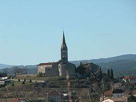 The church in Lablachère | |
Location of Lablachère 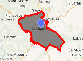
| |
 Lablachère  Lablachère | |
| Coordinates: 44°27′52″N 4°12′54″E | |
| Country | France |
| Region | Auvergne-Rhône-Alpes |
| Department | Ardèche |
| Arrondissement | Largentière |
| Canton | Les Cévennes ardéchoises |
| Government | |
| • Mayor (2008–2014) | Jean-Pierre Laporte |
| Area 1 | 26.38 km2 (10.19 sq mi) |
| Population (2017-01-01)[1] | 2,143 |
| • Density | 81/km2 (210/sq mi) |
| Time zone | UTC+01:00 (CET) |
| • Summer (DST) | UTC+02:00 (CEST) |
| INSEE/Postal code | 07117 /07230 |
| Elevation | 160–451 m (525–1,480 ft) (avg. 289 m or 948 ft) |
| 1 French Land Register data, which excludes lakes, ponds, glaciers > 1 km2 (0.386 sq mi or 247 acres) and river estuaries. | |
Population
| Year | Pop. | ±% |
|---|---|---|
| 1793 | 1,827 | — |
| 1800 | 1,752 | −4.1% |
| 1806 | 1,807 | +3.1% |
| 1821 | 2,312 | +27.9% |
| 1831 | 2,865 | +23.9% |
| 1836 | 2,780 | −3.0% |
| 1841 | 2,981 | +7.2% |
| 1846 | 2,836 | −4.9% |
| 1851 | 2,944 | +3.8% |
| 1856 | 2,861 | −2.8% |
| 1861 | 2,675 | −6.5% |
| 1866 | 2,528 | −5.5% |
| 1872 | 2,519 | −0.4% |
| 1876 | 2,276 | −9.6% |
| 1881 | 1,996 | −12.3% |
| 1886 | 2,029 | +1.7% |
| 1891 | 1,928 | −5.0% |
| 1896 | 1,891 | −1.9% |
| 1901 | 1,869 | −1.2% |
| 1906 | 1,872 | +0.2% |
| 1911 | 1,690 | −9.7% |
| 1921 | 1,558 | −7.8% |
| 1926 | 1,457 | −6.5% |
| 1931 | 1,530 | +5.0% |
| 1936 | 1,554 | +1.6% |
| 1946 | 1,400 | −9.9% |
| 1954 | 1,338 | −4.4% |
| 1962 | 1,250 | −6.6% |
| 1968 | 1,270 | +1.6% |
| 1975 | 1,277 | +0.6% |
| 1982 | 1,392 | +9.0% |
| 1990 | 1,562 | +12.2% |
| 1999 | 1,520 | −2.7% |
| 2008 | 1,815 | +19.4% |
See also
References
- "Populations légales 2017". INSEE. Retrieved 6 January 2020.
| Wikimedia Commons has media related to Lablachère. |
This article is issued from Wikipedia. The text is licensed under Creative Commons - Attribution - Sharealike. Additional terms may apply for the media files.