Kushinagar district
Kushinagar is a district of the state of Uttar Pradesh in India situated in the easternmost part of the state. It has the administrative headquarters at Ravindra Nagar Dhoos in Padrauna. The district is named such after the town Kushinagar, a Buddhist pilgrimage site where Gautama Buddha attained parinirvana in the 5th century BCE. Since the independence of India, Kushinagar district was a part of Deoria District and came into existence on 13 May 1994 as a separate district division. It was earlier known as Padrauna and thereafter was renamed Kushinagar on 19 June 1997.[1]
Kushinagar district Padrauna | |
|---|---|
District of Uttar Pradesh | |
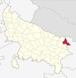 Location of Kushinagar district in Uttar Pradesh | |
| Country | India |
| State | Uttar Pradesh |
| Division | Gorakhpur |
| Established as Padrauna | 13th May 1994 |
| Name Changed from Padrauna to Kushinagar | 19 June 1997 |
| Headquarters | Padrauna |
| Tehsils | Padrauna Sadar, Khadda, Kushinagar/Kasia, Hata, Tamkuhiraj, Captanganj |
| Government | |
| • Member of Parliament (Kushinagar) | Vijay Kumar Dubey |
| • Lok Sabha constituencies | Kushinagar |
| • Vidhan Sabha constituencies | Padrauna Sadar, Khadda, Ramkola, Hata, Fazilnagar, Tamkuhiraj, Kushinagar |
| Area | |
| • Total | 2,873.5 km2 (1,109.5 sq mi) |
| Population (2011) | |
| • Total | 3,564,544 |
| • Density | 1,200/km2 (3,200/sq mi) |
| • Urban | 4.87 per cent |
| Demographics | |
| • Literacy | 67.66 per cent |
| • Sex ratio | 955 |
| Time zone | UTC+05:30 (IST) |
| Vehicle registration | UP 57 |
| Major highways | NH 27 and NH 727 (previously NH 28 and NH 28B) |
| Website | kushinagar |
District Officers | |
|---|---|
| Government | |
| • D.M. | Bhupendra S. Chaudhary |
| • A.D.M | Vindhyavasini Rai |
Location
Kushinagar District is bounded on the east by Bihar state, on the southwest by Deoria District, on the west by Gorakhpur District, and on the northwest by Maharajganj District. It is part of Gorakhpur Division.
Economy
In 2006 the Ministry of Panchayati Raj named Kushinagar one of the country's 250 most backward districts (out of a total of 640).[2] It is one of the 34 districts in Uttar Pradesh currently receiving funds from the Backward Regions Grant Fund Programme (BRGF).[2] It had as many as 12 sugar mills but most of them are defunct now forcing the local population to flee in search of jobs. There are no industries and people are mostly based on agriculture. Almost half of the population works in different places. There are very few or no jobs available. The current position of this district has been due to mix of issues such as politicians, bogus agitations, attitude of people towards politicians. But mainly due to its politicians negligence. Most of the MPs(past and current including) have been totally at backfoot when it comes to problems faced by the people. The last two MPs of Deoria has been outsiders only, who know nothing about the local problems. They just come for visits in marriage functions and even then people vote them.(Deoria loksabha constituency also covers three subdivisions(Tehsil) of Kushinagar.)
Transport
The Indian Government has approved a project for the construction of an International Airport which would be completed till 2019. The case of international airport has been pending since 1994 and would be a matter of pride and source of income for the nearby people. It was proposed as a part of Maitreya Project by The Maitreya Project Trust. Several state governments came and promised to start the airport at the earliest but that became an election gimmick only. This project is an extreme example of Indian way of stalling great things. Each government had its own reasons to not start this airport. It is believed that Mayawati was most concerned Chief Minister till date who had the will to start this airport, but she faced agitation from local politicians and hence shelved ghe project. Then came SP government(local politician who opposed it got elected and government was not willing to take up this project, but at the end of his term Akhilesh Yadav made an announcement to revive the International Airport. But then he lost and came Mr. Yogi Adityanath and since he hails from nearby Gorakhapur so his main aim was to move this international airport to Gorakhpur. It is believed in local population that this government is making full efforts to stall this project, because if this airport gets started and gets International status then a nearby airport cannot get it and hence Gorakhapur would be at a disadvantage being a larger city. In 2017, Uttar Pradesh Government has approved a project to develop Kushinagar bus station as an International Bus Station. Daily Buses from Gorakhpur to Tamkuhi Road and Gorakhpur to Padrauna through Kasia are available at Railway Station Bus Depot Gorakhpur.
Padrauna, Ramkola, Kaptanganj, Dudahi and Tamkuhi Road are some cities connected with train facility in the district.
Demographics
According to the 2011 census Kushinagar district has a population of 3,564,544,[3] roughly equal to the nation of Lithuania[4] or the US state of Connecticut.[5] This gives it a ranking of 81st in India (out of a total of 640).[3] The district has a population density of 1,226 inhabitants per square kilometre (3,180/sq mi).[3] Its population growth rate over the decade 2001-2011 was 23.08%.[3] Kushinagar has a sex ratio of 955 females for every 1000 males,[3] and a literacy rate of 67.66%.[3] According to 2011 Census, 99.49% of the population in the district spoke Hindi and 0.46% Urdu as their first language.[6]
| Year | Pop. | ±% p.a. |
|---|---|---|
| 1901 | 738,315 | — |
| 1911 | 804,023 | +0.86% |
| 1921 | 820,780 | +0.21% |
| 1931 | 876,462 | +0.66% |
| 1941 | 977,561 | +1.10% |
| 1951 | 1,043,419 | +0.65% |
| 1961 | 1,184,272 | +1.27% |
| 1971 | 1,401,482 | +1.70% |
| 1981 | 1,746,618 | +2.23% |
| 1991 | 2,255,120 | +2.59% |
| 2001 | 2,891,667 | +2.52% |
| 2011 | 3,564,544 | +2.11% |
| source:[7] | ||
References
- "2011 Census - Kushinagar district" (PDF). Retrieved 12 April 2019.
- Ministry of Panchayati Raj (8 September 2009). "A Note on the Backward Regions Grant Fund Programme" (PDF). National Institute of Rural Development. Archived from the original (PDF) on 5 April 2012. Retrieved 27 September 2011.
- "District Census 2011". Census2011.co.in. 2011. Retrieved 30 September 2011.
- US Directorate of Intelligence. "Country Comparison:Population". Retrieved 1 October 2011.
Lithuania 3,535,547 July 2011 est.
- "2010 Resident Population Data". U. S. Census Bureau. Archived from the original on 19 October 2013. Retrieved 30 September 2011.
Connecticut 3,574,097
- "C-16 Population By Mother Tongue - Uttar Pradesh". censusindia.gov.in. Retrieved 23 September 2019.
- Decadal Variation In Population Since 1901
Maitreya Project (http://mbpkushinagar.org)
External links
| Wikimedia Commons has media related to Kushinagar district. |
http://mbpkushinagar.org
Places adjacent to Kushinagar district | ||||||||||
|---|---|---|---|---|---|---|---|---|---|---|
| ||||||||||
| Authority control |
|
|---|