Kentucky Route 22
Kentucky Route 22 (KY 22) is a 121.213-mile-long (195.073 km) east–west highway running from the eastern suburbs of Louisville to an unincorporated place called Willow in Bracken County in Northern Kentucky.
| ||||
|---|---|---|---|---|
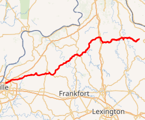
KY 22 highlighted in red | ||||
| Route information | ||||
| Maintained by KYTC | ||||
| Length | 121.213 mi[1] (195.073 km) | |||
| Major junctions | ||||
| West end | ||||
| ||||
| East end | ||||
| Location | ||||
| Counties | Jefferson, Oldham, Henry, Owen, Grant, Pendleton, Bracken | |||
| Highway system | ||||
| ||||

Route 22 has a short 0.332-mile (0.534 km) business route in Dry Ridge, an area which has become a commercial center as an I-75 exit.
It begins at US 42 at the city limit of a Louisville suburb called Northfield, Kentucky, and carries the name Brownsboro Road, a local road which begins near Downtown Louisville. It crosses the Kentucky River west of Gratz and terminates at Kentucky Route 10 in Willow.
Major intersections
| County | Location | mi[1] | km | Destinations | Notes |
|---|---|---|---|---|---|
| Jefferson | Louisville | 0.000 | 0.000 | ||
| 0.066 | 0.106 | Brownsboro Road | Former KY 22 west | ||
| 0.428 | 0.689 | Northern terminus of KY 2050 | |||
| 0.927 | 1.492 | Former KY 22 west | |||
| 3.704 | 5.961 | Northern terminus of KY 1747 | |||
| 4.068– 4.272 | 6.547– 6.875 | I-265 exit 34 | |||
| 4.827 | 7.768 | Southern terminus of KY 1694 | |||
| Oldham | Peewee Valley | 8.550 | 13.760 | ||
| Crestwood | 9.982 | 16.064 | Eastern terminus of KY 329 | ||
| 10.230 | 16.464 | West end of KY 146 overlap | |||
| 10.269 | 16.526 | East end of KY 146 overlap | |||
| 10.660 | 17.156 | Eastern terminus of KY 329 bypass | |||
| | 11.993 | 19.301 | Northern terminus of KY 2858 | ||
| Centerfield | 13.805 | 22.217 | West end of KY 393 overlap | ||
| | 14.760 | 23.754 | East end of KY 393 overlap | ||
| | 16.179 | 26.038 | Northern terminus of KY 2859 | ||
| Ballardsville | 17.717 | 28.513 | West end of KY 53 overlap | ||
| | 18.190 | 29.274 | East end of KY 53 overlap | ||
| Henry | | 21.536 | 34.659 | Western terminus of KY 1861 | |
| | 24.658 | 39.683 | |||
| Eminence | 28.011 | 45.079 | Southern terminus of KY 3323 | ||
| 28.605 | 46.035 | West end of KY 55 overlap | |||
| 28.707 | 46.199 | East end of KY 55 overlap | |||
| | 30.180 | 48.570 | Northern terminus of KY 1359 | ||
| | 30.897 | 49.724 | West end of US 421 concurrency | ||
| Pleasureville | 33.454 | 53.839 | |||
| 33.469 | 53.863 | East end of US 421 concurrency | |||
| | 36.876 | 59.346 | West end of KY 573 overlap | ||
| Bethlehem | 37.233 | 59.921 | East end of KY 573 overlap | ||
| | 40.368 | 64.966 | Southern terminus of KY 1360 | ||
| | 45.926 | 73.911 | |||
| Kentucky River | 46.209– 46.380 | 74.366– 74.641 | Gratz Bridge | ||
| Owen | Gratz | 46.622 | 75.031 | West end of KY 355 overlap | |
| 46.839 | 75.380 | East end of KY 355 overlap | |||
| | 50.007 | 80.478 | Western terminus of KY 3548 | ||
| | 52.123 | 83.884 | Eastern terminus of KY 1982 | ||
| | 53.719 | 86.452 | Southern terminus of KY 3215 | ||
| Owenton | 54.838 | 88.253 | Northern terminus of KY 1670 | ||
| 55.094 | 88.665 | Southern terminus of KY 1761 | |||
| 55.511 | 89.336 | Southern terminus of KY 2354 | |||
| 55.779 | 89.768 | West end of US 127/KY 227 concurrency | |||
| 55.851 | 89.883 | Southern terminus of KY 1287 | |||
| 56.343 | 90.675 | East end of US 127 concurrency | |||
| 57.422 | 92.412 | Northern terminus of KY 3549 | |||
| 57.928 | 93.226 | East end of KY 227 overlap | |||
| | 68.429 | 110.126 | Northern terminus of KY 1287 | ||
| Sweet Owen | 69.690 | 112.155 | West end of KY 845 overlap | ||
| | 70.540 | 113.523 | East end of KY 845 overlap | ||
| Needmore | 72.128 | 116.079 | Northern terminus of KY 3096 | ||
| Grant | Holbrook | 73.976 | 119.053 | Western terminus of KY 1993 | |
| Twin Bridges | 76.822 | 123.633 | Western terminus of KY 2937 | ||
| Four Corners | 79.104 | 127.306 | |||
| Dry Ridge | 84.094 | 135.336 | West end of KY 467 overlap | ||
| 84.435– 84.498 | 135.885– 135.986 | I-75 exit 159 | |||
| 84.771 | 136.426 | Western terminus of KY 22 business route | |||
| 85.080 | 136.923 | West end of US 25 concurrency | |||
| 86.274 | 138.845 | East end of KY 467 overlap | |||
| 87.388 | 140.637 | ||||
| Williamstown | 88.279 | 142.071 | Southern terminus of US 25 business route | ||
| 89.062 | 143.331 | Eastern terminus of KY 1560 | |||
| 90.118 | 145.031 | Southern terminus of KY 3025 | |||
| 90.377 | 145.448 | East end of US 25 concurrency | |||
| 92.056 | 148.150 | Southern terminus of KY 489 | |||
| Pendleton | | 96.137 | 154.718 | Northern terminus of KY 1054 | |
| | 104.568 | 168.286 | West end of US 27 concurrency | ||
| | 106.520 | 171.427 | Eastern terminus of KY 330 | ||
| Falmouth | 107.954 | 173.735 | East end of US 27 concurrency | ||
| 109.285 | 175.877 | Southern terminus of KY 159 | |||
| 111.466 | 179.387 | Eastern terminus of KY 3173 | |||
| Bracken | | 118.267 | 190.332 | Northern terminus of KY 359 | |
| Willow | 121.213 | 195.073 | |||
1.000 mi = 1.609 km; 1.000 km = 0.621 mi
| |||||
Special routes
East Louisville connector route
| |
|---|---|
| Location | Louisville |
| Length | 0.520 mi[1] (0.837 km) |
| Existed | 2013–present |
Kentucky Route 22C is a connector route of KY 22 that links the road to U.S. Route 42 in eastern Louisville northeast of the Thornhill.
Major intersections
The entire route is in Louisville, Jefferson County.
| mi[1] | km | Destinations | Notes | ||
|---|---|---|---|---|---|
| 0.000 | 0.000 | Western terminus | |||
| 0.520 | 0.837 | Eastern terminus | |||
| 1.000 mi = 1.609 km; 1.000 km = 0.621 mi | |||||
Gratz business route
| |
|---|---|
| Location | Gratz |
| Length | 0.091 mi[1] (0.146 km) |
| Existed | 2005–present |
Kentucky Route 22 Business (KY 22 Bus.) is an unsigned business route in Gratz that runs from Main Street and Brown Street to Kentucky Routes 22 and 355. It is part of an old alignment of KY 22 that approached a bridge over the Kentucky River, which was replaced by a newer bridge further downstream in 2011.
Major intersections
The entire route is in Gratz, Owen County.
| mi[1] | km | Destinations | Notes | ||
|---|---|---|---|---|---|
| 0.000 | 0.000 | Brown Street / Main Street | Western terminus; continues as Main Street beyond Brown Street | ||
| 0.091 | 0.146 | Eastern terminus | |||
| 1.000 mi = 1.609 km; 1.000 km = 0.621 mi | |||||
Dry Ridge business route
| |
|---|---|
| Location | Dry Ridge |
| Length | 0.336 mi[1] (0.541 km) |
| Existed | 2005[2]–present |
Kentucky Route 22 Business (KY 22 Business) is a business route of KY 22 in Dry Ridge. The highway runs 0.336 miles (0.541 km) between junctions with KY 22 and US 25 Business, passing through the heart of Dry Ridge. It was formed in 2005 with the opening of the Dry Ridge Bypass, which rerouted KY 22 around the city.[2]
Major intersections
The entire route is in Dry Ridge, Grant County.
| mi[1] | km | Destinations | Notes | ||
|---|---|---|---|---|---|
| 0.000 | 0.000 | Western terminus | |||
| 0.336 | 0.541 | Eastern terminus | |||
| 1.000 mi = 1.609 km; 1.000 km = 0.621 mi | |||||
See also
- Roads in Louisville, Kentucky
References
- "Kentucky Transportation Cabinet - Division of Planning". Retrieved April 29, 2017.
- "Dry Ridge bypass may spur business". Retrieved July 16, 2014.