Jumla (town)
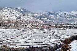
Jumla is the centre of Chandannath Municipality in Jumla District of Karnali province of Nepal. It is located at 2514 metres (8251 feet) elevation.[2]
Jumla जुम्ला | |
|---|---|
Town | |
 | |
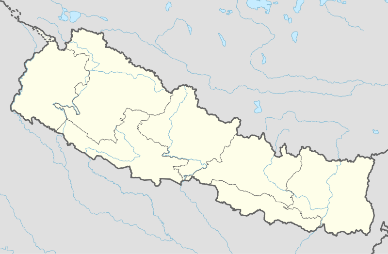 Jumla Location in Nepal | |
| Coordinates: 29°16′31″N 82°11′0″E | |
| Country | |
| Province | Karnali Pradesh[1] |
| District | Jumla District |
| Elevation | 2,514 m (8,248 ft) |
| Time zone | UTC+5:45 (Nepal Time) |
Geography
Jumla is one of the 77 districts in the midwestern hills of Nepal. Rice (Oryza sativa L) cultivation in Jumla ranges from 2,400 to 3,050 m altitude, which is the highest elevation in the world. The highest elevation at 3,050 m is Chhumjul of Jumla, a record altitude, where rice is cultivated in Nepal. Jumli Marshi, a Japonica variety of indigenous rice, having cold tolerant gene, is probably cultivated since 1,300 years ago in Jumla in the bank of the Tila river. The Tila Valley as well as the Sinja Khola Valley are covered with paddy fields growing the 'Kali Marshi' rice variety, a unique red rice that is sought after for its special taste.
Jumla has a STOL airport, Jumla Airport, and the road network first reached it from Surkhet in May 2007.[3] It is the usual starting point for treks to Rara Lake.
Climate
Jumla has a highland oceanic climate that is cooled down by its elevation. As a result, the climate retains strong diurnal temperature variation in winter and the moderation is from subtropical influence as opposed to maritime.
The highest temperature ever recorded in Jumla was 33.3 °C (91.9 °F) on 24 May 1998, while the lowest temperature ever recorded was −15.0 °C (5.0 °F) on 2 February 1975.[4]
| Climate data for Jumla (2300m) | |||||||||||||
|---|---|---|---|---|---|---|---|---|---|---|---|---|---|
| Month | Jan | Feb | Mar | Apr | May | Jun | Jul | Aug | Sep | Oct | Nov | Dec | Year |
| Average high °C (°F) | 13.9 (57.0) |
15.0 (59.0) |
18.5 (65.3) |
21.7 (71.1) |
24.1 (75.4) |
26.0 (78.8) |
25.0 (77.0) |
24.6 (76.3) |
24.2 (75.6) |
21.9 (71.4) |
18.6 (65.5) |
16.1 (61.0) |
20.8 (69.5) |
| Daily mean °C (°F) | 4.5 (40.1) |
6.0 (42.8) |
9.4 (48.9) |
12.7 (54.9) |
15.9 (60.6) |
19.4 (66.9) |
20.3 (68.5) |
20.0 (68.0) |
18.3 (64.9) |
13.1 (55.6) |
8.6 (47.5) |
5.8 (42.4) |
12.8 (55.1) |
| Average low °C (°F) | −5.0 (23.0) |
−3.1 (26.4) |
0.3 (32.5) |
3.6 (38.5) |
7.7 (45.9) |
12.9 (55.2) |
15.6 (60.1) |
15.3 (59.5) |
12.4 (54.3) |
4.2 (39.6) |
−1.5 (29.3) |
−4.5 (23.9) |
4.8 (40.7) |
| Average precipitation mm (inches) | 28.4 (1.12) |
39.4 (1.55) |
53.3 (2.10) |
42.6 (1.68) |
57.4 (2.26) |
74.1 (2.92) |
180.2 (7.09) |
174.3 (6.86) |
102.7 (4.04) |
35.3 (1.39) |
10.2 (0.40) |
13.5 (0.53) |
811.4 (31.94) |
| Source: http://www.dhm.gov.np/uploads/climatic/880251189NORMAL%20FILE.pdf | |||||||||||||
References
- "Province 6 renamed to Karnali Pradesh". Retrieved 10 March 2018.
- "redirect to /world/NP/00/Jumla2.html". www.fallingrain.com.
- .
- "Archived copy" (PDF). Archived from the original (PDF) on 4 March 2016. Retrieved 27 February 2016.CS1 maint: archived copy as title (link). Retrieved 27 February 2016.
Headquarter: Jumla | ||
| Municipalities: 1 |  | |
| Rural municipalities: 7 | ||
List of municipalities and rural municipalities of Nepal | ||