Hrebeniv
Hrebeniv (Ukrainian: Гребе́нів) – Carpathian village in the Skole Raion, Lviv Oblast of Western Ukraine.
The population of the village is about 593 people.[1] Local government is administered by Hrebenivska village council.[2]
Hrebeniv Гребенів | |
|---|---|
 Flag  Coat of arms | |
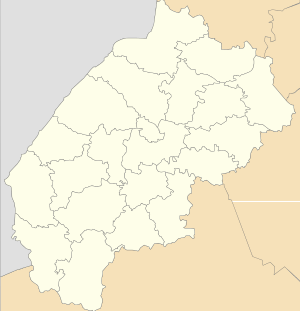 Hrebeniv | |
| Coordinates: 48°58′32″N 23°28′25″E | |
| Country | |
| Province | |
| District | |
| Established | 1100 |
| Area | |
| • Total | 1,04 km2 (40 sq mi) |
| Elevation /(average value of) | 489 m (1,604 ft) |
| Population | |
| • Total | 593 |
| • Density | 5.7/km2 (15/sq mi) |
| Time zone | UTC+2 (EET) |
| • Summer (DST) | UTC+3 (EEST) |
| Postal code | 82634 |
| Area code | +380 3251 |
| Website | село Гребенів, райцентр Сколе (Ukrainian) |
Geography
The village is located on the banks of the Opir River on the altitude of 489 metres (1,600 ft) above sea level.
That is located at a distance 4 kilometres (2.5 mi) from the Highway M06 (Ukraine) (![]()
History and Attractions
For the first time the village is mentioned in the studies of the Polish historian and ethnographer Jabłonowski [3] in 1589.[4] Although in these areas by archaeologists found the remains of many things and weapons from the 11th-12th centuries.
The tomb of Prince Svyatoslav Vladimirovich (982 – 1015) [5] is near Hrebeniv village, on the right bank of the Opir River.
The village has an architectural monumentes of local importance of Skole Raion (Skole district):
1. Church of the Annunciation of the Blessed Virgin Mary (wooden) 1928 (N- 2911 / 1M).
2. The bell tower of the church of the Annunciation of the Blessed Virgin Mary 1928 (N- 2911 / 2M).[6]
References
- Село Гребенів: карта вулиць (in Ukrainian)
- Гребенівська сільська рада (in Ukrainian)
- Jabłonowski (in Polish)
- Гребенів (in Ukrainian)
- Sviatoslav Vladimirovich Rurikid, Prince Drevlyansky
- Пам'ятки архітектури Сколівського району, с.Гребенів, 2911/1М, 2911/2M (in Ukrainian)
External links
- Життя Карпатського Народу/Гребенів, село (in Ukrainian)
- Населенні пункти Сколівського району - Гребенів (in Ukrainian)
- weather.in.ua/Hrebeniv (Lviv region)
- Гребенів/Церква Благовіщення Пр. Богородиці 1928 (in Ukrainian)
| Cities | Coat of arms of Skole Raion | |
|---|---|---|
| Settlements | ||
| Villages |
| |