Hogansville, Georgia
Hogansville is a city in Troup County, Georgia, United States. The population was 3,060 at the 2010 census. Since 1998, Hogansville has held an annual Hummingbird Festival in October. It is located approximately halfway between Atlanta and Columbus, Georgia on Interstate 85 via Interstate 185.
Hogansville, Georgia | |
|---|---|
 The East Main Street-Johnson Street Historic District was added to the National Register of Historic Places on July 14, 2000. | |
 Location in Troup County and the state of Georgia | |
| Coordinates: 33°10′12″N 84°54′33″W | |
| Country | United States |
| State | Georgia |
| County | Troup |
| Government | |
| • Type | Mayor Bill Stankiewicz |
| Area | |
| • Total | 7.40 sq mi (19.16 km2) |
| • Land | 7.32 sq mi (18.95 km2) |
| • Water | 0.08 sq mi (0.21 km2) |
| Elevation | 712 ft (217 m) |
| Population (2010) | |
| • Total | 3,060 |
| • Estimate (2019)[2] | 3,128 |
| • Density | 427.50/sq mi (165.07/km2) |
| Time zone | UTC-5 (Eastern (EST)) |
| • Summer (DST) | UTC-4 (EDT) |
| ZIP code | 30230 |
| Area code(s) | 706 |
| FIPS code | 13-39244[3] |
| GNIS feature ID | 0315520[4] |
| Website | www |
History
The community was named after William Hogan, owner of the original town site.[5]
Attractions and events
- Hogansville Hummingbird Festival, outdoor arts-and-crafts festival held the third weekend of October
- Christmas Parade, "Santa Claus and dozens of floats, both home-made and professional, our parade is small town life at its best"[6]
- Trunk or Treat, "A great Hogansville Halloween idea. Fun for kids of all ages. Proves the adage that it's better to give than receive."[6]
- Van Byars Antique Auction, a Hogansville tradition, every third Saturday throughout the year
Geography
Hogansville is located at 33°10′12″N 84°54′33″W (33.170022, -84.909146).[7] Hogansville is located along Interstate 85, which runs northeast to southwest through the city, leading northeast 50 mi (80 km) to Atlanta and southwest 98 mi (158 km) to Montgomery, Alabama. Other highways which run through the city include U.S. Route 29, Georgia State Route 54, and Georgia State Route 100.
According to the United States Census Bureau, the city has a total area of 6.7 square miles (17 km2), of which 6.6 square miles (17 km2) is land and 0.04 square miles (0.10 km2) (0.45%) is water.
Demographics
| Historical population | |||
|---|---|---|---|
| Census | Pop. | %± | |
| 1880 | 400 | — | |
| 1890 | 518 | 29.5% | |
| 1900 | 893 | 72.4% | |
| 1910 | 1,230 | 37.7% | |
| 1920 | 1,591 | 29.3% | |
| 1930 | 2,355 | 48.0% | |
| 1940 | 3,886 | 65.0% | |
| 1950 | 3,769 | −3.0% | |
| 1960 | 3,658 | −2.9% | |
| 1970 | 3,075 | −15.9% | |
| 1980 | 3,362 | 9.3% | |
| 1990 | 2,976 | −11.5% | |
| 2000 | 2,774 | −6.8% | |
| 2010 | 3,060 | 10.3% | |
| Est. 2019 | 3,128 | [2] | 2.2% |
| U.S. Decennial Census[8] | |||
As of the census[3] of 2000, there were 2,774 people, 1,099 households, and 727 families residing in the city. The population density was 418.1 people per square mile (161.3/km2). There were 1,249 housing units at an average density of 188.2 per square mile (72.6/km2). The racial makeup of the city was 55.16% White, 43.22% African American, 0.18% Native American, 0.47% Asian, 0.29% from other races, and 0.68% from two or more races. Hispanic or Latino of any race were 0.58% of the population.
There were 1,099 households, out of which 29.7% had children under the age of 18 living with them, 39.2% were married couples living together, 22.6% had a female householder with no husband present, and 33.8% were non-families. 31.4% of all households were made up of individuals, and 16.7% had someone living alone who was 65 years of age or older. The average household size was 2.49 and the average family size was 3.11.
In the city, the population was spread out, with 27.9% under the age of 18, 8.4% from 18 to 24, 25.3% from 25 to 44, 22.1% from 45 to 64, and 16.3% who were 65 years of age or older. The median age was 37 years. For every 100 females, there were 82.0 males. For every 100 females age 18 and over, there were 77.7 males.
The median income for a household in the city was $27,976, and the median income for a family was $32,979. Males had a median income of $27,028 versus $18,889 for females. The per capita income for the city was $12,592. About 10.2% of families and 12.6% of the population were below the poverty line, including 16.4% of those under age 18 and 13.9% of those age 65 or over.
Gallery
.JPG) The Royal Theater was built in 1937 and was added to the National Register of Historic Places on June 21, 2001. The building currently serves as the Hogansville City Hall.
The Royal Theater was built in 1937 and was added to the National Register of Historic Places on June 21, 2001. The building currently serves as the Hogansville City Hall. Stark Mill (pictured) and the Mill Village Historic District were added to the National Register of Historic Places on July 5, 2000.
.JPG) Built on East Main Street in the 1890s, The Grand Hotel is operated as a bed and breakfast. It is part of the East Main Street-Johnson Street Historic District.
Built on East Main Street in the 1890s, The Grand Hotel is operated as a bed and breakfast. It is part of the East Main Street-Johnson Street Historic District..JPG) Callaway High School is a public high school located in Hogansville.
Callaway High School is a public high school located in Hogansville.
Notable people
- J. M. Gates, preacher and gospel singer.
- Gar Heard, basketball player.
- Alfred Jenkins, football player.
- Derek Smith, basketball player.
- John Whelchel, football player.
- Cowboy Jimmy Moore, billiard champion.
- Ed Levy, Major League Baseball Player.
- Terry Godwin, Football Player UGA.
References
- "2019 U.S. Gazetteer Files". United States Census Bureau. Retrieved July 9, 2020.
- "Population and Housing Unit Estimates". United States Census Bureau. May 24, 2020. Retrieved May 27, 2020.
- "U.S. Census website". United States Census Bureau. Retrieved 2008-01-31.
- "US Board on Geographic Names". United States Geological Survey. 2007-10-25. Retrieved 2008-01-31.
- Krakow, Kenneth K. (1975). Georgia Place-Names: Their History and Origins (PDF). Macon, GA: Winship Press. p. 110. ISBN 0-915430-00-2.
- "Hogansville, Georgia" pamphlet
- "US Gazetteer files: 2010, 2000, and 1990". United States Census Bureau. 2011-02-12. Retrieved 2011-04-23.
- "Census of Population and Housing". Census.gov. Retrieved June 4, 2015.
- http://www.af.mil click on "About" and then "Biographies" and type in Milton Arnold's name
External links
- Official City of Hogansville Site
- Hogansville Hummingbird Festival
- Hogansville GA Welcome Center, operated by the Merchant's Association
Municipalities and communities of Troup County, Georgia, United States | ||
|---|---|---|
| Cities | 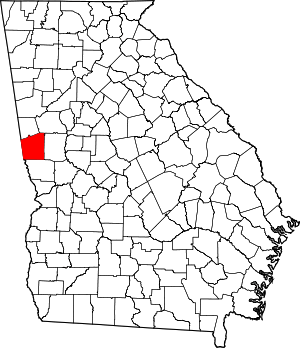 Map of Georgia highlighting Troup County | |
| Unincorporated communities | ||
| Footnotes | ‡This populated place also has portions in an adjacent county or counties | |
| Authority control |
|
|---|