High Ridge, Missouri
High Ridge is an unincorporated community and census-designated place (CDP) in Jefferson County, Missouri, United States. The population was 4,305 at the 2010 census.[3] At 927 feet (283 m) above sea level, High Ridge is the second-highest point in Jefferson County, second only to Sun Ridge, north of Hillsboro, according to data from the House Springs/Hillsboro 7.5 minute topographic quadrangles. The Beaumont Scout Reservation, a property of the Greater St. Louis Area Council, Boy Scouts of America, is 4 miles (6 km) north of High Ridge.
High Ridge, Missouri | |
|---|---|
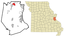 Location of High Ridge, Missouri | |
| Coordinates: 38°27′57″N 90°31′39″W | |
| Country | United States |
| State | Missouri |
| County | Jefferson |
| Area | |
| • Total | 3.80 sq mi (9.85 km2) |
| • Land | 3.80 sq mi (9.85 km2) |
| • Water | 0.0 sq mi (0.0 km2) |
| Elevation | 927 ft (283 m) |
| Population (2010) | |
| • Total | 4,305 |
| • Density | 1,132/sq mi (437.1/km2) |
| Time zone | UTC-6 (Central (CST)) |
| • Summer (DST) | UTC-5 (CDT) |
| ZIP code | 63049 |
| Area code(s) | 636 |
| FIPS code | 29-32140[1] |
| GNIS feature ID | 0736305[2] |
Geography
High Ridge is located in northern Jefferson County at 38°27′57″N 90°31′39″W (38.465787, -90.527517).[4] It is bordered to the north by Peaceful Village and Parkville. Missouri Route 30 runs through the community, leading northeast 23 miles (37 km) to downtown St. Louis and southwest 31 miles (50 km) to St. Clair.
High Ridge is a nine-armed local topographic high, capped with the Bushberg Sandstone and part of the Burlington Escarpment. The high point of the ridge is located near the Senior Center just north of High Ridge Boulevard (old Gravois/Missouri Highway 30). Flowing off this topographic high are Antire Creek, Rock Creek, Williams Creek, Saline Creek, Sugar Creek, Romaine Creek, Bear Creek, Little Antire Creek, and lesser streams. The high ground is bounded to the west by the Big River and to the west, north, and east by the Meramec River. The ridge is very cherty, and poor for conventional farming, hence the area became known for fruit trees, strawberries, blackberries, and truck farm produce which were sold in St. Louis.
According to the United States Census Bureau, the High Ridge CDP has a total area of 3.80 square miles (9.85 km2), all land.[3]
History
A post office called High Ridge has been in operation since 1856.[5] The community was so named on account of its lofty elevation.[6]
Demographics
As of the census[1] of 2000, there were 4,236 people, 1,556 households, and 1,145 families residing in the CDP. The population density was 1,061.0 people per square mile (409.9/km2). There were 1,609 housing units at an average density of 403.0/sq mi (155.7/km2). The racial makeup of the CDP was 97.78% White, 0.31% African American, 0.12% Native American, 0.40% Asian, 0.14% from other races, and 1.25% from two or more races. Hispanic or Latino of any race were 1.16% of the population.
There were 1,556 households, out of which 37.7% had children under the age of 18 living with them, 57.7% were married couples living together, 11.4% had a female householder with no husband present, and 26.4% were non-families. 20.8% of all households were made up of individuals, and 5.6% had someone living alone who was 65 years of age or older. The average household size was 2.70 and the average family size was 3.13.
In the CDP, the population was spread out, with 27.5% under the age of 18, 9.1% from 18 to 24, 33.3% from 25 to 44, 22.1% from 45 to 64, and 8.0% who were 65 years of age or older. The median age was 35 years. For every 100 females, there were 101.2 males. For every 100 females age 18 and over, there were 96.7 males.
The median income for a household in the CDP was $46,742, and the median income for a family was $50,125. Males had a median income of $36,053 versus $27,394 for females. The per capita income for the CDP was $17,959. About 4.7% of families and 5.4% of the population were below the poverty line, including 7.3% of those under age 18 and 18.9% of those age 65 or over.
Education
Northwest R-I School District operates two elementary schools at High Ridge.[7]
High Ridge has a public library, a branch of the Jefferson County Library.[8]
Notable people
- Bill Alter, Missouri state senator
- Michael Chandler, professional MMA fighter, NCAA wrestling All American (University of Missouri)
- Sarah Haskins, Olympic triathlete
References
- "U.S. Census website". United States Census Bureau. Retrieved 2008-01-31.
- "US Board on Geographic Names". United States Geological Survey. 2007-10-25. Retrieved 2008-01-31.
- "Geographic Identifiers: 2010 Census Summary File 1 (G001): High Ridge CDP, Missouri". American Factfinder. U.S. Census Bureau. Archived from the original on February 13, 2020. Retrieved August 17, 2018.
- "US Gazetteer files: 2010, 2000, and 1990". United States Census Bureau. 2011-02-12. Retrieved 2011-04-23.
- "Post Offices". Jim Forte Postal History. Retrieved 19 October 2016.
- "Jefferson County Place Names, 1928–1945 (archived)". The State Historical Society of Missouri. Archived from the original on 24 June 2016. Retrieved 19 October 2016.CS1 maint: BOT: original-url status unknown (link)
- "Northwest R-I School District". Great Schools. Retrieved 17 March 2018.
- "Our Branches". Jefferson County Library. Retrieved 17 March 2018.
Municipalities and communities of Jefferson County, Missouri, United States | ||
|---|---|---|
| Cities |  Map of Missouri highlighting Jefferson County | |
| Villages | ||
| Townships | ||
| CDPs | ||
| Unincorporated communities | ||