Greenfield, New York
Greenfield is a town in Saratoga County, New York, United States. The population was 7,362 at the 2000 census. The town is named after Greenfield, New Hampshire. It is located northwest of Saratoga Springs, which it borders, and students living in Greenfield attend schools of the Saratoga Springs City School District.
Greenfield, New York | |
|---|---|
Town | |
 Greenfield, New York Location within the state of New York | |
| Coordinates: 43°7′20″N 73°52′18″W | |
| Country | United States |
| State | New York |
| County | Saratoga |
| Area | |
| • Total | 67.69 sq mi (175.31 km2) |
| • Land | 67.39 sq mi (174.54 km2) |
| • Water | 0.30 sq mi (0.77 km2) |
| Elevation | 591 ft (180 m) |
| Population (2010) | |
| • Total | 7,775 |
| • Estimate (2016)[2] | 7,737 |
| • Density | 114.81/sq mi (44.33/km2) |
| Time zone | UTC-5 (Eastern (EST)) |
| • Summer (DST) | UTC-4 (EDT) |
| ZIP code | 12833 |
| Area code(s) | 518 |
| FIPS code | 36-30444 |
| GNIS feature ID | 0979019 |
| Website | Town website |
History
The area was first settled around 1786, and in 1793, the town was formed from parts of the Saratoga and Ballston. Its land area size was reduced in 1794 by contributions of some of its territory to the newly formed towns of Day, Corinth, and Hadley.
Geography
Greenfield is the largest town in the county, based on area. According to the United States Census Bureau, the town has a total area of 67.7 square miles (175 km2), of which, 67.4 square miles (175 km2) of it is land and 0.3 square miles (0.78 km2) of it (0.46%) is water.
Route 9N, a north-south highway, passes through east part of the town.
Demographics
| Historical population | |||
|---|---|---|---|
| Census | Pop. | %± | |
| 1820 | 3,024 | — | |
| 1830 | 3,151 | 4.2% | |
| 1840 | 2,803 | −11.0% | |
| 1850 | 2,890 | 3.1% | |
| 1860 | 2,970 | 2.8% | |
| 1870 | 2,698 | −9.2% | |
| 1880 | 2,448 | −9.3% | |
| 1890 | 2,169 | −11.4% | |
| 1900 | 1,837 | −15.3% | |
| 1910 | 1,552 | −15.5% | |
| 1920 | 1,481 | −4.6% | |
| 1930 | 1,544 | 4.3% | |
| 1940 | 1,698 | 10.0% | |
| 1950 | 1,961 | 15.5% | |
| 1960 | 2,548 | 29.9% | |
| 1970 | 4,378 | 71.8% | |
| 1980 | 5,104 | 16.6% | |
| 1990 | 6,338 | 24.2% | |
| 2000 | 7,362 | 16.2% | |
| 2010 | 7,775 | 5.6% | |
| Est. 2016 | 7,737 | [2] | −0.5% |
| U.S. Decennial Census[3] | |||
As of the census[4] of 2000, there were 7,362 people, 2,761 households, and 2,007 families residing in the town. The population density was 109.2 people per square mile (42.2/km2). There were 3,222 housing units at an average density of 47.8 per square mile (18.5/km2). The racial makeup of the town was 97.45% White, 0.65% African American, 0.14% Native American, 0.34% Asian, 0.22% from other races, and 1.21% from two or more races. Hispanic or Latino of any race were 1.13% of the population.
There were 2,761 households, out of which 38.1% had children under the age of 18 living with them, 58.2% were married couples living together, 9.5% had a female householder with no husband present, and 27.3% were non-families. 20.4% of all households were made up of individuals, and 7.4% had someone living alone who was 65 years of age or older. The average household size was 2.66 and the average family size was 3.05.
In the town, the population was spread out, with 27.2% under the age of 18, 7.3% from 18 to 24, 32.4% from 25 to 44, 23.6% from 45 to 64, and 9.5% who were 65 years of age or older. The median age was 36 years. For every 100 females, there were 100.3 males. For every 100 females age 18 and over, there were 98.4 males.
The median income for a household in the town was $44,784, and the median income for a family was $48,299. Males had a median income of $35,112 versus $27,127 for females. The per capita income for the town was $20,014. About 4.3% of families and 6.1% of the population were below the poverty line, including 8.5% of those under age 18 and 3.4% of those age 65 or over.
Communities and locations in Greenfield
- Chatfield Corner – A hamlet in the southwest part of the town on County Road 12.
- Frink Corner – A location on the south town line, southwest of Middle Grove.
- Greenfield – A hamlet in the south part of the town on County Road 19.
- Greenfield Center – A hamlet on NY-9N at the junction of County Road 36.
- Kings – A hamlet south of North Greenfield on NY-9N.
- Lake Desolation – (1) A hamlet in the northwest corner of the town on County Road 12 by (2) a lake, also known as Lake Desolation.
- Middle Grove – A hamlet in the southwest part of the town. It was earlier known as "Jamesville."
- Mt. Pleasant – A location in the northwest corner of the town, north of Lake Desolation.
- North Greenfield – A hamlet on NY-9N north of Greenfield Center.
- Pages Corners – A hamlet by the south town line between Middle Grove and South Greenfield on County Road 21.
- Porter Corners – A hamlet southwest of North Greenfield on County Road 19.
- South Greenfield – A location south of Greenfield village.
Notable residents
- William Aldrich, (1820–1885), born in Greenfield Center, United States Congressman from Illinois[5]
- Elihu Anthony (1818-1905), California pioneer
- William Brayton (1787–1828), Justice of the Vermont Supreme Court, resided in Greenfield before attending college and moving to Vermont.[6][7]
- Blackleach Burritt (1744–1794), noted clergyman in the American Revolution
- Sanford Robinson Gifford, (1823–1880) Hudson River School artist of some acclaim.
References
- "2016 U.S. Gazetteer Files". United States Census Bureau. Retrieved Jul 5, 2017.
- "Population and Housing Unit Estimates". Retrieved June 9, 2017.
- "Census of Population and Housing". Census.gov. Retrieved June 4, 2015.
- "U.S. Census website". United States Census Bureau. Retrieved 2008-01-31.
- Who Was Who in America, Historical Volume, 1607-1896. Marquis Who's Who. 1967.
- Library of Congress Transcript (January 10, 2017). "Catalogue of Students in Williams' College, November 1800" (PDF). cdn.loc.gov/. Washington, DC: Library of Congress. p. 4.
- General Catalogue of the Non-graduates of Williams College, 1796-1920. Williamstown, MA: Williams College. 1920. p. 6.
External links
Municipalities and communities of Saratoga County, New York, United States | ||
|---|---|---|
| Cities | 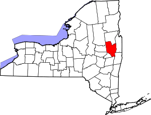 | |
| Towns | ||
| Villages | ||
| CDPs |
| |
| Other hamlets | ||
| Footnotes | ‡This populated place also has portions in an adjacent county or counties | |
| Authority control |
|---|