Grade I listed buildings in Surrey
There are over six thousand Grade I listed buildings in England. This page is a list of the 105 Grade I listed buildings in the county of Surrey, ordered by district. Of the eleven districts comprising Surrey, only Epsom and Ewell has no Grade I buildings. There are also nine Grade I listed parks and gardens in Surrey, which are not listed on this page.

Surrey shown within England
Elmbridge
| Name | Location | Type | Completed [note 1] | Date designated | Grid ref.[note 2] Geo-coordinates |
Entry number [note 3] | Image |
|---|---|---|---|---|---|---|---|
| Church of St Andrew | Cobham | Church | 12th century | 14 August 1953 | TQ1078659743 51°19′34″N 0°24′41″W |
1188115 |  Church of St Andrew |
| Church of St George | Esher | Church | 1540 | 14 August 1953 | TQ1394664623 51°22′09″N 0°21′52″W |
1030218 | |
| Church of St Mary | Stoke D'Abernon, COBHAM (post town capitalised) | Church | Late 7th century | 14 August 1953 | TQ1291958444 51°18′50″N 0°22′52″W |
1030111 |  Church of St Mary |
| Church of St Mary | Walton-on-Thames | Church | 13th century | 19 October 1951 | TQ1020066526 51°23′14″N 0°25′04″W |
1030224 | .jpg) Church of St Mary |
| Church of St Nicholas | Thames Ditton | Church | 13th century | 16 November 1984 | TQ1609767265 51°23′33″N 0°19′58″W |
1188441 | 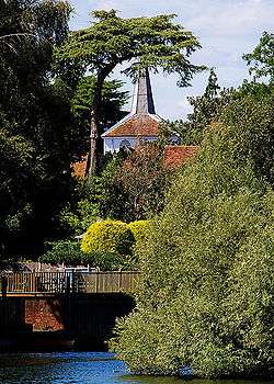 Church of St Nicholas |
| Claremont House | Esher | Country House | 1770 | 14 August 1953 | TQ1342863328 51°21′28″N 0°22′20″W |
1030202 | |
| Old Manor House | Walton on Thames | Manor House | 16th century | 19 October 1951 | TQ0988466687 51°23′19″N 0°25′20″W |
1030163 |  Old Manor House |
| Wayneflete Tower | Esher | Gatehouse | 1475-80 | 14 August 1953 | TQ1307965103 51°22′25″N 0°22′36″W |
1286940 |


Guildford
| Name | Location | Type | Completed [note 1] | Date designated | Grid ref.[note 2] Geo-coordinates |
Entry number [note 3] | Image |
|---|---|---|---|---|---|---|---|
| Old St Peter and St Paul's Church, Albury | Albury, GUILDFORD | Parish Church | 14th century | 14 June 1967 | TQ0632047848 51°13′12″N 0°28′44″W |
1294958 | |
| Chapel of St Catherine | Artington, GUILDFORD | Chapel | Early 14th century | 14 June 1967 | SU9934348190 51°13′27″N 0°34′44″W |
1377750 |  Chapel of St Catherine |
| Loseley House | Artington, GUILDFORD | Country House | 1562-1569 | 18 February 1958 | SU9749547149 51°12′55″N 0°36′20″W |
1029573 |  Loseley House |
| Church of St Nicholas | Compton, GUILDFORD | Church | 11th century | 14 June 1967 | SU9544547021 51°12′52″N 0°38′06″W |
1188621 |  Church of St Nicholas |
| Watts Mortuary Chapel | Compton, GUILDFORD | Chapel | 1896-1898 | 14 June 1967 | SU9563147397 51°13′04″N 0°37′56″W |
1029541 |  Watts Mortuary Chapel |
| Church of St Thomas of Canterbury | East Clandon, GUILDFORD | Church | 13th century | 14 June 1967 | TQ0601751736 51°15′18″N 0°28′56″W |
1029446 |  Church of St Thomas of Canterbury |
| Hatchlands Park | East Clandon, GUILDFORD | Country House | 1756-7 | 14 June 1967 | TQ0673352009 51°15′26″N 0°28′19″W |
1294970 | |
| Church of All Saints | Ockham, WOKING | Church | 14th century | 14 June 1967 | TQ0665056538 51°17′53″N 0°28′18″W |
1188424 |  Church of All Saints |
| Newark Priory | Ripley, WOKING | Priory | 13th century | 14 June 1967 | TQ0417257699 51°18′32″N 0°30′25″W |
1377835 | |
| Eashing Bridge | Lower Eashing, Shackleford, GODALMING | Bridge | 13th century | 14 June 1967 | SU9466843811 51°11′09″N 0°38′49″W |
1377743 | |
| Church of St Mary | Holmbury St Mary, Shere, GUILDFORD | Church | 1879 | 14 June 1967 | TQ1098944426 51°11′18″N 0°24′48″W |
1029485 | _(2).jpg) Church of St Mary |
| Holmdale | Holmbury St Mary, Shere, GUILDFORD | Country House | 1873 | 14 June 1967 | TQ1107343800 51°10′58″N 0°24′44″W |
1029481 |  |
| Church of St James | Shere, GUILDFORD | Church | 12th century | 14 June 1967 | TQ0743647781 51°13′09″N 0°27′47″W |
1377794 |  Church of St James |
| Church of St Bartholomew | Wanborough, GUILDFORD | Church | 12th-century origin | 14 June 1967 | SU9349048903 51°13′54″N 0°39′45″W |
1287038 | |
| Clandon Park | West Clandon, GUILDFORD | Country House | 1725-31 | 14 June 1967 | TQ0421051218 51°15′02″N 0°30′30″W |
1294591 |  Clandon Park |
| Church of St Mary the Virgin | West Horsley, GUILDFORD | Church | 12th century | 14 June 1967 | TQ0883352643 51°15′45″N 0°26′30″W |
1377828 |  Church of St Mary the Virgin |
| West Horsley Place | West Horsley, GUILDFORD | House | Early 17th century | 14 June 1967 | TQ0880053011 51°15′57″N 0°26′31″W |
1188949 | |
| Wisley Church | Wisley, WOKING | Church | 12th century | 14 June 1967 | TQ0568759610 51°19′33″N 0°29′04″W |
1294423 |  Wisley Church |
| Church of St Mary the Virgin | Worplesdon, GUILDFORD | Church | 13th century | 14 June 1967 | SU9729253574 51°16′23″N 0°36′24″W |
1377735 |  Church of St Mary the Virgin |
| Church of Holy Trinity | Guildford | Church | c. 1540 | 1 May 1953 | SU9988149499 51°14′09″N 0°34′15″W |
1029258 | |
| Church of St Mary | Guildford | Church | c. 1040 | 1 May 1953 | SU9961449344 51°14′05″N 0°34′28″W |
1377918 |  Church of St Mary |
| Former royal apartments at Guildford Castle | Guildford | Castle | Late 12th century | 1 May 1953 | SU9972049256 51°14′02″N 0°34′23″W |
1029306 | .jpg) Former royal apartments at Guildford Castle |
| Guildford Castle Keep | Guildford | Castle | Mid-12th century | 1 May 1953 | SU9976849312 51°14′03″N 0°34′21″W |
1377881 |  Guildford Castle Keep |
| Remains of shell keep at Guildford Castle | Guildford | Shell Keep | Early 12th century | 1 May 1953 | SU9976149297 51°14′03″N 0°34′21″W |
1177988 | .jpg) Remains of shell keep at Guildford Castle |
| Guildford Castle gateway and walls adjoining to the east and south | Guildford | Castle | Mid-13th century | 1 May 1953 | SU9969649237 51°14′01″N 0°34′24″W |
1029253 | .jpg) Guildford Castle gateway and walls adjoining to the east and south |
| Guildford House | Guildford | Jettied House | c. 1660 | 1 May 1953 | SU9982549515 51°14′10″N 0°34′17″W |
1180153 | |
| Hospital of the Blessed Holy Trinity | Guildford | Almshouse | 1619-1622 | 1 May 1953 | SU9986149532 51°14′10″N 0°34′16″W |
1029289 | |
| Somerset House | Guildford | Town House | Late 17th century | 1 May 1953 | TQ0003949602 51°14′13″N 0°34′06″W |
1029265 | .jpg) Somerset House |
| Guildford Grammar School | Guildford | School | 1557 | 1 May 1953 | TQ0001149575 51°14′12″N 0°34′08″W |
1294936 | |
| Guildford Guildhall | Guildford | Guildhall | c. 1550 | 1 May 1953 | SU9976449492 51°14′09″N 0°34′21″W |
1180101 |


Mole Valley
| Name | Location | Type | Completed [note 1] | Date designated | Grid ref.[note 2] Geo-coordinates |
Entry number [note 3] | Image |
|---|---|---|---|---|---|---|---|
| Church of St Michael | Betchworth, REIGATE | Church | 13th century | 11 November 1966 | TQ2105949702 51°14′01″N 0°16′03″W |
1378131 | |
| Church of Saint Nicholas | Charlwood, HORLEY | Church | 15th century | 11 November 1966 | TQ2405041111 51°09′21″N 0°13′39″W |
1248610 | |
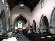
| Church of St John the Evangelist | Wotton, DORKING | Church | 13th century | 11 November 1966 | TQ1256847977 51°13′12″N 0°23′22″W |
1294098 |  Church of St John the Evangelist |
| Church of St Nicholas | Great Bookham, LEATHERHEAD | Church | 15th century | 7 September 1951 | TQ1350454660 51°16′47″N 0°22′26″W |
1028641 | .JPG) Church of St Nicholas |
| Slyfield Farmhouse, with attached garden wall | Fetcham (extreme north), LEATHERHEAD | Farmhouse | 18th century | 7 September 1951 | TQ1332757904 51°18′32″N 0°22′32″W |
1028670 |  Slyfield Farmhouse, with attached garden wall |
| Slyfield Manor or House, with attached garden walls | Fetcham (extreme north), LEATHERHEAD | House | 17th century | 7 September 1951 | TQ1335857878 51°18′31″N 0°22′30″W |
1294510 |  Slyfield Manor or House, with attached garden walls |

Reigate and Banstead
| Name | Location | Type | Completed [note 1] | Date designated | Grid ref.[note 2] Geo-coordinates |
Entry number [note 3] | Image |
|---|---|---|---|---|---|---|---|
| Church of St Bartholomew | Horley | Church | Early 14th century | 11 November 1966 | TQ2763342758 51°10′11″N 0°10′33″W |
1378035 | _(May_2012).JPG) Church of St Bartholomew |
| Church of Jesus Christ and the Wisdom of God | Lower Kingswood, TADWORTH | Church | 1891 | 29 September 1983 | TQ2486353750 51°16′09″N 0°12′42″W |
1029052 | |
| Church of St Andrew | Merstham, REDHILL | Church | 13th century | 19 October 1951 | TQ2753152875 51°15′39″N 0°10′25″W |
1294726 | |
| Church of St Margaret | Hooley, COULSDON | Church | 12th century | 24 July 1954 | TQ2833956401 51°17′32″N 0°09′39″W |
1029041 |  Church of St Margaret |
| Reigate Priory | Reigate | Priory | 13th century | 19 October 1951 | TQ2531850004 51°14′08″N 0°12′23″W |
1188089 |  Reigate Priory |
| Tadworth Court | Tadworth | Country House | c. 1700 | 12 August 1983 | TQ2387056468 51°17′38″N 0°13′29″W |
1029004 |  Tadworth Court |

.jpg)
Runnymede
| Name | Location | Type | Completed [note 1] | Date designated | Grid ref.[note 2] Geo-coordinates |
Entry number [note 3] | Image |
|---|---|---|---|---|---|---|---|
| Former Holloway Sanatorium (Crossland House, Virginia Park) | Virginia Water | Sanatorium | 1873-1885 | 17 November 1986 | TQ0026168257 51°24′16″N 0°33′36″W |
1189632 | |
| Great Fosters | Stroude, EGHAM | House | c. 1550-1600 | 11 July 1951 | TQ0130569674 51°25′01″N 0°32′40″W |
1294166 | |
| Founder's Building, Royal Holloway College | Englefield Green, EGHAM | Courtyard | 1879-87 | 17 November 1986 | SU9974870506 51°25′29″N 0°34′00″W |
1028946 |  Founder's Building, Royal Holloway College |
| Runnymede Park | Englefield Green, EGHAM | Country House | 1789-92 | 17 November 1986 | TQ0021471343 51°25′56″N 0°33′35″W |
1028921 | |


Spelthorne
| Name | Location | Type | Completed [note 1] | Date designated | Grid ref.[note 2] Geo-coordinates |
Entry number [note 3] | Image |
|---|---|---|---|---|---|---|---|
| Church of All Saints | Laleham, STAINES-UPON-THAMES | Church | Norman | 11 August 1952 | TQ0512968878 51°24′33″N 0°29′23″W |
1298923 |  Church of All Saints |
| Church of St Mary | Stanwell, STAINES-UPON-THAMES | Church | 13th century | 11 August 1952 | TQ0571174136 51°27′23″N 0°28′48″W |
1187042 | |
| Church of St Mary Magdalene | Littleton, SHEPPERTON | Church | 12th century | 11 September 1951 | TQ0706868639 51°24′24″N 0°27′43″W |
1377699 | .jpg) Church of St Mary Magdalene |

Surrey Heath
| Name | Location | Type | Completed [note 1] | Date designated | Grid ref.[note 2] Geo-coordinates |
Entry number [note 3] | Image |
|---|---|---|---|---|---|---|---|
| Church of St Lawrence | Chobham, WOKING | Church | 12th century | 28 February 1955 | SU9738061797 51°20′49″N 0°36′11″W |
1377490 |

Tandridge
| Name | Location | Type | Completed [note 1] | Date designated | Grid ref.[note 2] Geo-coordinates |
Entry number [note 3] | Image |
|---|---|---|---|---|---|---|---|
| Brewer Street Farm House | Bletchingley, REDHILL | Farmhouse | 16th century | 11 June 1958 | TQ3238851933 51°15′04″N 0°06′16″W |
1281258 |  Brewer Street Farm House |
| Church of St Mary the Virgin | Bletchingley, REDHILL | Church | 11th century | 11 June 1958 | TQ3276450849 51°14′29″N 0°05′58″W |
1029972 | 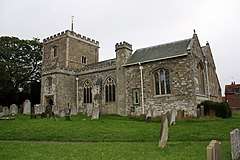 Church of St Mary the Virgin |
| Pendell House | Bletchingley, REDHILL | House | 1636 | 11 June 1958 | TQ3151151890 51°15′04″N 0°07′01″W |
1029987 | |
| Church of St Bartholemew | Burstow, HORLEY | Church | 12th century | 11 June 1958 | TQ3124041296 51°09′21″N 0°07′29″W |
1204775 |  Church of St Bartholemew |
| Church of St Lawrence | Caterham (Caterham-on-the-Hill) | Church | Norman | 21 September 1954 | TQ3358455397 51°16′55″N 0°05′10″W |
1377607 | .JPG) Church of St Lawrence |
| Church of St Peter and St Paul | Chaldon, CATERHAM | Church | 11th century | 21 September 1954 | TQ3087455694 51°17′07″N 0°07′29″W |
1029813 | |
| Church of St Mary the Virgin | Farleigh, Chelsham and Farleigh, CATERHAM | Church | c. 1100 | 19 November 1984 | TQ3723860076 51°19′24″N 0°01′55″W |
1377637 | |
| Crowhurst Place | Crowhurst, LINGFIELD | Country House | 15th century | 9 March 1982 | TQ3864246365 51°11′59″N 0°01′01″W |
1280991 |  Crowhurst Place |
| Old Surrey Hall | Dormansland, LINGFIELD | Country House | 15th century | 9 March 1982 | TQ4202039958 51°08′29″N 0°01′44″E |
1029883 | |
| Church of St Nicholas | Godstone | Church | 13th century | 11 June 1958 | TQ3572851506 51°14′48″N 0°03′24″W |
1188347 | .JPG) Church of St Nicholas |
| Church of St Peter | Limpsfield, OXTED | Church | 12th century | 11 June 1958 | TQ4050453238 51°15′40″N 0°00′44″E |
1188814 |  Church of St Peter |
| Old Court Cottage | Limpsfield, OXTED | House | Late 14th century | 11 June 1958 | TQ4049153361 51°15′44″N 0°00′44″E |
1029729 | |
| Stockenden | Limpsfield, OXTED | House | 16th century | 11 June 1958 | TQ4175150087 51°13′57″N 0°01′44″E |
1377651 |  Stockenden |
| Church of St Peter and St Paul | Lingfield | Church | 14th century | 11 June 1958 | TQ3888943775 51°10′35″N 0°00′52″W |
1029906 | |
| Pollard Cottage & Pollard House | Lingfield | House | C20 | 11 June 1958 | TQ3890943719 51°10′33″N 0°00′51″W |
1029911 | |
| St Peter's Cross and Village Cage | Lingfield | Cross and cage | 1773 | 11 June 1958 | TQ3859243570 51°10′28″N 0°01′08″W |
1205403 | |
| Outwood Post Mill | Outwood, REDHILL | Mill | 1665 | 11 June 1958 | TQ3277045551 51°11′38″N 0°06′05″W |
1029961 |  Outwood Post Mill |
| Barrow Green Court | Oxted | House | Early 17th century | 11 June 1958 | TQ3800753046 51°15′36″N 0°01′25″W |
1189488 | |
| Church of St Mary the Virgin | Oxted | Church | 12th century | 11 June 1958 | TQ3904552984 51°15′33″N 0°00′31″W |
1189608 |  Church of St Mary the Virgin |
| Church of St Peter | Tandridge, OXTED | Church | 12th century | 11 June 1958 | TQ3746151163 51°14′35″N 0°01′55″W |
1189811 | .JPG) Church of St Peter |


.jpg)
.jpg)
Waverley
| Name | Location | Type | Completed [note 1] | Date designated | Grid ref.[note 2] Geo-coordinates |
Entry number [note 3] | Image |
|---|---|---|---|---|---|---|---|
| Church of St Nicholas | Alfold, CRANLEIGH | Church | c. 1100 | 9 March 1960 | TQ0372033973 51°05′45″N 0°31′13″W |
1352752 |  Church of St Nicholas |
| Orchards | Bramley, GUILDFORD | House | 1899 | 9 March 1960 | SU9925843282 51°10′49″N 0°34′53″W |
1378318 | |
| Munstead Wood | Busbridge, GODALMING | Jettied House | 1897 | 9 March 1960 | SU9821142703 51°10′31″N 0°35′47″W |
1261159 | |
| Church of St Mary | Chiddingfold, GODALMING | Church | 17th century | 9 March 1960 | SU9600035394 51°06′35″N 0°37′48″W |
1378327 |  Church of St Mary |
| Church of St Mary and All Saints | Dunsfold, GODALMING | Church | c1270-1290 | 9 March 1960 | SU9983036345 51°07′04″N 0°34′30″W |
1044388 |  Church of St Mary and All Saints |
| Elstead Bridge | Elstead, GODLAMING | Bridge | 13th century | 9 March 1960 | SU9054143804 51°11′11″N 0°42′21″W |
1044453 |  Elstead Bridge |
| Church of St Peter and St Paul | Ewhurst, CRANLEIGH | Church | 12th century | 9 March 1960 | TQ0913640472 51°09′11″N 0°26′27″W |
1190455 |  Church of St Peter and St Paul |
| Church of St Andrew | Farnham | Church | 12th century | 29 December 1972 | SU8386446680 51°12′48″N 0°48′03″W |
1044627 | |
| Farnham Castle (comprising castle buildings to the south only) | Farnham | Castle | 12th century | 26 April 1950 | SU8374447271 51°13′07″N 0°48′08″W |
1044677 |  Farnham Castle (comprising castle buildings to the south only) |
| Outer curtain wall and gatehouse at Farnham Castle | Farnham | Gatehouse | Late 12th century to early 13th century | 26 April 1950 | SU8366447340 51°13′09″N 0°48′12″W |
1242110 |  Outer curtain wall and gatehouse at Farnham Castle |
| The Grange | Farnham | House | c.1710 | 26 April 1950 | SU8359447391 51°13′11″N 0°48′16″W |
1044678 |  The Grange |
| Willmer House | Farnham | House | 1718 | 26 April 1950 | SU8359746681 51°12′48″N 0°48′16″W |
1258470 |  Willmer House |
| Church of St Peter and St Paul | Godalming | Church | 11th century | 18 December 1947 | SU9681444000 51°11′13″N 0°36′58″W |
1044546 | _(4).JPG) Church of St Peter and St Paul |
| The Almshouses | Wyatt's Close, Godalming | Alms Houses | 1622 | 18 December 1947 | SU9818444808 51°11′39″N 0°35′47″W |
1293743 |  The Almshouses |
| Tigbourne Court | Wormley & Hambledon, GODALMING | House | 1899-1901 | 9 March 1960 | SU9567537910 51°07′57″N 0°38′02″W |
1240229 | |
| Granary at Home Farm | Peper Harow Park, Peper Harow, GODALMING | Granary | 17th century | 9 March 1960 | SU9345944178 51°11′21″N 0°39′51″W |
1294589 |  Granary at Home Farm |
| Peper Harow House | Peper Harow Park, Peper Harow, GODALMING | Country House | 1765-8 | 9 March 1960 | SU9356743929 51°11′13″N 0°39′45″W |
1044443 | |
| Church of St Michael and All Angels | Thursley, GODALMING | Church | Mid-11th century | 9 March 1960 | SU9010139378 51°08′48″N 0°42′48″W |
1260876 |  Church of St Michael and All Angels |
| Bridge over the River Wey to North East Side of Green | Tilford, FARNHAM | Bridge | 13th century | 9 March 1960 | SU8738643449 51°11′01″N 0°45′04″W |
1189159 |  Bridge over the River Wey to North East Side of Green |
| Bridge over the River Wey to the North West Corner of Tilford Green | Tilford, FARNHAM | Bridge | 13th century | 9 March 1960 | SU8717443524 51°11′04″N 0°45′15″W |
1044414 |  Bridge over the River Wey to the North West Corner of Tilford Green |
| Church of All Saints | Witley, GODALMING | Church | 11th century | 9 March 1960 | SU9466739698 51°08′55″N 0°38′53″W |
1260732 | _-_geograph.org.uk_-_1543211.jpg) Church of All Saints |
| Great Tangley Manor | Wonersh, GUILDFORD | Hall House | 15th century | 9 March 1960 | TQ0196046574 51°12′33″N 0°32′30″W |
1241457 |
_(14740855736).jpg)

_(1).jpg)


Woking
| Name | Location | Type | Completed [note 1] | Date designated | Grid ref.[note 2] Geo-coordinates |
Entry number [note 3] | Image |
|---|---|---|---|---|---|---|---|
| Church of St Mary the Virgin | Byfleet, WEST BYFLEET | Church | 13th century | 22 July 1953 | TQ0628860407 51°19′58″N 0°28′33″W |
1378241 | |
| Church of St Nicholas | Pyrford, WOKING | Church | 12th century | 22 July 1953 | TQ0398758231 51°18′49″N 0°30′34″W |
1044721 | |
| Church of St Peter | Old Woking, WOKING | Church | 1776 | 22 July 1953 | TQ0208456845 51°18′06″N 0°32′13″W |
1044724 | |
| Sutton Place including the service court yard | Woking | House | 17th century | 22 July 1953 | TQ0119553518 51°16′19″N 0°33′03″W |
1236810 |  Sutton Place including the service court yard |
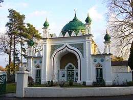
| Shah Jahan Mosque | Woking | Mosque | 1889 | 6 January 1984 | TQ0151459180 51°19′22″N 0°32′40″W |
1264438 |


See also
- Category:Grade I listed buildings in Surrey
- Grade II* listed buildings in Surrey
Notes
- The date given is the date used by Historic England as significant for the initial building or that of an important part in the structure's description.
- Sometimes known as OSGB36, the grid reference is based on the British national grid reference system used by the Ordnance Survey.
- The "List Entry Number" is a unique number assigned to each listed building and scheduled monument by Historic England.
References
External links
![]()
This article is issued from Wikipedia. The text is licensed under Creative Commons - Attribution - Sharealike. Additional terms may apply for the media files.